Area Overview for B21 9LY
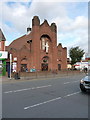
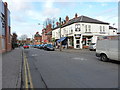
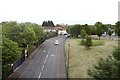
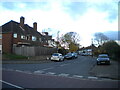
Photos of B21 9LY


Area Information
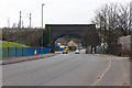
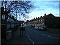
B21 9LY lies within the historic Handsworth Ward, just 2 kilometres north of Birmingham City Centre. This small residential cluster, home to 1,789 people, reflects a blend of industrial heritage and suburban living. Once a rural parish absorbed into Birmingham in 1911, the area was shaped by the Soho Manufactory, a pioneering industrial site founded by Matthew Boulton in 1766. Today, it retains echoes of its past through landmarks like Handsworth Park, opened in 1890, and St Mary’s Church, dating to the 13th century. The community is diverse, with the Asian population forming the predominant group. Daily life here balances proximity to Birmingham’s urban energy with the quiet charm of a neighbourhood that saw significant post-war immigration and civil unrest in 1985. Residents benefit from nearby retail, transport links, and green spaces, making it a compact area for those seeking a mix of history and practicality.
- Area Type
- Postcode
- Area Size
- Not available
- Population
- 1789
- Population Density
- 10643 people/km²
B21 9LY’s property market is characterised by a 41% home ownership rate, with houses being the primary accommodation type. This suggests a mix of owner-occupied and rental properties, though the relatively low ownership rate may indicate a stronger presence of private rentals. The area’s small size means the housing stock is limited, with homes likely concentrated around the residential cluster. Given the historical industrial roots of Handsworth, properties may reflect a blend of older, characterful homes and more modern builds. For buyers, this compact area offers a niche market with potential for family homes, but the limited inventory could mean competition for available properties. Proximity to Birmingham’s transport networks and amenities may also influence property values, though specific data on price trends is not provided.
House Prices in B21 9LY
No properties found in this postcode.
Energy Efficiency in B21 9LY
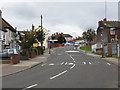
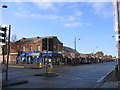
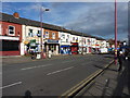
Living in B21 9LY offers access to a range of amenities within practical reach. Retail options include Lidl Handsworth, Iceland Handsworth, and Farmfoods Handsworth, ensuring daily shopping needs are met. Metro stations like Handsworth Booth Street and Soho Benson Road provide quick access to local transport, while rail services connect to broader networks. The area’s green spaces, such as Handsworth Park—a historic landmark with gardens, cricket grounds, and event spaces—offer recreational opportunities. The presence of St Mary’s Church and Soho House (now a museum) adds cultural depth. This mix of shops, transport, and open spaces creates a convenient, community-oriented lifestyle, blending practicality with historical charm.
Amenities
Schools
| Rank | School | Type | Entry gender | Ages |
|---|
Explore more schools in this area
Go to Schools tabDemographics
The median age in B21 9LY is 22, though the most common age range is adults aged 30–64, suggesting a mix of families and working-age residents. Home ownership stands at 41%, with houses being the predominant accommodation type. This indicates a modest proportion of owner-occupied homes, with the remainder likely rented. The area’s demographic profile is shaped by its history as a hub for Caribbean immigration post-World War II, with the Asian community now forming the largest ethnic group. While specific deprivation data is absent, the high proportion of adult residents and the presence of family-oriented housing suggest a community focused on stability and long-term living. The age distribution also implies a balance between younger professionals and established households, contributing to a dynamic but grounded local environment.
Household Size
Accommodation Type
Tenure
Ethnic Group
Religion
Household Composition
Age
Household Deprivation
NS-SEC
Explore more demographic insights in this area
Go to Demographics tabPlanning
Planning Constraints
- Flood RiskPremium
- Ramsar Wetland SitesPremium
- Area of Outstanding Natural BeautyPremium
- Protected Nature ReservePremium
- Protected WoodlandPremium