Area Overview for B21 9LW
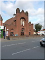
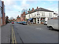
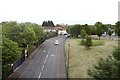
Photos of B21 9LW


Area Information
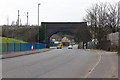
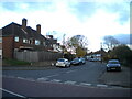
B21 9LW lies within the historic Handsworth Ward, just 2 kilometres north of Birmingham City Centre. This small residential cluster, with a population of 1,711, sits at the intersection of industrial heritage and suburban living. Once a rural parish recorded in the Domesday Survey of 1086, Handsworth evolved during the Industrial Revolution, shaped by Matthew Boulton’s Soho Manufactory and the influx of post-war migrants. Today, it is a mature community with a median age of 47, where adults aged 30–64 form the largest demographic group. The area’s character is defined by its proximity to Birmingham’s urban core, combined with pockets of green space like Handsworth Park, which has hosted citywide events since the 1890s. Residents benefit from easy access to retail, transport, and cultural landmarks, making it a pragmatic choice for those seeking a balance between city life and quieter living. The area’s Asian_total ethnic group predominance reflects its post-war demographic shifts, adding to its distinct identity within the West Midlands.
- Area Type
- Postcode
- Area Size
- Not available
- Population
- Not available
- Population Density
- Not available
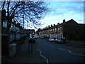
B21 9LW is a small area with a housing stock that leans heavily on owner-occupied properties, with 53% of residents owning their homes. The accommodation type is predominantly houses, which suggests a mix of family homes and larger properties typical of suburban settings. This contrasts with areas dominated by flats or rental units, implying a more stable, long-term resident base. Given the area’s size and limited housing stock, buyers may need to consider nearby zones for more options. The presence of houses also indicates potential for space and privacy, though the small postcode area means competition for properties could be keen. For those prioritising ownership, B21 9LW offers a blend of residential character and proximity to Birmingham’s amenities, though its compact size may limit scope for expansion.
House Prices in B21 9LW
No properties found in this postcode.
Energy Efficiency in B21 9LW
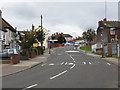
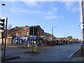
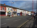
Daily life in B21 9LW is shaped by its proximity to retail, transport, and green spaces. The area’s five retail outlets, including Iceland Handsworth and Lidl Handsworth, offer essential shopping options, while Farmfoods Handsworth caters to convenience needs. Public transport is well-served by five metro stations, such as Winson Green Outer Circle, and three rail stations, including Jewellery Quarter Railway Station, providing easy access to Birmingham and surrounding areas. For leisure, Handsworth Park—officially opened in 1890—offers open space for recreation, with historical ties to the area’s 19th-century development. The park’s legacy as a venue for events like the Birmingham Flower Show adds to its appeal. This mix of practical amenities and green space supports a lifestyle that balances urban accessibility with local charm.
Amenities
Schools
| Rank | School | Type | Entry gender | Ages |
|---|
Explore more schools in this area
Go to Schools tabDemographics
The population of B21 9LW is 1,711, with a median age of 47, indicating a mature community. The largest age group is adults aged 30–64, suggesting a stable demographic with established households. Home ownership stands at 53%, meaning nearly half of residents live in owner-occupied properties, while the remaining 47% likely rent. The accommodation type is predominantly houses, which aligns with the area’s suburban character. The predominant ethnic group is Asian_total, reflecting historical migration patterns tied to post-war industrial demand. This demographic profile shapes a community with a mix of long-term residents and families, where local institutions and services cater to a settled population. The absence of specific deprivation data means quality of life is inferred from amenities and infrastructure, which appear sufficient for daily needs.
Household Size
Accommodation Type
Tenure
Ethnic Group
Religion
Household Composition
Age
Household Deprivation
NS-SEC
Explore more demographic insights in this area
Go to Demographics tabPlanning
Planning Constraints
- Flood RiskPremium
- Ramsar Wetland SitesPremium
- Area of Outstanding Natural BeautyPremium
- Protected Nature ReservePremium
- Protected WoodlandPremium