Area Overview for B21 9LU
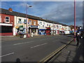
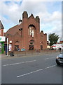
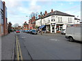
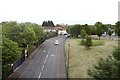
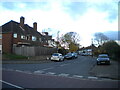
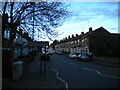
Photos of B21 9LU


Area Information
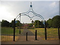
Living in B21 9LU means being part of a small, tightly knit residential cluster in the West Midlands, just 2 kilometres north of Birmingham City Centre. With a population of 1,632, this area reflects a blend of historical roots and modern suburban life. Originally part of Staffordshire, Handsworth was absorbed into Birmingham in 1911, evolving from a rural parish into an industrial hub during the 18th century. Today, it retains traces of its past, including St Mary’s Church, a 13th-century landmark, and Handsworth Park, a green space dating to the 1880s. The area’s proximity to Birmingham offers easy access to urban amenities, while its smaller scale fosters a quieter, community-focused atmosphere. Residents benefit from proximity to historic sites, such as Soho House, once the home of Matthew Boulton, and the Grove Estate, which hosts local events. This postcode is ideal for those seeking a balance between suburban tranquillity and urban connectivity.
- Area Type
- Postcode
- Area Size
- Not available
- Population
- 1632
- Population Density
- 14891 people/km²
The property market in B21 9LU is dominated by houses, with 47% of residents owning their homes. This suggests a mix of owner-occupied properties and rental stock, though the exact proportion of rentals is not specified. The prevalence of houses over flats indicates a focus on family-friendly housing, likely appealing to those prioritising space and privacy. Given the area’s small size, the housing stock is limited, making it a niche market for buyers seeking suburban living near Birmingham. The 47% home ownership rate also implies a significant number of rental properties, potentially attracting tenants looking for long-term stability. Proximity to Birmingham’s transport networks and amenities may enhance the area’s appeal, though buyers should consider the limited scope for expansion in such a compact postcode.
House Prices in B21 9LU
No properties found in this postcode.
Energy Efficiency in B21 9LU
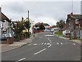
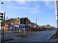
Residents of B21 9LU enjoy a range of amenities within practical reach, from retail to transport. Local shops include Iceland Handsworth, Lidl Handsworth, and Farmfoods Handsworth, offering grocery and convenience services. The area’s metro and rail stations—such as Soho Benson Road and Perry Barr—provide direct links to Birmingham’s business districts and beyond. Handsworth Park, a key green space, offers recreational opportunities, while historical sites like St Mary’s Church and Soho House add cultural value. The presence of three primary schools and community hubs like the Grove Estate underscores a family-friendly environment. These amenities contribute to a balanced lifestyle, blending suburban comfort with urban accessibility.
Amenities
Schools
Residents of B21 9LU have access to three primary schools: Grove School, Grove Infant and Nursery School, and Grove Junior School. Grove School holds a ‘good’ Ofsted rating, offering a benchmark of quality for primary education in the area. The presence of both infant and junior schools ensures a seamless educational pathway for children aged 3–11. This concentration of primary schools suggests a family-oriented community, where parents can access local schooling without long commutes. While no secondary schools are listed, the proximity to Birmingham’s broader network likely provides additional options. The mix of school types supports families at different stages of education, though parents should verify secondary school availability separately.
| Rank | School | Type | Entry gender | Ages |
|---|
Explore more schools in this area
Go to Schools tabDemographics
The population of B21 9LU is 1,632, with a median age of 47, indicating a community skewed towards middle-aged adults. The most common age range is 30–64 years, suggesting a mix of families and professionals. Home ownership stands at 47%, meaning nearly half of residents rent their homes. The area is characterised by houses rather than flats, reflecting a preference for single-family living. The predominant ethnic group is Asian, which shapes the cultural fabric of the neighbourhood. This demographic profile implies a stable, established community with a focus on long-term residency. The absence of specific deprivation data means no direct commentary on economic challenges, but the age distribution and ownership rates suggest a mix of generational needs, from family homes to retirement properties.
Household Size
Accommodation Type
Tenure
Ethnic Group
Religion
Household Composition
Age
Household Deprivation
NS-SEC
Explore more demographic insights in this area
Go to Demographics tabPlanning
Planning Constraints
- Flood RiskPremium
- Ramsar Wetland SitesPremium
- Area of Outstanding Natural BeautyPremium
- Protected Nature ReservePremium
- Protected WoodlandPremium