Area Overview for B21 9EW
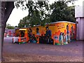
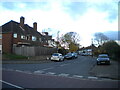
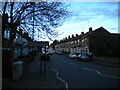
Photos of B21 9EW

Area Information
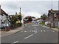
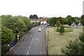
Living in B21 9EW means being part of a small, tightly knit residential cluster nestled in the West Midlands, just 2 kilometres north of Birmingham City Centre. This area, historically part of Staffordshire, has evolved from a rural parish into a suburban hub with roots in the Industrial Revolution. The population of 1,711 residents reflects a community shaped by its past as a centre for industrial innovation and post-war immigration. Daily life here balances proximity to Birmingham’s urban energy with the quiet character of a neighbourhood that retains traces of its 13th-century origins. The area’s compact size means amenities and transport links are within practical reach, while its history as a site of both industrial progress and civil unrest adds depth to its identity. For those seeking a mix of convenience and heritage, B21 9EW offers a snapshot of Birmingham’s layered past and present, with a focus on residential stability and community cohesion.
- Area Type
- Postcode
- Area Size
- Not available
- Population
- Not available
- Population Density
- Not available
The property market in B21 9EW is characterised by a 53% home ownership rate, with houses being the primary accommodation type. This indicates a market skewed towards owner-occupied homes rather than a rental-dominated area, though the relatively low ownership percentage suggests a significant proportion of properties are rented. The prevalence of houses may appeal to buyers seeking more space or privacy, though the small size of the area means housing stock is limited. Buyers should consider the proximity to Birmingham’s amenities, which could influence property values. The lack of high-rise developments or flats suggests a quieter, more residential feel. For those prioritising investment, the mix of owner-occupied and rental properties may offer opportunities, but the area’s compact size means competition for available homes could be fierce.
House Prices in B21 9EW
No properties found in this postcode.
Energy Efficiency in B21 9EW
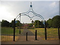
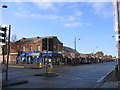
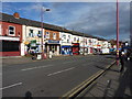
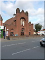
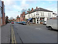
Life in B21 9EW is enriched by a range of nearby amenities within practical reach. Retail options include Iceland Handsworth, Lidl Handsworth, and Farmfoods Handsworth, offering everyday essentials. Metro stations such as Winson Green Outer Circle and Soho Benson Road provide convenient access to public transport, while rail stations like Jewellery Quarter and Perry Barr connect residents to broader networks. The area’s historical legacy is embodied in landmarks like Handsworth Park, a 19th-century green space that hosts events and offers recreational opportunities. St Mary’s Church, dating to the 13th century, adds cultural and historical depth. The mix of modern convenience and heritage sites creates a lifestyle that balances practicality with a connection to the past, making daily life both functional and engaging.
Amenities
Schools
| Rank | School | Type | Entry gender | Ages |
|---|
Explore more schools in this area
Go to Schools tabDemographics
The median age in B21 9EW is 47, with the majority of residents aged between 30 and 64. This suggests a community skewed towards middle-aged adults, likely including families and professionals. Home ownership stands at 53%, indicating a moderate balance between owner-occupied properties and rental stock. The accommodation type is predominantly houses, which may reflect a preference for more spacious living compared to flats. The predominant ethnic group is Asian, a statistic that aligns with the broader demographic trends in Birmingham’s post-war immigration history. This diversity contributes to a culturally rich environment, though specific data on deprivation or socioeconomic factors is not available. The age profile and ownership figures suggest a stable, long-term resident base, with fewer young families or transient populations compared to other urban areas.
Household Size
Accommodation Type
Tenure
Ethnic Group
Religion
Household Composition
Age
Household Deprivation
NS-SEC
Explore more demographic insights in this area
Go to Demographics tabPlanning
Planning Constraints
- Flood RiskPremium
- Ramsar Wetland SitesPremium
- Area of Outstanding Natural BeautyPremium
- Protected Nature ReservePremium
- Protected WoodlandPremium