Area Overview for B21 9ET
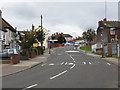
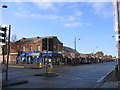
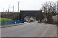
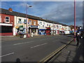
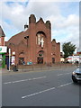
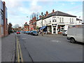
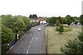
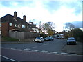
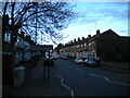
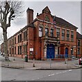
Photos of B21 9ET


Area Information
Living in B21 9ET means being part of a densely populated, small residential cluster nestled within Handsworth, just 2 kilometres north of Birmingham’s city centre. The area covers 6,860 square metres and is home to 1,426 residents, creating a compact, tightly knit community. Historically part of Staffordshire, Handsworth was absorbed into Birmingham in 1911, blending its rural origins with industrial growth. Today, it reflects a layered past: from 13th-century farms to the Soho Manufactory, which revolutionised engineering during the Industrial Revolution. The area’s character is defined by its proximity to Birmingham’s urban core, offering a mix of suburban tranquillity and easy access to city amenities. With a population density of 207,876 people per square kilometre, the community is closely connected, yet the area’s small size means residents often know their neighbours. The presence of Handsworth Park, a 19th-century green space, adds a touch of natural respite, while the area’s history as a hub for Caribbean immigration in the post-war period continues to shape its cultural fabric.
- Area Type
- Postcode
- Area Size
- 6860 m²
- Population
- 1426
- Population Density
- 8463 people/km²
The property market in B21 9ET is characterised by a 43% home ownership rate, suggesting that nearly half of the area’s housing stock is occupied by owners, while the remaining 57% is likely rented. The accommodation type is primarily houses, which is unusual for a small, densely populated area. This indicates a focus on larger properties, possibly family homes, which may appeal to buyers seeking space in a compact setting. However, the limited area size and high population density could mean that housing options are constrained, with competition for available properties. For buyers, this suggests a market where houses are in demand but may be scarce. The proximity to Birmingham’s city centre, combined with the presence of nearby rail and metro stations, could make B21 9ET an attractive option for those seeking a balance between suburban living and urban accessibility, though the small footprint of the area may limit expansion or redevelopment opportunities.
House Prices in B21 9ET
No properties found in this postcode.
Energy Efficiency in B21 9ET
The lifestyle in B21 9ET is shaped by its proximity to a range of amenities within practical reach. Retail options include Iceland Handsworth, Lidl Handsworth, and Farmfoods Handsworth, providing everyday shopping convenience. Metro stations such as Soho Benson Road and Handsworth Booth Street facilitate easy access to local services, while rail links like Jewellery Quarter Railway Station connect residents to broader destinations. The area’s green space is exemplified by Handsworth Park, a historic 19th-century park that hosts community events and offers recreational opportunities. This blend of retail, transport, and natural amenities creates a convenient, well-connected lifestyle, balancing urban accessibility with pockets of greenery. The presence of nearby schools and transport hubs further reinforces the area’s appeal for families and commuters.
Amenities
Schools
Residents of B21 9ET have access to two notable schools. Handsworth Grammar School is a primary institution, providing education for younger children. For secondary education, King Edward VI Handsworth Grammar School for Boys operates as an academy with a good Ofsted rating. This mix of primary and secondary schooling options offers families a range of educational pathways, though the absence of other school types, such as nurseries or specialist institutions, may require parents to travel further for additional needs. The good Ofsted rating for the grammar school suggests a reliable standard of education, which could be a key consideration for families prioritising academic outcomes. However, the limited number of schools in the immediate vicinity means that students may need to commute beyond the area for broader educational choices.
| Rank | School | Type | Entry gender | Ages |
|---|
Explore more schools in this area
Go to Schools tabDemographics
The community in B21 9ET is predominantly composed of adults aged 30–64, with a median age of 47. This suggests a mature, established population, likely with long-term ties to the area. Home ownership stands at 43%, meaning 57% of households are likely to be rental properties, reflecting a mix of owner-occupied and rented homes. The accommodation type is primarily houses, indicating a preference for larger, family-friendly properties over flats. The predominant ethnic group is Asian_total, a fact that aligns with Handsworth’s historical role as a centre for Caribbean and South Asian communities. While specific data on deprivation is absent, the high population density and historical patterns of migration suggest a community with diverse socioeconomic backgrounds. The age profile implies a stable demographic, with fewer young families and a focus on middle-aged households, which may influence local services and amenities.
Household Size
Accommodation Type
Tenure
Ethnic Group
Religion
Household Composition
Age
Household Deprivation
NS-SEC
Explore more demographic insights in this area
Go to Demographics tabPlanning
Planning Constraints
- Flood RiskPremium
- Ramsar Wetland SitesPremium
- Area of Outstanding Natural BeautyPremium
- Protected Nature ReservePremium
- Protected WoodlandPremium