Area Overview for B21 9DL
Photos of B21 9DL


Area Information
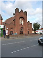
Living in B21 9DL places you in a small residential cluster within the broader historic Jewellery Quarter of Birmingham, a district renowned for its craftsmanship legacy. With a population of 2067, this area reflects a tight-knit community shaped by its industrial heritage. The Jewellery Quarter, once a global hub for jewellery manufacturing in the 18th and 19th centuries, now blends historic architecture with modern innovation. Residents here benefit from proximity to key landmarks like St. Paul’s Church and the Museum of the Jewellery Quarter, which highlights the area’s cultural significance. The postcode’s compact size means amenities and services are within practical reach, while its location near major transport routes, including rail and metro stations, enhances connectivity. The area’s demographic profile, with a median age of 47 and a majority of adults aged 30–64, suggests a stable, established population. This is a place where heritage meets everyday living, offering a distinct character that appeals to those valuing history and community.
- Area Type
- Postcode
- Area Size
- Not available
- Population
- 2067
- Population Density
- 7756 people/km²
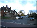
The property market in B21 9DL is characterised by a 31% home ownership rate, suggesting a majority of residents rent rather than own their homes. The predominant accommodation type is houses, which is atypical for a small urban postcode but aligns with the area’s residential cluster identity. This mix of ownership and rental properties may indicate a balance between long-term residents and those seeking temporary housing. The presence of houses rather than flats or apartments suggests a focus on family-oriented living, though the limited number of properties in such a small area could mean a competitive market for buyers. For those considering the area, the housing stock offers a blend of traditional and modern options, though the low home ownership rate might reflect affordability challenges or a preference for rental flexibility. Proximity to transport links and amenities may further enhance the appeal of this niche market.
House Prices in B21 9DL
No properties found in this postcode.
Energy Efficiency in B21 9DL
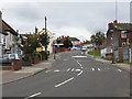
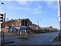
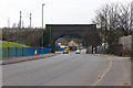
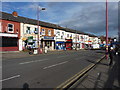
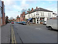
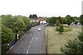
Daily life in B21 9DL is shaped by its proximity to a range of amenities. Retail options include supermarkets like Iceland Handsworth and Lidl Handsworth, ensuring easy access to groceries and household essentials. The area’s five metro stations, including Soho Benson Road and Handsworth Booth Street, and five rail stations, such as Hawthorns and Perry Barr, provide convenient travel for work, leisure, or shopping. While parks or green spaces are not explicitly listed, the area’s historical character and architectural heritage contribute to a unique urban lifestyle. The presence of the Jewellery Quarter’s museums and historic streets offers cultural enrichment, while the compact size of the postcode means amenities are within walking distance. This blend of practicality and heritage creates a lifestyle that balances convenience with a connection to the area’s rich past.
Amenities
Schools
Residents of B21 9DL have access to two schools within practical reach: Benson Community School, a primary school, and Oasis Academy Benson, an academy. While specific Ofsted ratings are not provided, the mix of primary and academy schools offers families a range of educational options. The presence of a primary school suggests the area is suitable for young families, while the academy may cater to older students with a broader curriculum. However, the lack of detailed performance data means prospective buyers must rely on local reputation or further research to assess educational quality. The schools’ proximity to homes in the area reinforces the postcode’s appeal as a family-friendly location, though the limited number of schools may necessitate commuting for secondary education.
| Rank | School | Type | Entry gender | Ages |
|---|
Explore more schools in this area
Go to Schools tabDemographics
The population of B21 9DL is 2067, with a median age of 47. The most common age range is adults aged 30–64, indicating a mature, working-age population. Home ownership stands at 31%, suggesting a mix of owner-occupied and rental properties. The predominant accommodation type is houses, which is unusual for urban areas, reflecting a residential cluster with more spacious living options. The predominant ethnic group is Asian, which influences the area’s cultural dynamics. This demographic profile implies a community with established families and professionals, likely prioritising stability and long-term residency. The lower home ownership rate may indicate a reliance on rental housing, which could affect property market dynamics. The absence of specific deprivation data means quality of life factors like access to services and infrastructure must be inferred from the area’s amenities and connectivity.
Household Size
Accommodation Type
Tenure
Ethnic Group
Religion
Household Composition
Age
Household Deprivation
NS-SEC
Explore more demographic insights in this area
Go to Demographics tabPlanning
Planning Constraints
- Flood RiskPremium
- Ramsar Wetland SitesPremium
- Area of Outstanding Natural BeautyPremium
- Protected Nature ReservePremium
- Protected WoodlandPremium