Area Overview for B21 8LL
Photos of B21 8LL


Area Information
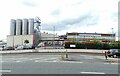
Living in B21 8LL means inhabiting a small, densely populated residential cluster within West Bromwich, a town with a long industrial heritage. The postcode area’s 2060 residents are spread across 1.88 km², creating a compact community with a population density of 1107 people per square kilometre. Situated in the Metropolitan Borough of Sandwell, B21 8LL is part of West Bromwich Central Ward, a historically significant area that once faced challenges like the 1831 cholera outbreak. Today, it is 8 miles west of Birmingham’s city centre, offering proximity to the city’s amenities while retaining a distinct local identity. The area’s character is shaped by its industrial past, with roads like the A41 and Black Country Spine Road linking it to surrounding regions. Daily life here is defined by a mix of practicality and community, with residents navigating a balance between urban connectivity and the quieter rhythms of a smaller postcode area.
- Area Type
- Postcode
- Area Size
- Not available
- Population
- 2060
- Population Density
- 1107 people/km²
The property market in B21 8LL is characterised by a low home ownership rate of 27%, suggesting that the area is predominantly a rental market. The accommodation type is largely flats, which is typical for high-density urban areas. This means that buyers looking for owner-occupied properties may find limited options within the postcode itself, with opportunities potentially extending to nearby areas. The concentration of flats may appeal to those seeking manageable, low-maintenance housing, but it could also limit choices for families requiring larger homes. Given the area’s small size and the prevalence of rental properties, prospective buyers should consider broader searches in surrounding parts of West Bromwich or Sandwell. The market’s dynamics are likely influenced by the broader economic context of the region, which includes industrial legacy and ongoing urban development.
House Prices in B21 8LL
No properties found in this postcode.
Energy Efficiency in B21 8LL
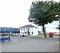
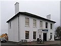
The lifestyle in B21 8LL is shaped by its proximity to retail, transport, and community hubs. Nearby shops include Spar, Farmfoods Handsworth, and Lidl Handsworth, offering everyday essentials within walking distance. The area’s rail and metro networks provide easy access to shopping, leisure, and employment opportunities in Birmingham and beyond. While specific parks or recreational spaces are not listed in the data, the presence of multiple transport stops and retail outlets suggests a practical, convenience-driven lifestyle. The compact nature of the postcode area means that amenities are closely clustered, reducing the need for long commutes. For residents, this balance of accessibility and local services supports a functional, if modest, daily routine.
Amenities
Schools
Residents of B21 8LL have access to two independent schools within practical reach: Sandwell Valley School, rated outstanding by Ofsted, and V.A.S.E Academy, rated good. Both institutions cater to families seeking private education, though their independent status may imply higher fees compared to state schools. The presence of an outstanding-rated school suggests strong academic provision for some households, while the good-rated academy offers a reliable alternative. The mix of school types reflects a range of educational choices, though no state schools are listed in the data. For families prioritising private education, these options are significant, but those seeking state-funded schooling may need to look beyond the immediate area.
| Rank | A + A* % | School | Type | Entry gender | Ages |
|---|---|---|---|---|---|
| 1 | N/A | Sandwell Valley School | independent | N/A | N/A |
| 2 | N/A | V.A.S.E Academy | independent | N/A | N/A |
Explore more schools in this area
Go to Schools tabDemographics
B21 8LL has a median age of 47, with the majority of residents aged 30–64. This suggests a community of middle-aged adults, many of whom may be in their prime working years. Home ownership is low at 27%, indicating that most households are likely renters, which could reflect the area’s housing stock composition. The predominant accommodation type is flats, a common feature in high-density urban areas. The predominant ethnic group is White, though specific data on diversity beyond this is not provided. The age profile and housing type suggest a population that may be more transient or focused on rental affordability. With no data on deprivation, it is unclear how this affects quality of life, but the low home ownership rate may indicate limited opportunities for long-term investment in property.
Household Size
Accommodation Type
Tenure
Ethnic Group
Religion
Household Composition
Age
Household Deprivation
NS-SEC
Explore more demographic insights in this area
Go to Demographics tabPlanning
Planning Constraints
- Flood RiskLocked
- Ramsar Wetland SitesLocked
- Area of Outstanding Natural BeautyLocked
- Protected Nature ReserveLocked
- Protected WoodlandLocked
- Crime RiskLocked