Area Overview for B21 8ES
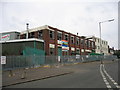
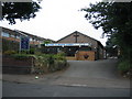
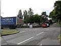
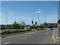
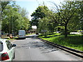
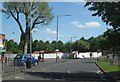
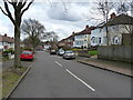
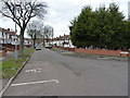
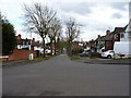
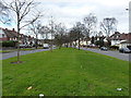
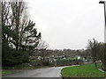
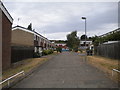
Photos of B21 8ES
Area Information
Living in B21 8ES means inhabiting a small, residential postcode area in Handsworth Wood, a historically distinct suburb north of Birmingham City Centre. With a population of 1,473, this area retains a suburban, low-density character, marked by large houses on substantial plots. Its roots trace back to the 19th century, when it became a sought-after retreat for Birmingham’s wealthy, offering a rural escape from industrialisation. Today, it remains predominantly suburban and affluent, with a village-like quality that contrasts with the denser parts of Handsworth. The area’s proximity to Birmingham—just 2 kilometres from the city centre—offers easy access to urban amenities while preserving a quieter, more spacious lifestyle. Its historical role as an evacuation zone during World War II, due to its undeveloped landscape and large properties, echoes in its current appeal to families and professionals seeking a balance between urban convenience and suburban tranquillity. The mix of historical architecture, such as St Mary’s Church and the Old Town Hall, and modern infrastructure makes B21 8ES a place where tradition and practicality coexist.
- Area Type
- Postcode
- Area Size
- Not available
- Population
- 1473
- Population Density
- 5141 people/km²
The property market in B21 8ES is characterised by low home ownership (36%) and a predominance of houses. This suggests that the area is not a hotbed for rental investments but rather a niche market for owner-occupiers seeking spacious, suburban homes. The presence of large properties on substantial plots aligns with the area’s historical role as a retreat for affluent families. However, the relatively low ownership rate may indicate a reliance on private rentals or shared ownership models. For buyers, this means a limited supply of properties, potentially driving up prices in the small cluster of homes available. The focus on houses rather than apartments or flats also means that the area caters to those prioritising space and privacy over urban convenience. Prospective buyers should consider the area’s proximity to Birmingham for work, as the local housing stock is unlikely to expand significantly due to its small, established footprint.
House Prices in B21 8ES
No properties found in this postcode.
Energy Efficiency in B21 8ES
Life in B21 8ES is shaped by its mix of suburban tranquillity and urban proximity. Residents have access to five retail outlets, including Tesco Handsworth and Farmfoods Handsworth, providing everyday shopping needs. The area’s transport network includes five metro stations and five rail stations, such as Hawthorns Railway Station and Hamstead Railway Station, facilitating easy travel to Birmingham and surrounding areas. Nearby, Handsworth Park offers green space with historical features like the Sunken Garden and St Mary’s Church, a 15th-century cruck-framed building. The Old Town Hall on College Road adds to the area’s heritage. This blend of retail, transport, and green spaces creates a lifestyle that balances convenience with a sense of community, ideal for those seeking both suburban comfort and access to city amenities.
Amenities
Schools
The nearest school to B21 8ES is St Augustine’s Catholic Primary School, which has an Ofsted rating of ‘good’. This primary school serves the local community, offering a faith-based education for younger children. The absence of secondary schools in the immediate area means families may need to look further afield for secondary education, though the proximity to Birmingham City Centre could provide access to larger school networks. The presence of a ‘good’-rated primary school is a positive for families prioritising early education, though the lack of secondary options may require careful planning. The school’s rating suggests a commitment to quality teaching, which could be a deciding factor for parents seeking a stable educational environment for their children.
| Rank | School | Type | Entry gender | Ages |
|---|
Explore more schools in this area
Go to Schools tabDemographics
The community in B21 8ES is predominantly composed of adults aged 30–64, with a median age of 47. This suggests a mature population, likely with established careers and families. Home ownership stands at 36%, indicating a mix of owner-occupied and rental properties. The area’s accommodation type is primarily houses, reflecting its suburban nature and the presence of large, spaced-out properties. The predominant ethnic group is the Asian community, though specific proportions are not detailed. This demographic profile suggests a stable, long-term resident base, with a focus on family living. The absence of deprivation data means the area’s quality of life can be inferred from its amenities and infrastructure, such as the proximity to schools, transport, and green spaces. The age range and ownership figures imply a community that values stability and space, with a strong emphasis on residential comfort over high-density living.
Household Size
Accommodation Type
Tenure
Ethnic Group
Religion
Household Composition
Age
Household Deprivation
NS-SEC
Explore more demographic insights in this area
Go to Demographics tabPlanning
Planning Constraints
- Flood RiskPremium
- Ramsar Wetland SitesPremium
- Area of Outstanding Natural BeautyPremium
- Protected Nature ReservePremium
- Protected WoodlandPremium