Area Overview for B21 8AW
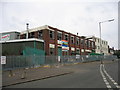
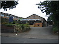
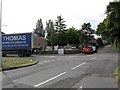
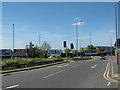
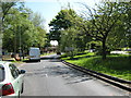
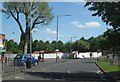
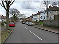
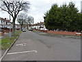
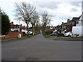
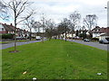
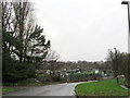
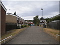
Photos of B21 8AW
Area Information
Living in B21 8AW means being part of a tightly knit residential cluster in England’s West Midlands, where the population of 1,587 reflects a small but active community. This area, though modest in size, sits at the intersection of historical and modern Birmingham, with roots tracing back to 18th-century infrastructure like the Wednesbury Turnpike. Daily life here is shaped by its proximity to key transport routes, including the A5, and a mix of Victorian architecture and contemporary housing. The area’s character is defined by its blend of practicality and heritage, with landmarks such as the New Inns public house standing as a testament to its long-standing history. Residents benefit from a range of nearby amenities, from retail outlets like Tesco Handsworth to public transport links such as the Handsworth Booth Street tram stop. While the population is older than Birmingham’s average, with a median age of 47, the community remains dynamic, supported by schools like Holyhead School, which received a “Good” Ofsted rating in 2020. This is a place where convenience meets tradition, offering a distinct urban living experience.
- Area Type
- Postcode
- Area Size
- Not available
- Population
- Not available
- Population Density
- Not available
The property market in B21 8AW is characterised by a 57% home ownership rate, with houses forming the predominant type of accommodation. This suggests a residential area where owner-occupiers are the majority, though rental properties also exist. The concentration of houses, rather than flats or apartments, indicates a preference for family-friendly, spacious living. Given the area’s small size, the housing stock is likely to be tightly clustered, with limited scope for expansion. For buyers, this means a focus on established properties rather than new developments. The presence of historical architecture, such as Victorian shop parades, adds to the area’s appeal, though potential buyers should consider the age of properties when assessing maintenance needs. The market’s compact nature means that proximity to amenities and transport is a key selling point, with residents benefiting from nearby retail, schools, and public transport links.
House Prices in B21 8AW
No properties found in this postcode.
Energy Efficiency in B21 8AW
Residents of B21 8AW have access to a range of amenities within practical reach. Retail options include major supermarkets like Tesco Handsworth, Farmfoods Handsworth, and Lidl Handsworth, ensuring everyday shopping is convenient. Public transport is well-integrated, with five metro stops and five rail stations nearby, including Handsworth Booth Street and Hawthorns Railway Station, facilitating easy travel to Birmingham’s city centre and beyond. The area also benefits from historical landmarks such as the New Inns public house, a 19th-century establishment that adds to the local character. For education, Holyhead School serves the community and holds a “Good” Ofsted rating. The mix of retail, transport, and cultural heritage creates a lifestyle that balances practicality with a sense of place. Parks and leisure facilities are not explicitly detailed in the data, but the area’s proximity to Birmingham’s broader infrastructure suggests opportunities for outdoor activities and social engagement.
Amenities
Schools
| Rank | School | Type | Entry gender | Ages |
|---|
Explore more schools in this area
Go to Schools tabDemographics
The community in B21 8AW is predominantly composed of adults aged 30–64, with a median age of 47. Home ownership stands at 57%, indicating a mix of owner-occupied properties and rental units. The area’s accommodation is largely houses, reflecting a residential focus rather than high-density housing. The predominant ethnic group is Asian_total, which shapes the cultural and social fabric of the neighbourhood. While specific data on deprivation is not provided, the demographic profile suggests a stable, working-age population with established ties to the area. The presence of a higher proportion of Black, Asian, and Minority Ethnic (BAME) residents aligns with broader trends in Birmingham’s inner-city wards. This demographic composition influences local amenities and services, ensuring they cater to a diverse range of needs. The age profile, skewed toward middle-aged adults, suggests a community with a strong emphasis on family life and long-term residency.
Household Size
Accommodation Type
Tenure
Ethnic Group
Religion
Household Composition
Age
Household Deprivation
NS-SEC
Explore more demographic insights in this area
Go to Demographics tabPlanning
Planning Constraints
- Flood RiskPremium
- Ramsar Wetland SitesPremium
- Area of Outstanding Natural BeautyPremium
- Protected Nature ReservePremium
- Protected WoodlandPremium