Area Overview for B21 8AF
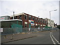
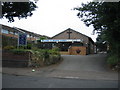
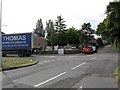
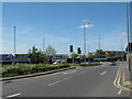
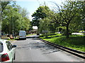
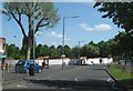
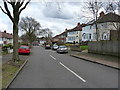
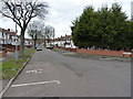
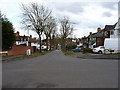
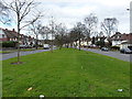
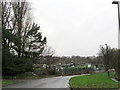
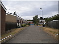
Photos of B21 8AF
Area Information
Living in B21 8AF means being part of a small, tightly knit residential cluster with a population of 1,587. This postcode sits in a historically significant part of Birmingham, where industrial heritage meets modern living. The area is characterised by a mix of housing types, with a strong emphasis on owner-occupied homes—over half of residents own their properties. The community skews towards adults aged 30–64, reflecting a mature demographic profile. While the area is compact, it is well-connected to nearby transport networks, including metro and rail services, making it accessible for commuters. Residents benefit from excellent broadband connectivity, with a score of 100, ensuring seamless digital experiences. Daily life here is shaped by proximity to essential amenities, from supermarkets like Tesco Handsworth and Lidl Handsworth to nearby rail stations such as Hamstead and Hawthorns. The area’s blend of practicality and connectivity makes it appealing for those seeking a balance between urban convenience and a stable, community-focused environment.
- Area Type
- Postcode
- Area Size
- Not available
- Population
- 1587
- Population Density
- Not available
The property market in B21 8AF is defined by a high rate of home ownership—57% of residents own their homes—indicating a preference for long-term investment over rental living. The area is primarily composed of houses, which contrasts with parts of Birmingham that lean towards apartments or terraced housing. This suggests a market that appeals to families and professionals seeking space and stability. Given the small size of the postcode, the housing stock is limited, making it a niche area for buyers. Proximity to transport links, including rail and metro stations, adds to the area’s appeal, particularly for commuters. However, the compact nature of B21 8AF means that property availability is restricted, and buyers should consider the surrounding areas for broader options. The combination of owner-occupation and house-dominated stock positions this area as a practical choice for those prioritising security and convenience.
House Prices in B21 8AF
No properties found in this postcode.
Energy Efficiency in B21 8AF
Residents of B21 8AF have access to a range of essential amenities within easy reach. The area is served by five retail outlets, including Tesco Handsworth, Farmfoods Handsworth, and Lidl Handsworth, ensuring everyday shopping needs are met. Public transport is a key feature of daily life, with five metro stops and five rail stations providing convenient access to Birmingham’s wider network. Stations like Soho Benson Road and Smethwick Rolfe Street offer connections to nearby towns and city centre hubs. While the area’s smaller size limits the diversity of leisure options, the proximity to transport links opens up opportunities for dining, entertainment, and cultural activities in surrounding districts. The mix of retail and transport infrastructure supports a practical, efficient lifestyle, ideal for those prioritising convenience without sacrificing urban access.
Amenities
Schools
| Rank | School | Type | Entry gender | Ages |
|---|
Explore more schools in this area
Go to Schools tabDemographics
B21 8AF has a median age of 47, with the majority of residents falling within the 30–64 age range. This suggests a community of working-age adults, many of whom are likely established professionals or families. Home ownership is strong here, with 57% of properties owned by residents, indicating a preference for long-term stability. The area is predominantly occupied by houses, which contrasts with other parts of Birmingham that may have more flats or apartments. The predominant ethnic group is Asian_total, reflecting a diverse yet cohesive community. While no specific deprivation data is provided, the high home ownership rate and moderate population size suggest a relatively stable economic environment. This demographic profile creates a neighbourhood where families and professionals coexist, with a shared focus on community and practical living.
Household Size
Accommodation Type
Tenure
Ethnic Group
Religion
Household Composition
Age
Household Deprivation
NS-SEC
Explore more demographic insights in this area
Go to Demographics tabPlanning
Planning Constraints
- Flood RiskPremium
- Ramsar Wetland SitesPremium
- Area of Outstanding Natural BeautyPremium
- Protected Nature ReservePremium
- Protected WoodlandPremium
- Crime RiskPremium