Area Overview for B21 0ST
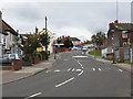
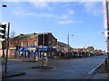
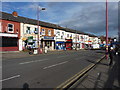
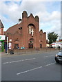
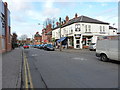
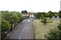
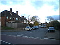
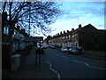
Photos of B21 0ST


Area Information
B21 0ST is a small residential postcode in England, home to 1,426 people spread across a compact cluster of properties. While not part of the historic Jewellery Quarter itself, it lies within reach of its cultural and economic influence. The area’s character is shaped by its proximity to Birmingham’s central districts, offering a blend of quiet residential living and access to urban amenities. With a median age of 47, the community is predominantly composed of adults aged 30–64, suggesting a mix of established residents and families. The area’s housing stock is largely made up of individual homes, reflecting a preference for private ownership. Daily life here is defined by proximity to retail, transport, and schools, with residents able to access essential services within walking or short driving distance. The postcode’s small size means it is tightly integrated with surrounding neighbourhoods, creating a sense of cohesion. However, its limited population and scale mean it is more of a satellite to larger districts rather than a standalone community. For buyers, B21 0ST offers a niche opportunity to own a home in a low-density area with clear links to Birmingham’s historic industrial heart.
- Area Type
- Postcode
- Area Size
- Not available
- Population
- 1426
- Population Density
- 8463 people/km²
The property market in B21 0ST is characterised by a 43% home ownership rate, with houses being the primary accommodation type. This suggests a market skewed towards rental properties, as the remaining 57% of residents likely live in rented homes. The presence of individual houses rather than apartments or flats indicates a focus on private, standalone living spaces. For buyers, this dynamic means the area is less about high-density housing and more about semi-detached or terraced homes. The relatively small population of 1,426 residents implies a limited number of properties available for purchase, which could drive competition among buyers. However, the low home ownership rate also suggests potential for growth in the rental sector, making B21 0ST an area where investors might find opportunities. The housing stock’s composition—primarily houses—means buyers should consider the practicalities of maintaining larger properties in a small, compact postcode.
House Prices in B21 0ST
No properties found in this postcode.
Energy Efficiency in B21 0ST
Living in B21 0ST offers access to a range of amenities within practical reach. The area is served by five retail outlets, including Iceland Handsworth and Lidl Handsworth, providing essential grocery and household goods. For transport, residents can use five metro stops such as Winson Green Outer Circle and Soho Benson Road, as well as five rail stations like Hawthorns Railway Station and Jewellery Quarter Railway Station. These connections facilitate travel to Birmingham’s central districts and beyond. While the area itself is small, its proximity to the historic Jewellery Quarter adds cultural and economic vibrancy. The presence of multiple retail and transport hubs suggests a convenient lifestyle, though the limited local amenities mean residents may need to travel further for leisure or dining options. The mix of retail, transport, and nearby historic districts creates a practical but not overly indulgent environment, ideal for those prioritising accessibility over extensive local facilities.
Amenities
Schools
Residents of B21 0ST have access to two notable schools within proximity. Handsworth Grammar School is a primary school, providing education for younger children. Nearby, King Edward VI Handsworth Grammar School for Boys is an academy with an Ofsted rating of “good,” indicating a high standard of education. The presence of both a primary school and an academy offers families a range of options, from early education to secondary schooling. The academy’s “good” rating suggests it meets or exceeds national standards in teaching quality and student outcomes. For parents, this mix of school types ensures continuity in education and access to a reputable secondary institution. However, the absence of additional schools in the data means the area’s educational offerings are limited to these two institutions. Families with children may need to consider commuting to other parts of Birmingham for further educational opportunities.
| Rank | School | Type | Entry gender | Ages |
|---|
Explore more schools in this area
Go to Schools tabDemographics
The population of B21 0ST is 1,426, with a median age of 47, indicating a mature demographic profile. The majority of residents fall within the 30–64 age range, suggesting a community of working-age adults and families. Home ownership in the area stands at 43%, which is lower than the national average, pointing to a significant rental market. The predominant accommodation type is houses, which is unusual for urban areas and may reflect the area’s semi-detached or terraced housing stock. The predominant ethnic group is Asian, though specific subgroups are not detailed. This demographic profile suggests a community with established roots and a focus on family living. The lower home ownership rate may indicate a reliance on rental properties, which could influence the local property market’s dynamics. For prospective buyers, this data highlights a market where owner-occupied homes are less common, potentially offering opportunities for investment in rental properties.
Household Size
Accommodation Type
Tenure
Ethnic Group
Religion
Household Composition
Age
Household Deprivation
NS-SEC
Explore more demographic insights in this area
Go to Demographics tabPlanning
Planning Constraints
- Flood RiskPremium
- Ramsar Wetland SitesPremium
- Area of Outstanding Natural BeautyPremium
- Protected Nature ReservePremium
- Protected WoodlandPremium