Area Overview for B21 0SS
Photos of B21 0SS
Area Information
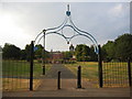
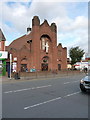
Living in B21 0SS means being part of a small, tightly knit residential cluster in England, with a population of just 2,067 people. This postcode area sits within the broader historical and economic heart of Birmingham’s Jewellery Quarter, a district renowned for its craftsmanship legacy and World Craft City status. The area’s compact size fosters a close-knit community feel, though its proximity to Birmingham’s industrial and cultural hubs offers access to a wealth of opportunities. The demographic profile suggests a mature population, with a median age of 47 and a majority of residents aged 30–64. This suggests a stable, established community with strong ties to local institutions. While the area is small, its strategic location near major transport routes and historic sites like St. Paul’s Church and the Museum of the Jewellery Quarter ensures residents are never far from cultural or economic activity. The low flood risk and absence of environmental constraints like AONB or protected woodlands make it a practical choice for those prioritising safety and planning certainty. However, the high crime risk score of 3/100 indicates a need for caution and awareness.
- Area Type
- Postcode
- Area Size
- Not available
- Population
- 2067
- Population Density
- 7756 people/km²
The property market in B21 0SS is characterised by a 31% home ownership rate, which is notably lower than the national average, suggesting that rental properties dominate the housing stock. The accommodation type is primarily houses, which is uncommon in densely populated urban areas but may reflect the area’s historical development as a residential cluster. This mix of housing suggests a balance between older, family-sized homes and newer developments. For buyers, the small size of the postcode area means competition may be fierce, with limited options for expansion or relocation within immediate surroundings. The predominance of houses could appeal to those seeking more space, but the low home ownership rate indicates a market skewed towards tenants. Prospective buyers should consider the area’s proximity to transport links and amenities, which may offset the limitations of a constrained housing stock.
House Prices in B21 0SS
No properties found in this postcode.
Energy Efficiency in B21 0SS
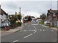
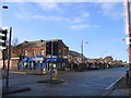
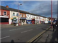
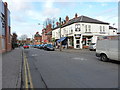
Residents of B21 0SS enjoy a range of amenities within practical reach, including five retail outlets such as Iceland Handsworth, Lidl Handsworth, and Farmfoods Handsworth, which cater to everyday shopping needs. The area’s transport network, with five metro stations and five rail stations, provides seamless access to Birmingham’s broader urban fabric. While the data does not mention parks or leisure facilities, the proximity to historic sites like St. Paul’s Church and the Museum of the Jewellery Quarter suggests cultural and historical attractions are nearby. The mix of retail, transport, and heritage sites creates a lifestyle that balances convenience with access to the area’s rich history. For those prioritising practicality, the availability of supermarkets and public transport ensures daily life is efficient, though the absence of specific details on green spaces or recreational facilities may require further local investigation.
Amenities
Schools
Residents of B21 0SS have access to two notable schools within practical reach: Benson Community School, a primary school, and Oasis Academy Benson, an academy. These institutions cater to different educational stages, providing a range of options for families. The presence of both a primary school and an academy suggests a diverse educational landscape, though specific Ofsted ratings are not provided. For parents, the mix of school types may offer flexibility in choosing between community-focused primary education and the structured environment of an academy. However, the absence of data on academic performance or student outcomes means prospective families must rely on local reputation or direct visits to assess quality. The schools’ proximity to the area reinforces the appeal of B21 0SS for families prioritising accessible education.
| Rank | School | Type | Entry gender | Ages |
|---|
Explore more schools in this area
Go to Schools tabDemographics
The population of B21 0SS is 2,067, with a median age of 47, indicating a predominantly middle-aged and older adult community. The most common age range is 30–64 years, suggesting a stable, working-age population with established careers and families. Home ownership here is relatively low at 31%, implying a higher proportion of renters compared to owner-occupied homes. The accommodation type is primarily houses, which is unusual for urban areas and may reflect a mix of older properties and newer developments. The predominant ethnic group is Asian, highlighting the area’s cultural diversity. This demographic profile suggests a community that values stability and may have strong intergenerational ties. However, the low home ownership rate could indicate economic pressures or a preference for rental living. The absence of specific deprivation data means the quality of life must be inferred from infrastructure and amenities, which appear to be adequate for daily needs.
Household Size
Accommodation Type
Tenure
Ethnic Group
Religion
Household Composition
Age
Household Deprivation
NS-SEC
Explore more demographic insights in this area
Go to Demographics tabPlanning
Planning Constraints
- Flood RiskPremium
- Ramsar Wetland SitesPremium
- Area of Outstanding Natural BeautyPremium
- Protected Nature ReservePremium
- Protected WoodlandPremium