Area Overview for B21 0NF
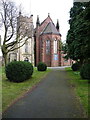
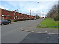
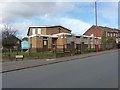
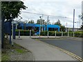
Photos of B21 0NF


Area Information
Living in B21 0NF means being part of a small, tightly knit residential cluster in England, home to 1,559 people. This area is characterised by its compact size and proximity to essential services, making it practical for daily life. The community here is predominantly composed of adults aged 30–64, reflecting a mature demographic. While the area is not part of the historic Jewellery Quarter (as per available data), it shares the same postcode structure as nearby regions, which may offer indirect access to some of Birmingham’s cultural and economic assets. Residents benefit from a mix of retail, public transport, and educational facilities within walking distance. The high broadband score of 99 ensures seamless internet connectivity, supporting both work and leisure. However, the area’s safety profile is a concern, with a critical crime risk rating. Despite this, the low flood risk and absence of environmental constraints like protected woodlands or AONB designations suggest a stable living environment. For those prioritising convenience and connectivity, B21 0NF offers a compact, functional base for daily life.
- Area Type
- Postcode
- Area Size
- Not available
- Population
- 1559
- Population Density
- 5657 people/km²
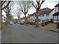
The property market in B21 0NF is defined by its low home ownership rate of 33%, indicating that the majority of residents rent rather than own their homes. This suggests a rental-focused market, which may appeal to those seeking flexibility or affordability. The accommodation type is primarily houses, which is unusual for a small postcode area, hinting at a mix of single-family homes and possibly multi-generational living. Buyers should consider that the limited number of properties may mean competition is high, particularly for owner-occupied homes. The area’s small size means the housing stock is likely concentrated, with limited scope for new developments. For those prioritising family homes, the presence of houses could be an advantage, but the low ownership rate may also reflect challenges in securing mortgages or long-term investment. Prospective buyers should weigh the practicality of renting against the potential for property value growth in this niche market.
House Prices in B21 0NF
No properties found in this postcode.
Energy Efficiency in B21 0NF
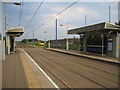
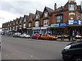
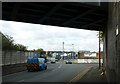
The lifestyle in B21 0NF is shaped by its proximity to retail, dining, and transport hubs. Residents can access five retail outlets, including Lidl Handsworth, Farmfoods Handsworth, and Iceland Handsworth, which provide everyday shopping convenience. The metro stations—such as Handsworth Booth Street and Winson Green Outer Circle—offer frequent services, while rail stations like Smethwick Galton Bridge High Level provide connections to broader networks. Though the data does not mention parks or leisure facilities, the area’s compact design suggests a focus on practicality over expansive recreational spaces. The presence of multiple transport options and retail venues indicates a community-oriented environment where daily needs are met within a short distance. However, the lack of specific details on dining or leisure venues means the full range of lifestyle options remains unclear.
Amenities
Schools
Residents of B21 0NF have access to Holyhead School, a primary school, and another Holyhead School, which operates as an academy with a good Ofsted rating. The presence of both a primary school and an academy suggests a range of educational options for families. The academy’s good rating indicates a school that meets national standards in teaching quality and student outcomes. However, the data does not specify the age range of students at the academy, nor does it provide additional details about curriculum or extracurricular offerings. For parents, the proximity of these schools is a key advantage, reducing the need for long commutes. The dual presence of schools may also indicate a focus on education in the area, though the lack of data on pupil numbers or performance metrics limits a deeper analysis of the educational environment.
| Rank | School | Type | Entry gender | Ages |
|---|
Explore more schools in this area
Go to Schools tabDemographics
The population of B21 0NF is 1,559, with a median age of 47, indicating a community skewed towards middle-aged adults. The most common age range is 30–64 years, suggesting a mature, established population. Home ownership here is relatively low at 33%, pointing to a rental-heavy market. The area is predominantly composed of houses, which is uncommon in many urban postcode clusters. The predominant ethnic group is Asian_total, reflecting a culturally diverse community. This demographic profile shapes the area’s character, with a focus on stability and long-term residency. However, the lack of specific deprivation data means quality of life factors like access to services or employment opportunities are not quantified here. The presence of a primary school and academy nearby suggests families are a key demographic, though the broader economic context of the area remains underexplored in the data.
Household Size
Accommodation Type
Tenure
Ethnic Group
Religion
Household Composition
Age
Household Deprivation
NS-SEC
Explore more demographic insights in this area
Go to Demographics tabPlanning
Planning Constraints
- Flood RiskPremium
- Ramsar Wetland SitesPremium
- Area of Outstanding Natural BeautyPremium
- Protected Nature ReservePremium
- Protected WoodlandPremium