Area Overview for B21 0LF
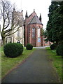
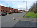
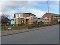
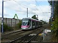
Photos of B21 0LF

Area Information
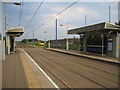
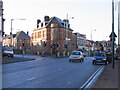
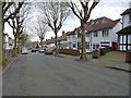
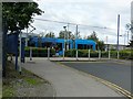
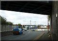
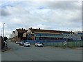
Living in B21 0LF means inhabiting a small, tightly knit residential cluster in the heart of Birmingham’s Holyhead ward. With a population of 1,559, this area is compact but historically rich, situated to the north-west of the city centre. Its character blends Victorian architecture with modern conversions, as seen in the surviving shop parades and the New Inns public house, which has stood since the 18th century. The ward’s demographics reflect a younger population than the city as a whole, with a significant presence of Asian communities. Daily life here is shaped by proximity to key transport routes like the A5 and a network of tram and rail connections. While the area lacks sprawling green spaces, its density offers convenience, with shops, schools, and transport hubs within easy reach. The mix of historic and contemporary elements, coupled with a diverse community, makes B21 0LF a distinct microcosm of Birmingham’s urban fabric.
- Area Type
- Postcode
- Area Size
- Not available
- Population
- 1559
- Population Density
- 5657 people/km²
The property market in B21 0LF is shaped by its 33% home ownership rate, which suggests that the majority of housing stock is rented out. Despite this, the accommodation type is predominantly houses, a rarity in such a small, urban postcode. This combination implies a niche market where rental properties are primarily single-family homes, possibly attracting tenants seeking more space than typical flats. The limited number of owner-occupied homes may indicate a focus on short-term investment or rental yields, though the small area size means buyers must consider nearby surroundings. For those seeking to purchase, the scarcity of owner-occupied properties could present challenges, with opportunities more likely in adjacent areas. The presence of houses rather than apartments also means the area caters to households requiring larger living spaces, though the overall market remains constrained by the postcode’s compact footprint.
House Prices in B21 0LF
No properties found in this postcode.
Energy Efficiency in B21 0LF
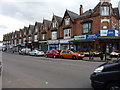
Residents of B21 0LF enjoy a range of amenities within practical reach, including retail outlets like Farmfoods Handsworth, Lidl Handsworth, and Iceland Handsworth. These stores provide everyday shopping needs, reducing the need for long trips. The area’s transport network also grants access to leisure and dining options beyond the immediate postcode. While specific parks or recreational spaces are not mentioned in the data, the presence of historic buildings like the New Inns pub and Victorian shop parades suggests a mix of cultural and commercial character. The proximity to rail and metro stations further enhances lifestyle convenience, enabling easy access to Birmingham’s broader amenities. The compact nature of the area means residents can navigate daily life with minimal travel, though the absence of detailed park or leisure data leaves room for further exploration of local green spaces.
Amenities
Schools
Residents of B21 0LF have access to Holyhead School, a primary school and an academy with an Ofsted rating of “Good.” The dual presence of a primary school and an academy provides a range of educational options for families, though the data does not specify separate Ofsted ratings for the primary and academy phases. The school’s “Good” rating suggests it meets national standards, offering a reliable foundation for local children’s education. However, the absence of additional schools in the data means families may need to look beyond the immediate area for secondary education or specialist provisions. The proximity of Holyhead School to the postcode is a key asset, reducing travel time for parents and ensuring children are served by a locally established institution with a documented track record of performance.
| Rank | School | Type | Entry gender | Ages |
|---|
Explore more schools in this area
Go to Schools tabDemographics
The community in B21 0LF is defined by a median age of 47, with the most common age group being adults aged 30–64. This suggests a mature, stable population, though the area’s 33% home ownership rate indicates that a majority of residents are likely to rent. The accommodation type is predominantly houses, which is unusual for a small inner-city ward, hinting at a mix of older properties and newer developments. The predominant ethnic group is Asian_total, reflecting the ward’s broader demographic profile as one of Birmingham’s more ethnically diverse areas. With a population of 1,559, the community is compact but socially varied, offering a contrast to the city’s wider trends. The lower home ownership rate may influence the local economy, potentially increasing reliance on rental income and shaping the area’s character as a transient or investment-driven neighbourhood.
Household Size
Accommodation Type
Tenure
Ethnic Group
Religion
Household Composition
Age
Household Deprivation
NS-SEC
Explore more demographic insights in this area
Go to Demographics tabPlanning
Planning Constraints
- Flood RiskPremium
- Ramsar Wetland SitesPremium
- Area of Outstanding Natural BeautyPremium
- Protected Nature ReservePremium
- Protected WoodlandPremium