Area Overview for B21 0DQ
Photos of B21 0DQ


Area Information
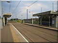
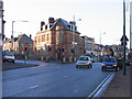
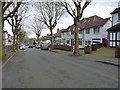
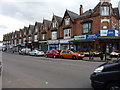
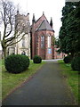
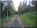
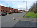
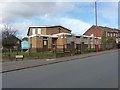
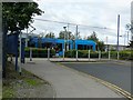
Living in B21 0DQ means being part of a compact, residential postcode area in England, home to 1,723 people. This small cluster of homes sits within a historically significant part of Birmingham, where the A5 road — historically linking London to Holyhead — runs through. The area’s character is shaped by its mix of Victorian architecture and modern conversions, with landmarks like the New Inns public house, which has stood since the 18th century. Daily life here is defined by proximity to essential services, including five metro stops, five railway stations, and retail options like Farmfoods Handsworth and Lidl. The community is predominantly adults aged 30–64, with a strong Asian presence, creating a culturally diverse environment. While the area lacks large green spaces or natural reserves, its connectivity to Birmingham’s transport network and proximity to schools like Holyhead School — rated “Good” by Ofsted — make it appealing for families. The compact nature of B21 0DQ means residents live close to amenities, though the small population size suggests a tight-knit, localised community feel.
- Area Type
- Postcode
- Area Size
- Not available
- Population
- 1723
- Population Density
- 14918 people/km²
The property market in B21 0DQ is characterised by a 40% home ownership rate, with the majority of properties being houses rather than flats or apartments. This suggests a focus on single-family homes, which may appeal to those seeking space and privacy in a compact urban setting. The low proportion of owner-occupied properties indicates a rental market that could be competitive, particularly for first-time buyers looking to enter a small area with limited housing stock. Given the postcode’s small size, property values may be influenced by proximity to transport links and schools like Holyhead School. However, the lack of large-scale development or regeneration projects means the housing stock remains relatively static. Buyers should consider the area’s limited size, which may restrict options for those seeking larger homes or additional properties. The predominance of houses also means the market is less suited to those prioritising high-density living or investment in rental portfolios.
House Prices in B21 0DQ
No properties found in this postcode.
Energy Efficiency in B21 0DQ
Daily life in B21 0DQ is shaped by its proximity to essential amenities. Residents have access to five metro stops, including Handsworth Booth Street and Soho Benson Road, offering frequent connections to Birmingham’s transport network. Railway stations like Hawthorns and Smethwick Rolfe Street provide links to regional and local routes. For shopping, Farmfoods Handsworth, Lidl, and Spar are within practical reach, catering to everyday needs. The area’s historical character is evident in landmarks like the New Inns public house, which has been a local fixture since the 18th century. While there are no large parks or green spaces mentioned, the compact layout ensures residents can access urban conveniences without long commutes. The presence of Holyhead School, rated “Good” by Ofsted, adds to the area’s appeal for families. Overall, B21 0DQ offers a blend of historical charm and modern practicality, with amenities that support both daily routines and community engagement.
Amenities
Schools
| Rank | School | Type | Entry gender | Ages |
|---|
Explore more schools in this area
Go to Schools tabDemographics
B21 0DQ has a median age of 47, with the majority of residents aged 30–64. This suggests a mature, stable community, likely with a mix of working professionals and families. Home ownership stands at 40%, meaning 60% of households are likely renters, reflecting a balance between owner-occupied and rental properties. The area is primarily composed of houses, which is unusual for inner-city postcodes, hinting at a preference for single-family living. The predominant ethnic group is Asian_total, indicating a significant cultural diversity that shapes local traditions and community dynamics. While no specific deprivation data is provided, the high proportion of adults and home ownership levels suggest a relatively stable economic profile. However, the absence of detailed deprivation metrics means assumptions about quality of life must be cautious. The area’s demographics align with broader trends in Birmingham, where inner-city wards often have younger populations and higher BAME representation compared to the city as a whole.
Household Size
Accommodation Type
Tenure
Ethnic Group
Religion
Household Composition
Age
Household Deprivation
NS-SEC
Explore more demographic insights in this area
Go to Demographics tabPlanning
Planning Constraints
- Flood RiskPremium
- Ramsar Wetland SitesPremium
- Area of Outstanding Natural BeautyPremium
- Protected Nature ReservePremium
- Protected WoodlandPremium