Area Overview for B21 0BG
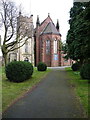
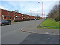
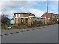
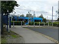
Photos of B21 0BG


Area Information
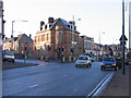
Living in B21 0BG means being part of a small, tightly knit residential cluster in England, with a population of 1,559. This postcode sits within the broader historic Jewellery Quarter, a district renowned for its 18th-century industrial heritage and recent designation as a World Craft City. While B21 0BG itself is a modest area, it benefits from proximity to the Quarter’s legacy of craftsmanship and innovation. The community here reflects a blend of historical significance and modern practicality, with homes positioned near key infrastructure like rail lines and retail hubs. Daily life is shaped by the area’s compact size, offering easy access to local amenities while maintaining a quiet, residential character. The absence of major planning constraints—such as protected woodlands or AONB designations—means development is unencumbered, though the high crime risk noted in assessments underscores the need for vigilance. For buyers, B21 0BG represents a chance to live in a historically rich area with contemporary connectivity, albeit with considerations for safety.
- Area Type
- Postcode
- Area Size
- Not available
- Population
- 1559
- Population Density
- 5657 people/km²
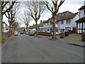
The property market in B21 0BG is characterised by a 33% home ownership rate, suggesting that most residents rent rather than own their homes. The predominant accommodation type is houses, which is atypical for a small postcode area but may indicate a mix of semi-detached or terraced properties. This configuration implies a market skewed toward rental properties, with limited scope for long-term investment in owner-occupied homes. The compact size of the area means that property availability is constrained, and buyers may need to look beyond immediate surroundings for larger options. The focus on houses rather than flats or apartments could appeal to families seeking space, though the low home ownership rate highlights the area’s reliance on private rentals. For prospective buyers, this suggests a niche market with limited competition but potential challenges in securing ownership.
House Prices in B21 0BG
No properties found in this postcode.
Energy Efficiency in B21 0BG
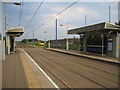
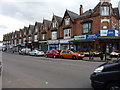
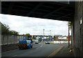
Daily life in B21 0BG is shaped by its proximity to retail, dining, and transport hubs. The area’s five nearby retail outlets include Lidl Handsworth, Farmfoods Handsworth, and Iceland Handsworth, offering convenient access to groceries and everyday essentials. For commuters, five metro stations and five rail stations provide seamless connectivity to Birmingham’s urban centres, with stops such as Handsworth Booth Street and Smethwick Galton Bridge High Level Railway Station facilitating travel. While the data does not mention parks or leisure facilities, the area’s integration with the Jewellery Quarter’s historic character suggests a blend of heritage sites and modern amenities. The compact layout ensures that residents can access shopping, transport, and local services without lengthy journeys, though the absence of named parks or recreational spaces may limit opportunities for outdoor leisure.
Amenities
Schools
Near B21 0BG, Holyhead School serves as both a primary school and an academy with a good Ofsted rating. This dual presence offers families a range of educational options, from early years schooling to secondary-level education. The academy’s good rating indicates a school that meets national standards in teaching quality and student outcomes. However, the absence of other schools in the data means the area’s educational landscape is limited to these two institutions. For parents, this could be a drawback, as it reduces choice and may necessitate longer commutes for alternative schooling. The concentration of educational provision in a single name—Holyhead—suggests a reliance on this institution, which could be both a strength and a risk depending on its performance and capacity.
| Rank | School | Type | Entry gender | Ages |
|---|
Explore more schools in this area
Go to Schools tabDemographics
The median age in B21 0BG is 47, with the majority of residents falling within the 30–64 age range. This suggests a community of established adults, many of whom may be in their prime working years. Home ownership here is relatively low at 33%, indicating a rental market dominance. The predominant accommodation type is houses, which is unusual for a small postcode area but may reflect a mix of older properties and newer developments. The largest ethnic group is the Asian community, which shapes the cultural fabric of the area. While no specific deprivation data is provided, the low home ownership rate could imply a reliance on rental income or shared living arrangements. The demographic profile points to a stable, middle-aged population with a focus on practical housing needs, though the lack of detailed socioeconomic data limits deeper analysis of quality of life factors.
Household Size
Accommodation Type
Tenure
Ethnic Group
Religion
Household Composition
Age
Household Deprivation
NS-SEC
Explore more demographic insights in this area
Go to Demographics tabPlanning
Planning Constraints
- Flood RiskPremium
- Ramsar Wetland SitesPremium
- Area of Outstanding Natural BeautyPremium
- Protected Nature ReservePremium
- Protected WoodlandPremium