Area Overview for B20 3SA
Photos of B20 3SA
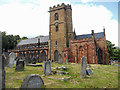
63 photos from this area
Area Information
Key information about the B20 3SA including its size, population, and administrative classification.
- Area Type
- Postcode
- Area Size
- 2976 m²
- Population
- 1641
- Population Density
- 6187 people/km²
House Prices in B20 3SA
8
Properties
£136,611
Average Sold Price
£51,444
Lowest Price
£220,000
Highest Price
Showing 8 properties
| Address | Type | Beds | Baths | Last Sale Price | Last Sale Date | |
|---|---|---|---|---|---|---|
| 39 Upper Grosvenor Road, Birmingham, B20 3SA | house | - | - | £220,000 | Sep 2024 | |
| 41 Upper Grosvenor Road, Birmingham, B20 3SA | Semi-detached | 3 | - | £150,000 | May 2018 | |
| 35 Upper Grosvenor Road, Birmingham, B20 3SA | Semi-detached | 3 | - | £125,000 | May 2014 | |
| 45 Upper Grosvenor Road, Birmingham, B20 3SA | Semi-detached | - | - | £51,444 | Oct 1999 | |
| 33 Upper Grosvenor Road, Birmingham, B20 3SA | Terraced | - | - | - | - | |
| 31 Upper Grosvenor Road, Birmingham, B20 3SA | house | - | - | - | - | |
| 43 Upper Grosvenor Road, Birmingham, B20 3SA | house | - | - | - | - | |
| 37 Upper Grosvenor Road, Birmingham, B20 3SA | house | - | - | - | - |
Energy Efficiency in B20 3SA
Amenities
Schools
| Rank | School | Type | Entry gender | Ages |
|---|
Explore more schools in this area
Go to Schools tabDemographics
Household Size
One person
most common
Accommodation Type
Houses
most common
Tenure
62
majority
Ethnic Group
asian_total
most common
Religion
N/A
most common
Household Composition
N/A
most common
Age
47
median
Adults (30-64 years)
most common
Household Deprivation
N/A
with no deprivation
NS-SEC
21
in Lower managerial occupations
Explore more demographic insights in this area
Go to Demographics tabPlanning
Planning Constraints
- Flood RiskPremium
- Ramsar Wetland SitesPremium
- Area of Outstanding Natural BeautyPremium
- Protected Nature ReservePremium
- Protected WoodlandPremium