Area Overview for B20 3QH
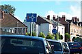
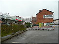
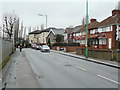
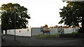
Photos of B20 3QH
Area Information
B20 3QH is a small, tightly knit residential postcode area in Birmingham’s Birchfield ward, part of the Perry Barr constituency. With a population of 1,794, it reflects the broader demographic of inner-city Birmingham, shaped by 19th-century expansion and historical ties to local institutions like Aston Villa Football Club and Birchfield Harriers athletics club. The area’s compact size fosters a sense of community, though its proximity to Birmingham’s urban core means it balances residential tranquillity with city accessibility. Residents benefit from nearby heritage sites, including the Birchfield Heritage Trail and Hollick & Taylor Studios, which highlight the area’s cultural legacy. While the postcode itself is small, it sits within a larger ward of 12,473 people, offering a mix of local character and urban convenience. For those seeking a quieter slice of Birmingham with historical depth, B20 3QH offers a distinct blend of residential life and regional identity.
- Area Type
- Postcode
- Area Size
- Not available
- Population
- 1794
- Population Density
- 11383 people/km²
B20 3QH’s property market is characterised by a low home ownership rate of 29%, suggesting that the area is more rental-focused than owner-occupied. The accommodation type is predominantly houses, which may appeal to families seeking more space than typical urban flats. However, the small population and limited postcode area mean housing stock is constrained, potentially limiting options for buyers. Those considering purchase may need to look beyond B20 3QH to nearby wards, where larger housing inventories exist. The low ownership rate also indicates that landlords may dominate the market, which could affect property availability and prices. For buyers, this small area offers a niche opportunity, but proximity to Birmingham’s broader housing market is essential for a wider selection.
House Prices in B20 3QH
No properties found in this postcode.
Energy Efficiency in B20 3QH
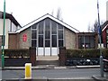
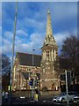
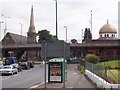
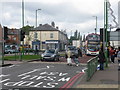
B20 3QH’s residents enjoy proximity to retail outlets like M&S Perry and Asda Perry, offering convenient shopping options. The Vale local shopping centre, situated at the intersection of five roads, serves as a focal point for daily errands. Public transport links, including rail and metro stations, provide easy access to Birmingham’s broader amenities. The area’s historical sites, such as the Birchfield Heritage Trail and Hollick & Taylor Studios, add cultural value. While parks and green spaces are not explicitly listed, the absence of planning constraints like AONB or protected woodlands suggests open areas may be available nearby. The combination of retail, transport, and heritage sites creates a lifestyle that balances urban convenience with local character.
Amenities
Schools
The nearest schools to B20 3QH are both listed as Westminster Primary School, a primary-level institution. No secondary schools are mentioned in the data, so families with older children may need to consider nearby areas for secondary education. The presence of two primary schools suggests a focus on early education within the area, though the duplication of the same school name may indicate a need for further verification. For families prioritising primary schooling, Westminster Primary School offers proximity, but the absence of secondary options could be a limitation. Parents should assess the broader Birmingham school network for comprehensive educational needs.
| Rank | School | Type | Entry gender | Ages |
|---|
Explore more schools in this area
Go to Schools tabDemographics
The population of B20 3QH is 1,794, with a median age of 47 and the majority of residents falling within the 30-64 age range. This suggests a community skewed towards middle-aged adults, likely including families and professionals. Home ownership is relatively low at 29%, indicating that most households are renters, which may influence the area’s housing market dynamics. The predominant accommodation type is houses, though the small population suggests limited housing stock. The largest ethnic group is the Asian community, reflecting Birmingham’s broader diversity. While no specific deprivation data is provided, the low home ownership rate could imply economic pressures or a transient population. The age profile suggests a stable, established community, but the lack of younger residents may affect local schools and amenities.
Household Size
Accommodation Type
Tenure
Ethnic Group
Religion
Household Composition
Age
Household Deprivation
NS-SEC
Explore more demographic insights in this area
Go to Demographics tabPlanning
Planning Constraints
- Flood RiskPremium
- Ramsar Wetland SitesPremium
- Area of Outstanding Natural BeautyPremium
- Protected Nature ReservePremium
- Protected WoodlandPremium