Area Overview for B20 3HF
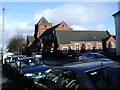
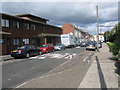
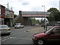
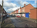
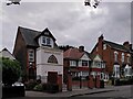
Photos of B20 3HF


Area Information
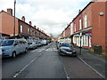
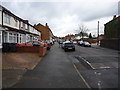
Living in B20 3HF means inhabiting a small, defined postcode area in north-east Birmingham, part of the Aston ward. With a population of 1,815, this compact residential cluster sits within a historically industrialised district, shaped by 20th-century regeneration projects like Aston Pride. The area’s character is defined by late 19th- and early 20th-century terraced housing, some of which was disrupted by the 1960s Aston Expressway. Despite its urban setting, B20 3HF benefits from proximity to major transport routes, including the M6 motorway and Spaghetti Junction, making it a strategic location for commuters. The community is diverse, with a strong presence of Asian residents, and has seen improvements in housing and safety since the 1980s. For those seeking a balance between city access and a sense of place, B20 3HF offers a compact, connected environment with schools, shops, and transport links within practical reach.
- Area Type
- Postcode
- Area Size
- Not available
- Population
- 1815
- Population Density
- 6545 people/km²
B20 3HF is characterised by a housing stock that leans heavily towards detached or semi-detached houses, as opposed to flats or apartments. With 40% of residents owning their homes, the area is not dominated by rental properties but remains accessible to buyers seeking traditional housing. This mix of ownership and rental availability suggests a modest property market, where demand for homes is balanced by the area’s small size and limited new developments. The predominance of houses may appeal to families or those preferring more space, though the compact nature of the postcode means buyers must consider proximity to surrounding areas for larger options. Given the area’s history of regeneration, property values may reflect improvements in infrastructure and safety, but the small footprint of B20 3HF means buyers should explore nearby wards for broader choices.
House Prices in B20 3HF
No properties found in this postcode.
Energy Efficiency in B20 3HF
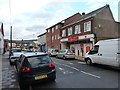
B20 3HF’s lifestyle is shaped by its proximity to retail, transport, and community hubs. Nearby shops include Tesco Aston, Asda Perry, and Iceland Perry, offering everyday essentials within walking distance. The area’s rail and metro stations—Witton, Perry Barr, and Aston—provide convenient access to Birmingham’s transport network, linking residents to city-wide opportunities. While the postcode itself is small, its integration with surrounding areas means residents can access broader amenities, from leisure centres to cultural venues. The presence of multiple retail outlets and transport links fosters a practical, connected lifestyle, ideal for those prioritising accessibility over sprawling suburban spaces.
Amenities
Schools
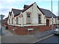
Residents of B20 3HF have access to two notable schools: Broadway School, a primary school, and Broadway Academy, an academy with a ‘good’ Ofsted rating. The presence of both primary and secondary education options within the area provides families with a range of choices, though the academy’s rating indicates a higher standard of education compared to the primary school. The proximity of these institutions to homes in B20 3HF makes it a viable option for families prioritising ease of access to schooling. However, the area’s small size means that students may need to travel slightly beyond the postcode for specialist subjects or higher education. The mix of school types reflects a commitment to both foundational and advanced learning, though parents should verify current performance metrics and capacity for future growth.
| Rank | School | Type | Entry gender | Ages |
|---|
Explore more schools in this area
Go to Schools tabDemographics
The median age in B20 3HF is 47, with the most common age range being adults aged 30–64. This suggests a mature, stable population, likely with established careers and families. Home ownership sits at 40%, indicating a mix of owner-occupied and rental properties, though the area’s accommodation type is predominantly houses, not flats. The predominant ethnic group is Asian, reflecting historical immigration patterns from the Indian subcontinent and Caribbean since the 1950s. This diversity contributes to a culturally rich community, though it also means services and amenities must cater to a broad demographic. The area’s population size and age profile suggest a relatively low turnover of residents, fostering a sense of continuity. However, the 40% home ownership rate implies a significant portion of the population may rely on rental housing, which could influence local property dynamics.
Household Size
Accommodation Type
Tenure
Ethnic Group
Religion
Household Composition
Age
Household Deprivation
NS-SEC
Explore more demographic insights in this area
Go to Demographics tabPlanning
Planning Constraints
- Flood RiskPremium
- Ramsar Wetland SitesPremium
- Area of Outstanding Natural BeautyPremium
- Protected Nature ReservePremium
- Protected WoodlandPremium