Area Overview for B20 3HB
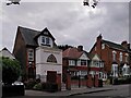
Photos of B20 3HB


Area Information
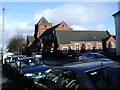
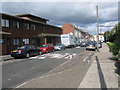
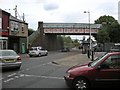
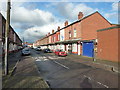
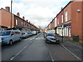
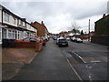
Living in B20 3HB, a small residential cluster in north-east Birmingham, means being part of a community shaped by its history and regeneration. The area, formed in 1911 after Birmingham’s expansion, has a population of 1,815, with a median age of 47 and a strong presence of adults aged 30–64. Its character is defined by late 19th- and early 20th-century terraced housing, though the Aston Expressway disrupted some parts of the district. The area’s past struggles with deprivation have been addressed through projects like “Aston Pride,” which improved housing and reduced crime. Today, B20 3HB is accessible via major routes like the M6 motorway and Spaghetti Junction, with nearby rail stations and retail hubs. Its proximity to Aston Road North and the historic Aston Manor Brewery adds to its distinct urban charm. For those seeking a compact, connected inner-city location with a mix of heritage and modern infrastructure, B20 3HB offers a blend of practicality and historical context.
- Area Type
- Postcode
- Area Size
- Not available
- Population
- 1815
- Population Density
- 6545 people/km²
The property market in B20 3HB is characterised by a 40% home ownership rate, indicating that most residents rent rather than own their homes. The accommodation type is primarily houses, which is unusual for an inner-city area and suggests a focus on family-oriented housing. This mix of owner-occupied and rental properties creates a dynamic market, though the small size of the postcode area means the housing stock is limited. Buyers should consider that the area’s housing is largely composed of older, terraced properties, many of which date back to the late 19th and early 20th centuries. The proximity to major transport routes like the Aston Expressway may influence property values, but the small scale of the area means that opportunities for expansion or redevelopment are constrained.
House Prices in B20 3HB
No properties found in this postcode.
Energy Efficiency in B20 3HB
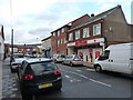
The lifestyle in B20 3HB is shaped by its proximity to key amenities and urban infrastructure. Residents have access to five retail outlets, including major supermarkets like Tesco and Asda, which support everyday shopping needs. The area’s transport links, including rail and metro stations, provide easy access to Birmingham’s cultural and commercial hubs. While the postcode area is small, its location near the Aston Expressway and Spaghetti Junction offers swift connections to motorways and regional destinations. The presence of historic sites like the Aston Manor Brewery and former radio studios adds a layer of local character. However, the area’s urban density means green spaces are limited, and the lifestyle is more focused on convenience and connectivity than leisurely outdoor activities.
Amenities
Schools
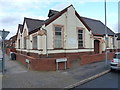
Residents of B20 3HB have access to two notable schools. Broadway School is a primary school, providing education for younger children, while Broadway Academy is an academy with a good Ofsted rating. The presence of both a primary school and an academy offers families a range of educational options, from early years to secondary education. The good rating at Broadway Academy suggests a strong academic environment, which is a key consideration for parents. The proximity of these schools to the area makes them practical choices for families, reducing commuting times and reinforcing the area’s appeal for households with children. The mix of school types ensures that residents can choose between traditional and more specialised educational models.
| Rank | School | Type | Entry gender | Ages |
|---|
Explore more schools in this area
Go to Schools tabDemographics
The community in B20 3HB is predominantly composed of adults aged 30–64, with a median age of 47. Home ownership sits at 40%, indicating a rental-heavy market, and the primary accommodation type is houses rather than flats. The area’s demographic profile is shaped by its history of immigration from the Indian subcontinent and the Caribbean since the 1950s–60s, with the Asian population forming the largest ethnic group. This diversity contributes to a culturally rich but tightly knit community. The 40% home ownership rate suggests a significant proportion of residents rent, which may influence local property dynamics. Despite past issues of deprivation, regeneration efforts have improved living conditions, though the area still reflects the challenges of urban inner-city life.
Household Size
Accommodation Type
Tenure
Ethnic Group
Religion
Household Composition
Age
Household Deprivation
NS-SEC
Explore more demographic insights in this area
Go to Demographics tabPlanning
Planning Constraints
- Flood RiskPremium
- Ramsar Wetland SitesPremium
- Area of Outstanding Natural BeautyPremium
- Protected Nature ReservePremium
- Protected WoodlandPremium