Area Overview for B20 3DF
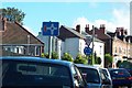
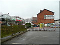
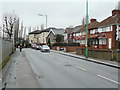
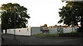
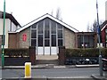
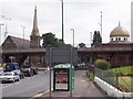
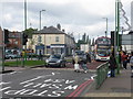
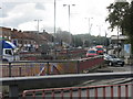
Photos of B20 3DF


Area Information
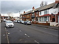
Living in B20 3DF means being part of a small, tightly knit residential cluster in north-east Birmingham, where history and modernity intersect. The postcode area, part of the Aston ward, has a population of 1,641, reflecting a compact, community-focused environment. Its origins trace back to the early 20th century, when Aston was absorbed into Birmingham, and it retains echoes of its industrial past, including the Aston Expressway and proximity to the infamous Spaghetti Junction. Today, the area is defined by terraced housing, many built in the late 19th and early 20th centuries, with some redevelopment from the 2001–2011 Aston Pride project. Residents benefit from a mix of urban convenience and historical character, with easy access to major roads and transport links. The median age of 47 suggests a mature population, and the area’s predominantly Asian community adds cultural diversity. While challenges remain, the area’s regeneration has improved living conditions, offering a balance of affordability and accessibility for those seeking a base in Birmingham’s dynamic urban fabric.
- Area Type
- Postcode
- Area Size
- Not available
- Population
- Not available
- Population Density
- Not available
The property market in B20 3DF is characterised by high home ownership (75%) and a predominance of houses, suggesting a focus on owner-occupied, family-friendly housing. The area’s small size means the housing stock is limited, with properties likely to be older terraced homes built in the late 19th and early 20th centuries. This contrasts with newer developments in Birmingham’s outer suburbs, making B20 3DF an attractive option for buyers seeking affordability in a central location. However, the limited availability of homes may mean competition for properties, particularly those in good condition. The presence of major transport links, such as the Aston Expressway, adds to the area’s appeal for commuters, though buyers should consider the impact of nearby infrastructure on property values. For those prioritising space and stability, the mix of homes and ownership rates offers a practical alternative to Birmingham’s more densely populated zones.
House Prices in B20 3DF
No properties found in this postcode.
Energy Efficiency in B20 3DF
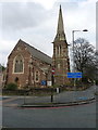
Residents of B20 3DF enjoy a range of amenities within easy reach, including major retail outlets like Tesco Aston and Asda Perry, which cater to everyday needs. The area’s proximity to rail and metro stations, such as Perry Barr and St Paul’s, ensures convenient access to public transport. While the data does not list parks or leisure facilities explicitly, the area’s historical character includes sites like the Aston Manor Brewery and former ATV Alpha Studios, hinting at a mix of industrial heritage and community spaces. The presence of multiple retail and transport hubs suggests a practical, urban lifestyle, ideal for those prioritising convenience over expansive green spaces. The compact nature of the area means amenities are closely clustered, reducing travel time for errands and social activities. This blend of accessibility and historical context shapes a lifestyle that balances modern demands with the area’s enduring urban identity.
Amenities
Schools
Residents of B20 3DF have access to two primary schools: Birchfield Community School and Birchfield Primary School, both located within practical reach. Birchfield Primary School holds a ‘good’ Ofsted rating, indicating a strong educational offering for younger children. The presence of two primary schools provides families with options, though no secondary schools are listed in the data. The concentration of primary education suggests the area is well-suited for families with young children, though parents may need to travel further for secondary schooling. The quality of local schools is a key consideration for homebuyers, and the ‘good’ rating at Birchfield Primary School signals a reliable foundation for early education. However, the absence of secondary schools nearby means families should plan for commuting or consider the broader Birmingham school network.
| Rank | School | Type | Entry gender | Ages |
|---|
Explore more schools in this area
Go to Schools tabDemographics
The community in B20 3DF is predominantly composed of adults aged 30–64, with a median age of 47, indicating a mature, stable population. Home ownership is high at 75%, suggesting a strong presence of long-term residents and a focus on family homes. The accommodation type is largely houses, reflecting a preference for standalone properties over flats. The predominant ethnic group is Asian, highlighting the area’s historical roots as a destination for post-war immigration from the Indian subcontinent and the Caribbean. While no specific deprivation data is provided, the area’s regeneration efforts have addressed past issues of poverty and crime. This demographic profile suggests a community with established routines, a focus on family living, and a cultural richness shaped by its diverse origins. The mix of ages and ownership levels indicates a mix of retirees, working-age adults, and families, all contributing to a dynamic yet cohesive social environment.
Household Size
Accommodation Type
Tenure
Ethnic Group
Religion
Household Composition
Age
Household Deprivation
NS-SEC
Explore more demographic insights in this area
Go to Demographics tabPlanning
Planning Constraints
- Flood RiskPremium
- Ramsar Wetland SitesPremium
- Area of Outstanding Natural BeautyPremium
- Protected Nature ReservePremium
- Protected WoodlandPremium