Area Overview for B20 3BE
Photos of B20 3BE
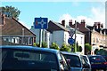
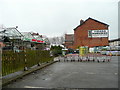
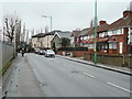
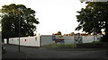
45 photos from this area
Area Information
Key information about the B20 3BE including its size, population, and administrative classification.
- Area Type
- Postcode
- Area Size
- 8772 m²
- Population
- Not available
- Population Density
- Not available
House Prices in B20 3BE
25
Properties
£111,857
Average Sold Price
£35,000
Lowest Price
£195,000
Highest Price
Showing 25 properties
| Address | Type | Beds | Baths | Last Sale Price | Last Sale Date | |
|---|---|---|---|---|---|---|
| 18 Normandy Road, Birmingham, B20 3BE | Terraced | - | - | £195,000 | Jan 2024 | |
| 32 Normandy Road, Birmingham, B20 3BE | Terraced | 3 | 1 | £188,000 | Sep 2023 | |
| 3 Normandy Road, Birmingham, B20 3BE | house | - | - | £75,000 | Jun 2020 | |
| 5 Normandy Road, Birmingham, B20 3BE | house | - | - | £120,000 | Mar 2009 | |
| 26 Normandy Road, Birmingham, B20 3BE | Terraced | 1 | 2 | £130,000 | Feb 2008 | |
| 16 Normandy Road, Birmingham, B20 3BE | Terraced | - | - | £35,000 | Mar 2000 | |
| 30 Normandy Road, Birmingham, B20 3BE | house | - | - | £40,000 | May 1999 | |
| 6 Normandy Road, Birmingham, B20 3BE | Terraced | 3 | 1 | - | - | |
| 2 Normandy Road, Birmingham, B20 3BE | Semi-detached | 3 | 1 | - | - | |
| 8 Normandy Road, Birmingham, B20 3BE | Terraced | - | - | - | - |
Page 1 of 3
Energy Efficiency in B20 3BE
Amenities
Schools
| Rank | School | Type | Entry gender | Ages |
|---|
Explore more schools in this area
Go to Schools tabDemographics
Household Size
Family (3-5 people)
most common
Accommodation Type
Houses
most common
Tenure
75
majority
Ethnic Group
asian_total
most common
Religion
N/A
most common
Household Composition
N/A
most common
Age
47
median
Adults (30-64 years)
most common
Household Deprivation
N/A
with no deprivation
NS-SEC
15
in Lower managerial occupations
Explore more demographic insights in this area
Go to Demographics tabPlanning
Planning Constraints
- Flood RiskPremium
- Ramsar Wetland SitesPremium
- Area of Outstanding Natural BeautyPremium
- Protected Nature ReservePremium
- Protected WoodlandPremium