Area Overview for B20 3AB
Photos of B20 3AB


Area Information
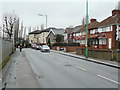
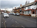
B20 3AB lies within the Aston ward of north-east Birmingham, a historically significant urban area shaped by 19th-century industrial growth and post-1980s regeneration. With a population of 1,738, it is a compact residential cluster defined by terraced housing and proximity to major transport routes like the Aston Expressway and Spaghetti Junction. The area’s character reflects its past as a working-class community, with early 20th-century industries and post-war redevelopment influencing its current layout. Today, it offers a mix of practical living with access to essential services, though its small size means amenities are concentrated within a short reach. The postcode’s location near Birmingham’s core provides connectivity to the city’s broader infrastructure, while its history of multi-ethnic settlement—particularly from the Indian subcontinent and Caribbean—adds cultural diversity. For homebuyers, B20 3AB balances affordability with proximity to urban amenities, though buyers should consider its medium crime risk and the need for standard security measures.
- Area Type
- Postcode
- Area Size
- Not available
- Population
- 1738
- Population Density
- 9100 people/km²
B20 3AB’s property market is characterised by a 40% home ownership rate, suggesting a balance between owner-occupied homes and rental properties. The accommodation type is primarily houses, which is unusual for a small postcode area but may indicate a focus on family homes or multi-generational living. This mix of ownership and rental options could appeal to first-time buyers seeking affordability, though the limited size of the area may restrict property diversity. The presence of terraced housing, some affected by the 1960s Aston Expressway, suggests older stock with potential for renovation. Buyers should consider the area’s proximity to major transport links, which may enhance property value, but also the medium crime risk, which could affect desirability. For those prioritising space and community, B20 3AB offers a compact urban setting with practical connectivity, though its small footprint means buyers must weigh the benefits of proximity against potential limitations in housing choice.
House Prices in B20 3AB
No properties found in this postcode.
Energy Efficiency in B20 3AB
Residents of B20 3AB benefit from a range of nearby amenities that support daily life. Retail options include major supermarkets like Iceland Perry and Asda Perry, as well as M&S Perry, ensuring access to groceries and everyday essentials. The area’s rail network, with stations such as Perry Barr and Witton, connects to Birmingham’s broader transport system, while metro services like the Soho Benson Road line provide additional commuting routes. Although parks and green spaces are not explicitly mentioned, the absence of protected nature reserves or AONB coverage suggests that recreational areas may be limited. However, the area’s proximity to the Aston Expressway and major roads indicates a focus on connectivity over natural landscapes. For those prioritising convenience, the compact layout of B20 3AB ensures that shops, transport hubs, and community services are within walking or short driving distance, though buyers should consider the lack of extensive leisure facilities when evaluating the area’s appeal.
Amenities
Schools
Residents of B20 3AB have access to a range of educational institutions, including Canterbury Cross Primary School and Sacred Heart Catholic School, both of which are primary schools. The latter is also listed as an academy with an Ofsted rating of satisfactory, indicating a moderate standard of education. An independent school, the Institute of Higher Excellence, provides alternative options for families seeking non-state-funded education. The mix of state and independent schools offers flexibility, though the Ofsted rating for Sacred Heart suggests room for improvement in certain areas. For primary school-aged children, the availability of two primary schools within the area reduces the need for long commutes, while the independent school caters to families prioritising private education. The presence of an academy also reflects the area’s commitment to educational diversity, though buyers should consider school performance data when evaluating the area for family living.
| Rank | School | Type | Entry gender | Ages |
|---|
Explore more schools in this area
Go to Schools tabDemographics
The population of B20 3AB has a median age of 47, with the majority of residents falling in the 30-64 age range. This suggests a community skewed toward working-age adults, likely reflecting long-term residents and families. Home ownership stands at 40%, indicating a mix of owner-occupied and rented properties. The predominant accommodation type is houses, though the small population and compact area suggest limited housing stock. The dominant ethnic group is Asian, reflecting historical immigration patterns from the Indian subcontinent since the 1950s. This demographic profile shapes a community with established cultural ties and a focus on family living. The 40% home ownership rate implies a significant rental market, which may influence property values and availability. While the area’s regeneration has improved living conditions, the medium crime risk and historical deprivation necessitate awareness of safety and community resources.
Household Size
Accommodation Type
Tenure
Ethnic Group
Religion
Household Composition
Age
Household Deprivation
NS-SEC
Explore more demographic insights in this area
Go to Demographics tabPlanning
Planning Constraints
- Flood RiskPremium
- Ramsar Wetland SitesPremium
- Area of Outstanding Natural BeautyPremium
- Protected Nature ReservePremium
- Protected WoodlandPremium