Area Overview for B20 2WE
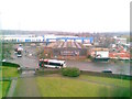
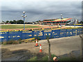
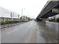
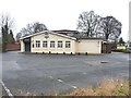
Photos of B20 2WE
Area Information
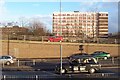
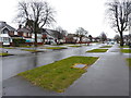
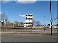
Living in B20 2WE means inhabiting a small, defined postcode area in England’s West Midlands, part of the suburban Handsworth Wood district. With a population of 2,265, this is a tightly knit community characterised by its large, spacious properties set on substantial plots. Historically, Handsworth Wood was a rural retreat for Birmingham’s wealthy, offering a tranquil escape from industrialisation. Today, it retains a village-like quality, distinct from the more densely populated parts of Handsworth. Its proximity to Birmingham City Centre—just over 2 kilometres away—offers easy access to urban amenities while maintaining a suburban feel. The area’s low-density development and legacy as an evacuation zone during World War II have left it with a unique identity: affluent, low-rise, and quietly residential. Residents benefit from nearby railway stations and a mix of retail and leisure options, yet the area remains relatively untouched by the high-rise sprawl of modern cities. For those seeking a balance between suburban calm and urban convenience, B20 2WE offers a specific, characterful alternative.
- Area Type
- Postcode
- Area Size
- Not available
- Population
- 2265
- Population Density
- 7493 people/km²
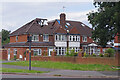
The property market in B20 2WE is defined by its large, spacious houses set on substantial plots, a legacy of its 19th-century development as a suburban retreat. With 38% of homes owner-occupied, the area is not dominated by rental properties, though the exact proportion of rentals is unspecified. The predominance of houses over flats or apartments suggests a market skewed towards families and individuals seeking more private, low-density living. Given the area’s historical association with affluent residents, property values likely reflect this demand for spacious, traditional homes. Buyers should note that the small postcode area may limit immediate housing options, requiring consideration of nearby suburbs or extensions of the Handsworth district. The combination of limited stock and specific demand could influence both pricing and availability for prospective buyers.
House Prices in B20 2WE
No properties found in this postcode.
Energy Efficiency in B20 2WE
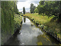
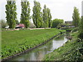
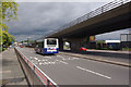
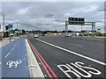
Residents of B20 2WE have access to a range of amenities within practical reach. Retail options include M&S Perry, Iceland Perry, and Asda Perry, providing everyday shopping convenience. The area’s rail network—served by Perry Barr, Witton, and Handsworth stations—offers frequent connections to Birmingham and surrounding areas, while metro lines like Soho Benson Road and Winson Green Outer Circle add to transport flexibility. Locally, Handsworth Park (formerly Victoria Park) is a focal point, featuring formal gardens and historic landmarks such as St. Mary’s Church and the Old Town Hall. The park’s Sunken Garden, centred on a bronze sculpture, adds cultural value. These amenities combine to create a lifestyle that balances suburban tranquillity with urban accessibility, offering both recreational spaces and practical conveniences.
Amenities
Schools
| Rank | School | Type | Entry gender | Ages |
|---|
Explore more schools in this area
Go to Schools tabDemographics
The community in B20 2WE has a median age of 47, with the majority of residents falling within the 30–64 age range. This suggests a mature, established population, likely with long-term ties to the area. Home ownership stands at 38%, indicating a mix of owner-occupied and rental properties. The predominant accommodation type is houses, reflecting the area’s suburban, low-density character. The most common ethnic group is Asian, which aligns with broader trends in the West Midlands. While no specific deprivation data is provided, the high proportion of owner-occupied homes and the presence of large properties suggest a relatively stable, middle- to upper-middle-income demographic. The age profile and housing stock imply a community focused on family living and long-term residency, with fewer transient populations compared to more urbanised areas.
Household Size
Accommodation Type
Tenure
Ethnic Group
Religion
Household Composition
Age
Household Deprivation
NS-SEC
Explore more demographic insights in this area
Go to Demographics tabPlanning
Planning Constraints
- Flood RiskPremium
- Ramsar Wetland SitesPremium
- Area of Outstanding Natural BeautyPremium
- Protected Nature ReservePremium
- Protected WoodlandPremium