Area Overview for B20 2SP
Photos of B20 2SP
Area Information
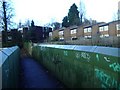
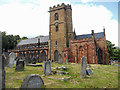
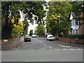
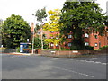
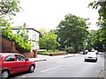
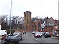
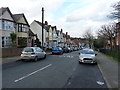
Living in B20 2SP means being part of a small, tightly knit residential cluster in Birmingham’s Birchfield area. With a population of 1,641, this postcode is part of a larger ward with 12,473 residents, reflecting a community that balances urban proximity with local character. Historically shaped by 19th-century expansion, the area features terraced housing and landmarks like the Birchfield Heritage Trail, which highlights its cultural and sporting heritage. Notable sites include the birthplace of Birchfield Harriers athletics club and connections to Aston Villa Football Club. The area’s compact size means residents benefit from easy access to nearby amenities, including retail, transport, and community hubs. While it sits north of Birmingham’s city centre, its proximity to rail and metro networks ensures connectivity to the broader West Midlands. Daily life here is defined by a mix of historical legacy and modern convenience, with a population skewed toward adults aged 30–64, suggesting a community rooted in stability and routine.
- Area Type
- Postcode
- Area Size
- Not available
- Population
- 1641
- Population Density
- 6187 people/km²
The property market in B20 2SP is characterised by a high rate of home ownership—62%—indicating that most residents are homeowners rather than renters. The accommodation type is primarily houses, which is typical of Birmingham’s older residential areas developed in the 19th century. This suggests a housing stock that includes terraced and semi-detached properties, many of which may date back to the period of industrial expansion. As a small postcode area, B20 2SP is unlikely to have a large volume of properties for sale, meaning buyers should consider nearby postcodes for a broader selection. The focus on owner-occupied homes implies a stable market, but buyers should be aware that the limited size of the area may restrict options. The predominance of houses also means that flats or apartments are less common, which could influence property search strategies.
House Prices in B20 2SP
No properties found in this postcode.
Energy Efficiency in B20 2SP
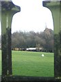
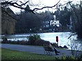
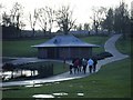
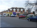
Residents of B20 2SP have access to a range of amenities within practical reach. Retail options include major stores like M&S Perry, Tesco Handsworth, and Iceland Perry, ensuring everyday shopping needs are met. The area’s transport links—five railway stations and three metro stops—provide easy access to Birmingham’s broader network, whether for commuting, leisure, or visiting nearby attractions. The Birchfield Heritage Trail offers a historical dimension to daily life, with sites like the Vale local shopping centre and Birchfield House adding to the area’s character. While there are no parks explicitly mentioned in the data, the proximity to Birmingham’s urban green spaces is likely within reach. The mix of retail, transport, and historical sites creates a lifestyle that balances convenience with a sense of local identity.
Amenities
Schools
| Rank | School | Type | Entry gender | Ages |
|---|
Explore more schools in this area
Go to Schools tabDemographics
The community in B20 2SP is predominantly composed of adults aged 30–64, with a median age of 47. This suggests a mature, established population, likely with long-term ties to the area. Home ownership rates are high at 62%, indicating a stable housing market where most residents live in their own homes rather than renting. The accommodation type is primarily houses, which aligns with the area’s historical development of terraced housing. The predominant ethnic group is Asian_total, reflecting the diverse demographic makeup of Birmingham’s broader population. While no specific deprivation data is provided, the age profile and home ownership figures suggest a community with a strong sense of place and economic resilience. The absence of data on household types or income levels means these aspects remain unexplored in this context.
Household Size
Accommodation Type
Tenure
Ethnic Group
Religion
Household Composition
Age
Household Deprivation
NS-SEC
Explore more demographic insights in this area
Go to Demographics tabPlanning
Planning Constraints
- Flood RiskPremium
- Ramsar Wetland SitesPremium
- Area of Outstanding Natural BeautyPremium
- Protected Nature ReservePremium
- Protected WoodlandPremium