Area Overview for B20 2SN
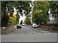
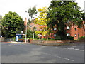
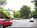
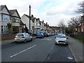
Photos of B20 2SN


Area Information
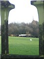
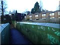
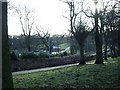
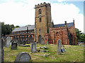
Living in B20 2SN means inhabiting a small, residential postcode area nestled in Handsworth Wood, a suburb north of Birmingham City Centre. With a population of 2,250, this area retains a distinct suburban character, marked by large, spacious properties on substantial plots. Historically, Handsworth Wood was a rural retreat for Birmingham’s wealthy, evolving into a semi-detached suburb with a village-like ambience. Its proximity to Birmingham—just 2 kilometres from the city centre—offers easy access to urban amenities while preserving a quieter, more residential feel. The area’s legacy as an evacuation zone during World War II still echoes in its layout, with wide open spaces and large homes. Today, it remains predominantly suburban and affluent, contrasting with the denser, industrialised parts of Handsworth. Residents benefit from a low-density environment, where the pace of life is slower, and the sense of community is palpable. The area’s blend of historical significance and modern convenience makes it a unique choice for those seeking space and a connection to Birmingham’s past.
- Area Type
- Postcode
- Area Size
- Not available
- Population
- 2250
- Population Density
- Not available
The property market in B20 2SN is characterised by a predominance of houses, reflecting the area’s suburban and low-density development. With 36% of homes owner-occupied, the market is not exclusively rental-driven but includes a significant number of private residences. The presence of large properties on spacious plots aligns with the area’s historical appeal to families and professionals seeking space. This housing stock suggests that buyers in B20 2SN are likely to prioritise property size and outdoor space, making it an attractive option for those requiring room for children or home offices. The small postcode area’s limited size means that property availability is constrained, potentially increasing competition for available homes. For buyers, this implies a need to act swiftly and consider the broader Handsworth district for nearby options, where similar characteristics might be found.
House Prices in B20 2SN
No properties found in this postcode.
Energy Efficiency in B20 2SN
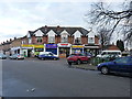
Residents of B20 2SN enjoy access to a range of amenities within walking or short driving distance. Retail options include major stores such as Tesco Handsworth, M&S Perry, and Iceland Handsworth, providing everyday shopping convenience. The area’s transport links to rail and metro stations enhance accessibility to Birmingham’s broader retail and leisure hubs. While specific parks or recreational facilities are not detailed in the data, the proximity to Handsworth Park—a landmark with formal gardens and historical significance—offers green space for relaxation. The suburban character of the area, combined with its retail and transport options, supports a lifestyle that balances convenience with a quieter, community-focused environment. The presence of multiple railway stations also facilitates easy access to cultural and professional opportunities in the city.
Amenities
Schools
Residents of B20 2SN have access to two primary schools within proximity. St Mary’s CofE Junior and Infant School (NC) serves as a primary education provider, though its specific Ofsted rating is not detailed. Nearby, St Marys C of E Primary and Nursery, Academy, Handsworth holds a ‘Good’ Ofsted rating, indicating a school that meets standards in teaching quality and student outcomes. The presence of two primary schools within the area provides families with options for early education, though secondary school facilities are not mentioned in the data. The mix of schools suggests a focus on foundational education, which is critical for young families. However, those requiring secondary schooling may need to look beyond the immediate area for comprehensive options.
| Rank | School | Type | Entry gender | Ages |
|---|
Explore more schools in this area
Go to Schools tabDemographics
The population of B20 2SN is 2,250, with a median age of 47 and the majority of residents falling within the 30–64 age range. This suggests a mature, stable community with a focus on family life and long-term residency. Home ownership in the area stands at 36%, indicating a mix of owner-occupied and rental properties. The accommodation type is predominantly houses, reflecting the area’s suburban nature. The predominant ethnic group is Asian, which shapes the cultural and social fabric of the neighbourhood. While specific deprivation data is not provided, the high proportion of households in this age bracket and the prevalence of owner-occupied homes suggest a community with established economic stability. The demographic profile aligns with the area’s historical role as a residential retreat, attracting families and professionals seeking a balance between urban proximity and suburban tranquility.
Household Size
Accommodation Type
Tenure
Ethnic Group
Religion
Household Composition
Age
Household Deprivation
NS-SEC
Explore more demographic insights in this area
Go to Demographics tabPlanning
Planning Constraints
- Flood RiskPremium
- Ramsar Wetland SitesPremium
- Area of Outstanding Natural BeautyPremium
- Protected Nature ReservePremium
- Protected WoodlandPremium
- Crime RiskPremium