Area Overview for B20 2JU
Photos of B20 2JU
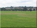
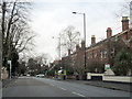
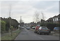
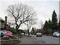
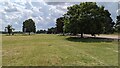
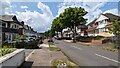
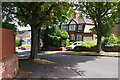
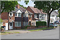
17 photos from this area
Area Information
Key information about the B20 2JU including its size, population, and administrative classification.
- Area Type
- Postcode
- Area Size
- 1.8 hectares
- Population
- 1737
- Population Density
- 3895 people/km²
House Prices in B20 2JU
45
Properties
£142,294
Average Sold Price
£40,000
Lowest Price
£305,000
Highest Price
Showing 45 properties
| Address | Type | Beds | Baths | Last Sale Price | Last Sale Date | |
|---|---|---|---|---|---|---|
| 58 Coopers Road, Birmingham, B20 2JU | Semi-detached | 3 | 1 | £305,000 | Aug 2025 | |
| 77 Coopers Road, Birmingham, B20 2JU | Detached | 3 | 1 | £260,000 | Aug 2021 | |
| 79 Coopers Road, Birmingham, B20 2JU | Detached | 3 | 3 | £275,000 | Apr 2021 | |
| 54 Coopers Road, Birmingham, B20 2JU | house | - | - | £245,000 | Mar 2020 | |
| 71 Coopers Road, Birmingham, B20 2JU | Semi-detached | 3 | 1 | £205,000 | Jun 2016 | |
| 75 Coopers Road, Birmingham, B20 2JU | house | 3 | - | £150,000 | Aug 2013 | |
| 64 Coopers Road, Birmingham, B20 2JU | house | 3 | - | £175,000 | Sep 2012 | |
| 67 Coopers Road, Birmingham, B20 2JU | house | - | - | £150,000 | Jul 2009 | |
| 34 Coopers Road, Birmingham, B20 2JU | house | - | - | £240,000 | Oct 2006 | |
| 26 Coopers Road, Birmingham, B20 2JU | Semi-detached | - | - | £225,000 | Mar 2006 |
Page 1 of 5
Energy Efficiency in B20 2JU
Amenities
Schools
| Rank | School | Type | Entry gender | Ages |
|---|
Explore more schools in this area
Go to Schools tabDemographics
Household Size
Family (3-5 people)
most common
Accommodation Type
Houses
most common
Tenure
82
majority
Ethnic Group
asian_total
most common
Religion
N/A
most common
Household Composition
N/A
most common
Age
47
median
Adults (30-64 years)
most common
Household Deprivation
N/A
with no deprivation
NS-SEC
35
in Lower managerial occupations
Explore more demographic insights in this area
Go to Demographics tabPlanning
Planning Constraints
- Flood RiskPremium
- Ramsar Wetland SitesPremium
- Area of Outstanding Natural BeautyPremium
- Protected Nature ReservePremium
- Protected WoodlandPremium