Area Overview for B20 2HW
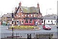
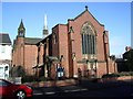
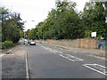
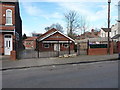
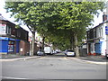
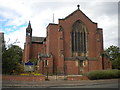
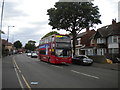
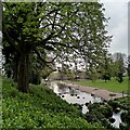
Photos of B20 2HW
Area Information
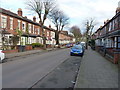
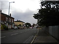
Living in B20 2HW means inhabiting a small, suburban cluster in Handsworth Wood, a historically distinct area north of Birmingham. With a population of 1,795, the postcode reflects a quiet, low-density residential community characterised by large, spacious properties on substantial plots. This area has long been associated with affluence and a village-like quality, retaining its suburban charm despite proximity to the city. Its history as a 19th-century evacuation zone during World War II underscores its role as a place of stability and safety. Today, it remains predominantly residential, with a clear geographical boundary from the more industrialised parts of Handsworth. Residents benefit from a blend of historical legacy and modern convenience, with nearby amenities and transport links. The area’s character is defined by its low-rise housing, open spaces, and a sense of separation from urban density, making it appealing to those seeking a balanced lifestyle with access to city resources.
- Area Type
- Postcode
- Area Size
- Not available
- Population
- 1795
- Population Density
- 6841 people/km²
The property market in B20 2HW is defined by large, spacious houses on substantial plots, with 54% of homes owner-occupied. This indicates a mix of private residences and rental properties, though the area is not heavily geared toward short-term lets. The dominance of houses over flats or apartments aligns with its suburban character, appealing to families and professionals seeking private living spaces. Given the small size of the postcode and its immediate surroundings, the housing stock is likely limited, making it a niche market for buyers prioritising space and seclusion. The presence of large properties also suggests potential for renovation or expansion, though competition for listings may be fierce. For buyers, this area offers a rare blend of suburban tranquillity and proximity to Birmingham, though the limited supply means careful consideration of location and property condition is essential.
House Prices in B20 2HW
No properties found in this postcode.
Energy Efficiency in B20 2HW
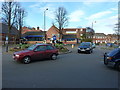
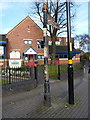
Residents of B20 2HW enjoy access to a range of amenities within practical reach. Retail options include Tesco Handsworth, Iceland Handsworth, and Farmfoods Handsworth, providing everyday shopping convenience. Metro stations such as Winson Green Outer Circle and Soho Benson Road offer local transport links, while rail stations like Perry Barr and Handsworth connect to broader networks. The area’s suburban character is complemented by nearby green spaces, including Handsworth Park, which features formal gardens and historical landmarks. These amenities contribute to a lifestyle that balances suburban tranquillity with urban accessibility, making daily errands, commuting, and leisure activities efficient. The presence of multiple transport hubs and retail outlets ensures that residents can meet most needs without long journeys, enhancing the area’s practical appeal.
Amenities
Schools
Residents of B20 2HW have access to three schools within practical reach. Handsworth Wood Boys’ School and Handsworth Wood Girls’ School are both primary institutions, providing early education for local children. The King Edward VI Handsworth Wood Girls’ Academy, an outstanding-rated academy, offers secondary education with a strong academic reputation. This mix of primary and secondary schooling caters to families with children at different stages of education. The presence of an outstanding-rated academy suggests high standards in secondary education, though parents should verify admissions policies and catchment areas. The proximity of these schools reinforces the area’s appeal for families prioritising quality education and a cohesive school network.
| Rank | School | Type | Entry gender | Ages |
|---|
Explore more schools in this area
Go to Schools tabDemographics
The population of B20 2HW is 1,795, with a median age of 47 and the majority of residents aged 30–64. This suggests a community of established adults, likely including families and professionals. Home ownership stands at 54%, indicating a mix of owner-occupied and rental properties, though the area is not dominated by either extreme. The predominant accommodation type is houses, reflecting the suburban nature of the area. The largest ethnic group is the Asian community, which shapes the cultural landscape. While specific deprivation data is not provided, the high home ownership rate and presence of large properties suggest a relatively stable economic environment. The age profile implies a mature demographic, potentially with strong community ties and a focus on long-term residency.
Household Size
Accommodation Type
Tenure
Ethnic Group
Religion
Household Composition
Age
Household Deprivation
NS-SEC
Explore more demographic insights in this area
Go to Demographics tabPlanning
Planning Constraints
- Flood RiskPremium
- Ramsar Wetland SitesPremium
- Area of Outstanding Natural BeautyPremium
- Protected Nature ReservePremium
- Protected WoodlandPremium