Area Overview for B20 2HJ
Photos of B20 2HJ
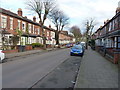
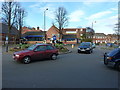
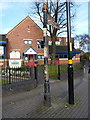
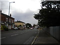
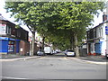

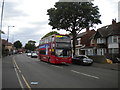
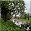
33 photos from this area
Area Information
Key information about the B20 2HJ including its size, population, and administrative classification.
- Area Type
- Postcode
- Area Size
- 2.2 hectares
- Population
- 1795
- Population Density
- 6841 people/km²
House Prices in B20 2HJ
43
Properties
£250,164
Average Sold Price
£79,700
Lowest Price
£664,450
Highest Price
Showing 43 properties
| Address | Type | Beds | Baths | Last Sale Price | Last Sale Date | |
|---|---|---|---|---|---|---|
| Chestnut Lodge, 135-137 Church Lane, Handsworth Wood, Birmingham, B20 2HJ | Detached | 14 | 3 | £664,450 | Sep 2020 | |
| 117 Church Lane, Handsworth Wood, Birmingham, B20 2HJ | house | - | - | £200,000 | Jun 2017 | |
| 105 Church Lane, Handsworth Wood, Birmingham, B20 2HJ | house | - | - | £280,000 | Nov 2009 | |
| 127 Church Lane, Handsworth Wood, Birmingham, B20 2HJ | house | - | - | £275,000 | Jun 2009 | |
| 125 Church Lane, Handsworth Wood, Birmingham, B20 2HJ | Semi-detached | 7 | 2 | £150,000 | Jun 2003 | |
| 121 Church Lane, Handsworth Wood, Birmingham, B20 2HJ | house | - | - | £102,000 | Feb 2000 | |
| 113 Church Lane, Handsworth Wood, Birmingham, B20 2HJ | Semi-detached | - | - | £79,700 | Mar 1995 | |
| Flat 1, 115 Church Lane, Handsworth Wood, Birmingham, B20 2HJ | Semi-detached | 7 | 3 | - | - | |
| 131 Church Lane, Handsworth Wood, Birmingham, B20 2HJ | Semi-detached | 5 | - | - | - | |
| 129 Church Lane, Handsworth Wood, Birmingham, B20 2HJ | house | 5 | - | - | - |
Page 1 of 5
Energy Efficiency in B20 2HJ
Amenities
Schools
| Rank | School | Type | Entry gender | Ages |
|---|
Explore more schools in this area
Go to Schools tabDemographics
Household Size
Family (3-5 people)
most common
Accommodation Type
Houses
most common
Tenure
54
majority
Ethnic Group
asian_total
most common
Religion
N/A
most common
Household Composition
N/A
most common
Age
47
median
Adults (30-64 years)
most common
Household Deprivation
N/A
with no deprivation
NS-SEC
22
in Lower managerial occupations
Explore more demographic insights in this area
Go to Demographics tabPlanning
Planning Constraints
- Flood RiskPremium
- Ramsar Wetland SitesPremium
- Area of Outstanding Natural BeautyPremium
- Protected Nature ReservePremium
- Protected WoodlandPremium