Area Overview for B20 2HA
Photos of B20 2HA
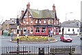

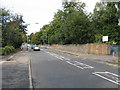
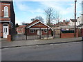
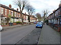
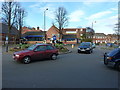
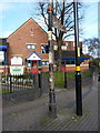
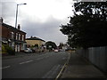
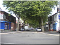

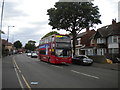
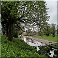
33 photos from this area
Area Information
Key information about the B20 2HA including its size, population, and administrative classification.
- Area Type
- Postcode
- Area Size
- 7507 m²
- Population
- 1832
- Population Density
- 10893 people/km²
House Prices in B20 2HA
13
Properties
£166,744
Average Sold Price
£35,000
Lowest Price
£930,000
Highest Price
Showing 13 properties
| Address | Type | Beds | Baths | Last Sale Price | Last Sale Date | |
|---|---|---|---|---|---|---|
| 255 Grove Lane, Handsworth Wood, Birmingham, B20 2HA | house | - | - | £930,000 | Nov 2024 | |
| 265 Grove Lane, Handsworth Wood, Birmingham, B20 2HA | Semi-detached | - | - | £109,950 | Feb 2005 | |
| 267 Grove Lane, Handsworth Wood, Birmingham, B20 2HA | Semi-detached | - | - | £75,000 | Sep 2002 | |
| 263 Grove Lane, Handsworth Wood, Birmingham, B20 2HA | Terraced | - | - | £45,500 | Apr 2001 | |
| 273 Grove Lane, Handsworth Wood, Birmingham, B20 2HA | Semi-detached | 2 | 1 | £46,500 | Jul 2000 | |
| 271 Grove Lane, Handsworth Wood, Birmingham, B20 2HA | Semi-detached | 2 | 1 | £41,000 | Jun 2000 | |
| 269 Grove Lane, Handsworth Wood, Birmingham, B20 2HA | house | 4 | 1 | £35,000 | Apr 1996 | |
| 261 Grove Lane, Handsworth Wood, Birmingham, B20 2HA | house | - | - | £51,000 | Apr 1996 | |
| 251 Grove Lane, Handsworth Wood, Birmingham, B20 2HA | house | - | - | - | - | |
| 257 Grove Lane, Handsworth Wood, Birmingham, B20 2HA | undefined | 17 | - | - | - |
Page 1 of 2
Energy Efficiency in B20 2HA
Amenities
Schools
| Rank | School | Type | Entry gender | Ages |
|---|
Explore more schools in this area
Go to Schools tabDemographics
Household Size
One person
most common
Accommodation Type
Flats
most common
Tenure
10
majority
Ethnic Group
White
most common
Religion
N/A
most common
Household Composition
N/A
most common
Age
22
median
Young Adults (15-29 years)
most common
Household Deprivation
N/A
with no deprivation
NS-SEC
18
in Lower managerial occupations
Explore more demographic insights in this area
Go to Demographics tabPlanning
Planning Constraints
- Flood RiskPremium
- Ramsar Wetland SitesPremium
- Area of Outstanding Natural BeautyPremium
- Protected Nature ReservePremium
- Protected WoodlandPremium