Area Overview for B20 2FD
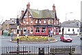
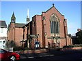
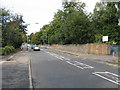
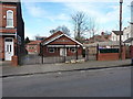
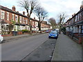
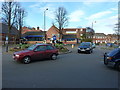
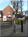
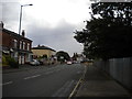
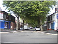
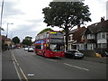
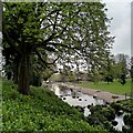
Photos of B20 2FD

Area Information
Living in B20 2FD means inhabiting a small, tightly knit residential cluster in England’s West Midlands, just 2 kilometres north of Birmingham City Centre. This postcode area, part of the historic Handsworth Ward, reflects layers of rural, industrial, and post-war urban evolution. With a population of 1,832, it is a compact community where the past meets the present. The area’s roots trace back to the 1086 Domesday Survey, when it was a Saxon farm estate. By the 18th century, industrial growth, led by Matthew Boulton’s Soho Manufactory, transformed it into a hub of innovation. Today, B20 2FD retains a suburban character, with pockets of green space like Handsworth Park and a mix of historic and modern infrastructure. Its proximity to Birmingham’s core offers easy access to urban amenities, while its smaller scale fosters a sense of local identity. For those seeking a balance between city connectivity and a distinct neighbourhood, B20 2FD offers a snapshot of England’s industrial heritage and contemporary suburban living.
- Area Type
- Postcode
- Area Size
- Not available
- Population
- 1832
- Population Density
- 10893 people/km²
The property market in B20 2FD is characterised by a low home ownership rate of 10%, suggesting that the area is not a traditional owner-occupied neighbourhood but rather a rental market. The predominant accommodation type is flats, which are typical in densely populated urban or semi-urban areas. This housing stock reflects a focus on efficiency and affordability, catering to younger residents and those prioritising proximity to Birmingham’s amenities. For buyers, the small size of the postcode area and its surrounding clusters mean that property choices are limited to a handful of flats, often in multi-unit developments. The low home ownership rate may indicate limited opportunities for long-term investment, though rental yields could be competitive given the area’s location. Prospective buyers should consider the transient nature of the market and the potential for fluctuating demand from students or young professionals.
House Prices in B20 2FD
No properties found in this postcode.
Energy Efficiency in B20 2FD
Residents of B20 2FD have access to a range of amenities that cater to daily life, from shopping to leisure. The nearby retail options include Tesco Handsworth, Iceland Handsworth, and Farmfoods Handsworth, providing essential grocery and household supplies. For transport, the area is served by five metro stations, including Winson Green Outer Circle and Handsworth Booth Street, as well as rail stations like Hamstead and Perry Barr, ensuring easy access to Birmingham and beyond. Green spaces are also within reach, with Handsworth Park—a former royal park established in 1890—offering recreational opportunities. The park’s history as a site for events like the Birmingham Flower Show adds cultural value. These amenities create a lifestyle that balances convenience with access to nature, making B20 2FD suitable for those prioritising accessibility and community-focused living.
Amenities
Schools
| Rank | School | Type | Entry gender | Ages |
|---|
Explore more schools in this area
Go to Schools tabDemographics
The community in B20 2FD is predominantly young, with a median age of 22 and the most common age range being 15–29 years. This suggests a population skewed towards students, early-career professionals, and young families. Home ownership is exceptionally low at 10%, indicating that the majority of residents rent their accommodation. The primary housing type is flats, reflecting a compact, urbanised living arrangement. The predominant ethnic group is White, though the area’s history of post-war immigration means its demographic profile is shaped by both historical and contemporary influences. The low home ownership rate implies a rental market dominated by private landlords or housing associations, which may affect long-term stability for residents. This demographic profile aligns with a community in transition, where transient populations and shared living spaces are the norm.
Household Size
Accommodation Type
Tenure
Ethnic Group
Religion
Household Composition
Age
Household Deprivation
NS-SEC
Explore more demographic insights in this area
Go to Demographics tabPlanning
Planning Constraints
- Flood RiskPremium
- Ramsar Wetland SitesPremium
- Area of Outstanding Natural BeautyPremium
- Protected Nature ReservePremium
- Protected WoodlandPremium