Area Overview for B20 2EA
Photos of B20 2EA

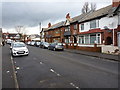
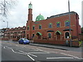
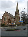
45 photos from this area
Area Information
Key information about the B20 2EA including its size, population, and administrative classification.
- Area Type
- Postcode
- Area Size
- 2.4 hectares
- Population
- 2265
- Population Density
- 7493 people/km²
House Prices in B20 2EA
36
Properties
£86,798
Average Sold Price
£29,000
Lowest Price
£120,000
Highest Price
Showing 36 properties
| Address | Type | Beds | Baths | Last Sale Price | Last Sale Date | |
|---|---|---|---|---|---|---|
| 197 Wellington Road, Lozells And East Handsworth, Birmingham, B20 2EA | house | 3 | 1 | £117,500 | Feb 2020 | |
| 163 Wellington Road, Lozells And East Handsworth, Birmingham, B20 2EA | Terraced | 3 | 1 | £60,000 | Aug 2019 | |
| 225 Wellington Road, Lozells And East Handsworth, Birmingham, B20 2EA | Terraced | 3 | 1 | £120,000 | Nov 2018 | |
| 201 Wellington Road, Lozells And East Handsworth, Birmingham, B20 2EA | Terraced | 3 | - | £105,000 | Oct 2018 | |
| 229 Wellington Road, Lozells And East Handsworth, Birmingham, B20 2EA | Terraced | 3 | 1 | £120,000 | Sep 2018 | |
| 175 Wellington Road, Lozells And East Handsworth, Birmingham, B20 2EA | Terraced | 2 | 1 | £120,000 | Aug 2018 | |
| 221 Wellington Road, Lozells And East Handsworth, Birmingham, B20 2EA | Terraced | 3 | 1 | £108,000 | Jul 2016 | |
| 203 Wellington Road, Lozells And East Handsworth, Birmingham, B20 2EA | house | - | - | £95,000 | Mar 2016 | |
| 207 Wellington Road, Lozells And East Handsworth, Birmingham, B20 2EA | house | 6 | 2 | £72,000 | Sep 2015 | |
| 193 Wellington Road, Lozells And East Handsworth, Birmingham, B20 2EA | Terraced | 3 | 1 | £118,000 | May 2007 |
Page 1 of 4
Energy Efficiency in B20 2EA
Amenities
Schools
| Rank | School | Type | Entry gender | Ages |
|---|
Explore more schools in this area
Go to Schools tabDemographics
Household Size
Family (3-5 people)
most common
Accommodation Type
Houses
most common
Tenure
38
majority
Ethnic Group
asian_total
most common
Religion
N/A
most common
Household Composition
N/A
most common
Age
47
median
Adults (30-64 years)
most common
Household Deprivation
N/A
with no deprivation
NS-SEC
20
in Lower managerial occupations
Explore more demographic insights in this area
Go to Demographics tabPlanning
Planning Constraints
- Flood RiskPremium
- Ramsar Wetland SitesPremium
- Area of Outstanding Natural BeautyPremium
- Protected Nature ReservePremium
- Protected WoodlandPremium