Area Overview for B20 2DF
Photos of B20 2DF


Area Information
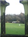
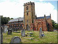
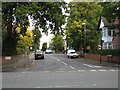
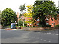
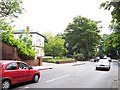
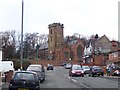
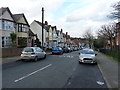
Living in B20 2DF means inhabiting a small, residential postcode cluster in Handsworth Wood, a suburb of Birmingham. With a population of 1,631, this area retains a suburban, low-density character, marked by large, spacious properties on substantial plots. Historically, it was a rural retreat for Birmingham’s wealthy in the 19th century, and its proximity to the city centre—just 2 kilometres south—offers easy access to urban amenities without sacrificing the tranquillity of a village-like setting. The area’s distinctiveness lies in its blend of historical significance and modern convenience. Once a separate parish, it became part of Birmingham in 1911 but has preserved its identity as an affluent, family-oriented community. Daily life here balances suburban seclusion with connectivity to nearby rail networks and retail hubs. The presence of Handsworth Park, with its formal gardens and historic landmarks, adds a layer of cultural richness. For those seeking a home with space, privacy, and a touch of heritage, B20 2DF offers a compelling mix of old and new.
- Area Type
- Postcode
- Area Size
- Not available
- Population
- 1631
- Population Density
- 5157 people/km²
The property market in B20 2DF is characterised by a 46% home ownership rate, with houses forming the predominant accommodation type. This suggests a market skewed towards owner-occupied homes rather than rentals, though the exact proportion of rental properties is not specified. The prevalence of houses on spacious plots aligns with the area’s suburban nature, offering buyers larger living spaces compared to more densely populated parts of Handsworth. For those seeking a home in this small postcode, the limited size of the area means properties are likely to be in close proximity to one another. This could be both a benefit—ensuring a tight-knit community—and a challenge, as the market may have fewer options for buyers looking for variety. The historical development of Handsworth Wood, with its large properties, continues to define the housing stock, making it an attractive choice for those prioritising space and privacy.
House Prices in B20 2DF
No properties found in this postcode.
Energy Efficiency in B20 2DF
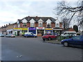
Life in B20 2DF is enriched by a range of nearby amenities, including retail hubs like Tesco Handsworth, M&S Perry, and Iceland Perry, which cater to everyday needs. The area’s rail network is particularly well-developed, with stations such as Perry Barr and Handsworth providing direct links to Birmingham and surrounding regions. Metro services, including Soho Benson Road and Winson Green Outer Circle, offer additional transport options for commuting and leisure. While the data does not list parks or recreational spaces explicitly, the area’s proximity to Handsworth Park—mentioned in historical records—suggests opportunities for outdoor activities. The combination of retail, transport, and historical landmarks creates a lifestyle that balances suburban comfort with urban accessibility, making it appealing to those who value convenience without sacrificing space.
Amenities
Schools
The nearest school to B20 2DF is St Teresa’s Catholic Primary School, a primary institution with a ‘good’ Ofsted rating. This school serves the local community, offering education for younger children in a setting that combines academic standards with a religious ethos. As the only school explicitly mentioned in the data, it is the primary educational option for families in the area. The absence of secondary schools nearby may influence decisions about long-term residency, though the proximity to Birmingham’s city centre could mitigate this by providing access to broader educational networks. For families prioritising a strong foundation in primary education, St Teresa’s provides a reliable choice, supported by its positive rating. However, the limited range of schools in the immediate vicinity underscores the importance of considering broader transport links for secondary education.
| Rank | A + A* % | School | Type | Entry gender | Ages |
|---|---|---|---|---|---|
| 1 | N/A | St Teresa's Catholic Primary School | primary | N/A | N/A |
Explore more schools in this area
Go to Schools tabDemographics
The population of B20 2DF has a median age of 47, with the majority of residents falling within the 30-64 age range. This suggests a mature, stable community, likely comprising families and professionals. Home ownership stands at 46%, indicating a mixed housing market where nearly half of properties are rented. The predominant accommodation type is houses, reflecting the area’s suburban layout and larger plots. The dominant ethnic group is Asian, which shapes the cultural fabric of the community. While specific deprivation data is not provided, the combination of home ownership and age profile implies a population that may prioritise long-term stability over transient living. The presence of St Teresa’s Catholic Primary School, rated ‘good’ by Ofsted, further supports the area’s appeal to families. These demographics paint a picture of a cohesive, established neighbourhood with a strong sense of community.
Household Size
Accommodation Type
Tenure
Ethnic Group
Religion
Household Composition
Age
Household Deprivation
NS-SEC
Explore more demographic insights in this area
Go to Demographics tabPlanning
Planning Constraints
- Flood RiskLocked
- Ramsar Wetland SitesLocked
- Area of Outstanding Natural BeautyLocked
- Protected Nature ReserveLocked
- Protected WoodlandLocked
- Crime RiskLocked