Area Overview for B20 1LL
Photos of B20 1LL
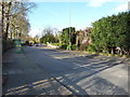
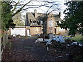
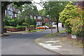
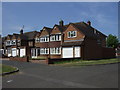
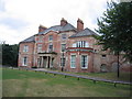
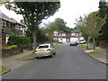
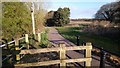
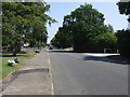
13 photos from this area
Area Information
Key information about the B20 1LL including its size, population, and administrative classification.
- Area Type
- Postcode
- Area Size
- 1.1 hectares
- Population
- 1583
- Population Density
- 941 people/km²
House Prices in B20 1LL
23
Properties
£150,559
Average Sold Price
£65,000
Lowest Price
£245,000
Highest Price
Showing 23 properties
| Address | Type | Beds | Baths | Last Sale Price | Last Sale Date | |
|---|---|---|---|---|---|---|
| 50 Craythorne Avenue, Birmingham, B20 1LL | house | - | - | £245,000 | Oct 2021 | |
| 64 Craythorne Avenue, Birmingham, B20 1LL | Detached | 3 | 1 | £195,000 | Aug 2017 | |
| 28 Craythorne Avenue, Birmingham, B20 1LL | Detached | 5 | 2 | £170,000 | Apr 2013 | |
| 56 Craythorne Avenue, Birmingham, B20 1LL | house | 5 | 3 | £190,000 | May 2012 | |
| 36 Craythorne Avenue, Birmingham, B20 1LL | Detached | 3 | 1 | £167,500 | Oct 2009 | |
| 46 Craythorne Avenue, Birmingham, B20 1LL | Semi-detached | - | - | £230,000 | Feb 2008 | |
| 52 Craythorne Avenue, Birmingham, B20 1LL | house | 3 | 2 | £215,000 | Nov 2007 | |
| 66 Craythorne Avenue, Birmingham, B20 1LL | Detached | 3 | 1 | £218,000 | Nov 2007 | |
| 68 Craythorne Avenue, Birmingham, B20 1LL | Semi-detached | - | - | £200,000 | Jan 2007 | |
| 70 Craythorne Avenue, Birmingham, B20 1LL | Semi-detached | - | - | £158,000 | Dec 2002 |
Page 1 of 3
Energy Efficiency in B20 1LL
Amenities
Schools
| Rank | School | Type | Entry gender | Ages |
|---|
Explore more schools in this area
Go to Schools tabDemographics
Household Size
Family (3-5 people)
most common
Accommodation Type
Houses
most common
Tenure
88
majority
Ethnic Group
asian_total
most common
Religion
N/A
most common
Household Composition
N/A
most common
Age
47
median
Adults (30-64 years)
most common
Household Deprivation
N/A
with no deprivation
NS-SEC
30
in Lower managerial occupations
Explore more demographic insights in this area
Go to Demographics tabPlanning
Planning Constraints
- Flood RiskPremium
- Ramsar Wetland SitesPremium
- Area of Outstanding Natural BeautyPremium
- Protected Nature ReservePremium
- Protected WoodlandPremium