Area Overview for B20 1JL
Photos of B20 1JL
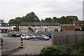
28 photos from this area
Area Information
Key information about the B20 1JL including its size, population, and administrative classification.
- Area Type
- Postcode
- Area Size
- 1.3 hectares
- Population
- 1592
- Population Density
- 5136 people/km²
House Prices in B20 1JL
21
Properties
£230,461
Average Sold Price
£86,500
Lowest Price
£490,000
Highest Price
Showing 21 properties
| Address | Type | Beds | Baths | Last Sale Price | Last Sale Date | |
|---|---|---|---|---|---|---|
| 7 Greenridge Road, Birmingham, B20 1JL | Semi-detached | 5 | 3 | £490,000 | Apr 2024 | |
| 5 Greenridge Road, Birmingham, B20 1JL | house | - | - | £370,000 | Nov 2023 | |
| 27 Greenridge Road, Birmingham, B20 1JL | house | - | - | £347,500 | Aug 2022 | |
| 9 Greenridge Road, Birmingham, B20 1JL | house | - | - | £350,000 | Dec 2016 | |
| 23 Greenridge Road, Birmingham, B20 1JL | Detached | 4 | - | £240,000 | Jan 2012 | |
| 25 Greenridge Road, Birmingham, B20 1JL | house | - | - | £220,000 | Nov 2005 | |
| 45 Greenridge Road, Birmingham, B20 1JL | Semi-detached | - | - | £219,950 | Nov 2005 | |
| 29 Greenridge Road, Birmingham, B20 1JL | Detached | - | - | £250,000 | Aug 2004 | |
| 41 Greenridge Road, Birmingham, B20 1JL | Detached | - | - | £175,000 | Dec 2003 | |
| 37 Greenridge Road, Birmingham, B20 1JL | house | - | - | £160,000 | Dec 2001 |
Page 1 of 3
Energy Efficiency in B20 1JL
Amenities
Schools
| Rank | School | Type | Entry gender | Ages |
|---|
Explore more schools in this area
Go to Schools tabDemographics
Household Size
Family (3-5 people)
most common
Accommodation Type
Houses
most common
Tenure
84
majority
Ethnic Group
asian_total
most common
Religion
N/A
most common
Household Composition
N/A
most common
Age
47
median
Adults (30-64 years)
most common
Household Deprivation
N/A
with no deprivation
NS-SEC
31
in Lower managerial occupations
Explore more demographic insights in this area
Go to Demographics tabPlanning
Planning Constraints
- Flood RiskPremium
- Ramsar Wetland SitesPremium
- Area of Outstanding Natural BeautyPremium
- Protected Nature ReservePremium
- Protected WoodlandPremium