Area Overview for B20 1HN
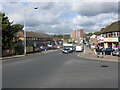
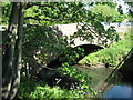
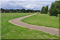
Photos of B20 1HN


Area Information
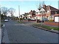
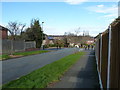
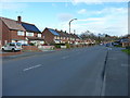
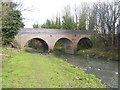
Living in B20 1HN means inhabiting a small, tightly knit residential cluster in England’s West Midlands, just 2 kilometres north of Birmingham City Centre. With a population of 1,583 and a density of 941 people per square kilometre, the area retains a suburban, low-density character shaped by its history as a 19th-century expansion zone for Birmingham’s wealthy. Large, spacious properties dominate, set on substantial plots, reflecting its legacy as a rural retreat before urbanisation. The area’s distinctiveness lies in its blend of historical roots and modern connectivity: it once housed evacuees during World War II due to its undeveloped, country-like landscape, yet today it offers proximity to Birmingham’s cultural and economic hubs. Daily life here is defined by quiet streets, a strong sense of community, and easy access to transport networks. Residents benefit from a mix of local amenities, including schools, retail outlets, and public transport, while the area’s low crime rate and flood risk further enhance its appeal for families seeking a balanced lifestyle.
- Area Type
- Postcode
- Area Size
- Not available
- Population
- 1583
- Population Density
- 941 people/km²
The property market in B20 1HN is overwhelmingly owner-occupied, with 88% of homes owned by residents rather than rented. This reflects a community of long-term residents who have invested in their homes. The area is dominated by houses rather than flats, a hallmark of its suburban character. These properties are typically large, set on spacious plots, a legacy of its 19th-century development as a rural retreat for Birmingham’s wealthy. For buyers, this means a market focused on private ownership rather than rental yields. The limited size of the area and its surrounding clusters suggest a niche market where properties are not in high demand, potentially offering opportunities for those seeking spacious, low-density housing. However, the lack of recent data on price trends or new developments means the market’s current dynamics remain opaque.
House Prices in B20 1HN
No properties found in this postcode.
Energy Efficiency in B20 1HN
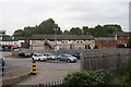
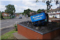
Residents of B20 1HN enjoy a range of amenities within walking or short driving distance. Local retail options include major chains like Tesco Great, Lidl Birmingham, and Co-op Birmingham, ensuring everyday shopping needs are met. The area’s transport network includes five rail stations and three metro stops, providing frequent connections to Birmingham and beyond. Parks and open spaces are also accessible, with Handsworth Park offering formal gardens, a Sunken Garden, and historic landmarks like St. Mary’s Church. This blend of retail, transport, and green spaces creates a convenient, balanced lifestyle. The presence of large properties and low-density development further enhances the area’s appeal for those seeking a quieter, family-friendly environment with easy access to urban amenities.
Amenities
Schools
Residents of B20 1HN have access to a cluster of primary schools, including Grestone Junior School, Grestone Infant School, and Grestone Primary School, all serving the local community. The area also includes Grestone Academy, an academy with a Good Ofsted rating. This mix of primary and secondary education options provides families with a range of choices, from early years schooling to comprehensive secondary education. The presence of multiple schools in close proximity suggests a strong focus on education within the area, likely supporting a family-oriented demographic. The Good rating at Grestone Academy indicates a school performing above average, which is a key consideration for parents prioritising quality education for their children.
| Rank | School | Type | Entry gender | Ages |
|---|---|---|---|---|
| 1 | Grestone Junior School | primary | N/A | N/A |
| 2 | Grestone Infant School | primary | N/A | N/A |
| 3 | Grestone Primary School | primary | N/A | N/A |
| 4 | Grestone Academy | academy | N/A | N/A |
Explore more schools in this area
Go to Schools tabDemographics
The community in B20 1HN is predominantly middle-aged, with a median age of 47 and the majority of residents falling within the 30-64 age range. Home ownership is exceptionally high at 88%, indicating a stable, long-term population. The area is characterised by houses rather than flats, reflecting its suburban layout. The predominant ethnic group is Asian, which shapes the cultural fabric of the neighbourhood. This demographic profile suggests a mature, established community with strong family ties. The absence of specific deprivation data means quality of life is inferred from factors like low crime rates and access to amenities. The high home ownership rate and age profile suggest a population prioritising stability and long-term residency over transient living.
Household Size
Accommodation Type
Tenure
Ethnic Group
Religion
Household Composition
Age
Household Deprivation
NS-SEC
Explore more demographic insights in this area
Go to Demographics tabPlanning
Planning Constraints
- Flood RiskPremium
- Ramsar Wetland SitesPremium
- Area of Outstanding Natural BeautyPremium
- Protected Nature ReservePremium
- Protected WoodlandPremium