Area Overview for B19 3SY
Photos of B19 3SY


Area Information
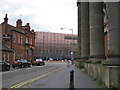
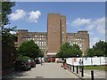
Living in B19 3SY means being part of a small, tightly knit residential cluster in the heart of Birmingham’s Newtown Ward. With a population of 2,226, this area is compact but rich in history and character. Situated north-west of the city centre, it lies within the ring-road network of the A4540 and A34, linking it to surrounding districts like the Jewellery Quarter and Aston. The area’s post-war redevelopment shaped its identity, with tower blocks and multi-storey flats dominating the landscape. Despite its urban setting, it is bordered by areas like Lozells and Birchfield, offering a mix of industrial heritage and modern living. The community is young, with a median age of 22, reflecting a dynamic population of students and early-career professionals. Daily life here is defined by proximity to transport hubs, retail outlets, and educational institutions, making it a practical choice for those prioritising connectivity over traditional housing. The area’s character is shaped by its history as Aston New Town, a post-war renewal project that transformed slum housing into a structured residential estate. For buyers, this means a compact, well-connected environment with clear advantages for those seeking affordability and accessibility.
- Area Type
- Postcode
- Area Size
- Not available
- Population
- 2226
- Population Density
- 4221 people/km²
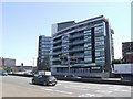
The property market in B19 3SY is characterised by a high proportion of rental properties, with only 15% of homes owned by residents. This suggests a market dominated by landlords and tenants rather than owner-occupiers. The accommodation type is almost entirely flats, a direct result of the post-war redevelopment that created a large tower block estate. While three of these original 20-storey blocks remain, the area’s housing stock reflects a legacy of high-density living. For buyers, this means limited availability of owner-occupied homes, with most properties available for rent. The small size of the postcode area and its proximity to Birmingham’s transport networks make it an attractive option for those seeking affordability and convenience over traditional housing. However, the dominance of flats may limit options for those preferring larger properties or family homes. The market’s rental focus also means that property values are less influenced by long-term ownership trends, instead reflecting the dynamics of local demand and supply.
House Prices in B19 3SY
No properties found in this postcode.
Energy Efficiency in B19 3SY
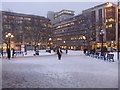
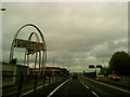
Life in B19 3SY is shaped by its proximity to essential amenities, including retail, dining, and transport hubs. Nearby shops such as Tesco Bagot, Asda Aston, and Morrisons Select provide convenient access to groceries and daily necessities. The area’s metro stations—St Chads, St Paul’s, and Bull Street—offer easy access to Birmingham’s public transport network, while rail services at Birmingham Snow Hill, Moor Street, and Jewellery Quarter connect residents to broader regional routes. For leisure, the area’s historic pubs like The Bartons Arms and cultural venues such as The Drum Arts Centre add to its character. Although there are no parks listed in the data, the surrounding districts like the Jewellery Quarter offer green spaces and recreational opportunities. The combination of retail, transport, and cultural venues creates a practical, accessible lifestyle. Residents benefit from a compact environment where essential services are within walking distance, reducing the need for long commutes. This convenience supports a dynamic, urban lifestyle focused on efficiency and connectivity.
Amenities
Schools
Residents of B19 3SY have access to a range of educational institutions, including primary schools and a special needs academy. St George’s CofE Junior and Infant School and St George’s CofE School provide primary education, while St George’s Church of England Academy, Newtown, is an academy with a ‘good’ Ofsted rating. Arc Oakbridge School, a special school, also holds a ‘good’ rating. This mix of school types ensures options for both mainstream and specialist education. The presence of a special school indicates a commitment to inclusive education, which is crucial for families with children requiring tailored support. The ‘good’ Ofsted ratings for the academy and special school suggest that these institutions meet quality standards, offering reassurance for parents. However, the lack of secondary schools in the immediate area may require families to consider commuting to nearby districts. Overall, the school provision reflects a balance between accessibility and specialised needs, supporting a diverse community.
| Rank | School | Type | Entry gender | Ages |
|---|
Explore more schools in this area
Go to Schools tabDemographics
B19 3SY has a median age of 22, with the majority of residents aged 15–29. This young demographic is reflected in the area’s 15% home ownership rate, which indicates that most households are renters rather than property owners. The accommodation type is predominantly flats, a legacy of the post-war redevelopment that prioritised high-density housing. The predominant ethnic group is Black residents, highlighting the area’s cultural diversity. This demographic profile suggests a community that is largely transient, with students, young professionals, and families in early stages of life. The low home ownership rate and focus on rental properties imply limited long-term investment in property, which may influence the local housing market. For residents, this means a shared living environment with communal spaces and a reliance on local amenities for daily needs. The youth-driven population also shapes the area’s vibrancy, with a focus on accessibility to education, transport, and employment opportunities rather than traditional family-oriented infrastructure.
Household Size
Accommodation Type
Tenure
Ethnic Group
Religion
Household Composition
Age
Household Deprivation
NS-SEC
Explore more demographic insights in this area
Go to Demographics tabPlanning
Planning Constraints
- Flood RiskPremium
- Ramsar Wetland SitesPremium
- Area of Outstanding Natural BeautyPremium
- Protected Nature ReservePremium
- Protected WoodlandPremium