Area Overview for B19 3PP
Photos of B19 3PP


Area Information
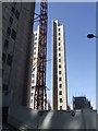
Living in B19 3PP means being part of a small, tightly packed residential cluster in England’s inner city. The postcode covers a compact area with a population of 2,226, reflecting its scale as a focused neighbourhood. Situated in Newtown Ward—also known as Aston New Town—this area lies to the north-west of Birmingham’s city centre, bounded by the Jewellery Quarter, the University of Aston, and surrounding districts. Its character is shaped by post-war redevelopment, which introduced tower blocks and multi-storey flats as the dominant housing type. The area’s proximity to major roads like the A34 and A4540 ring-road, along with nearby rail stations, makes it a practical choice for commuters. Daily life here is defined by a young demographic, with 15-29-year-olds making up the majority. While the area lacks green spaces, its density offers convenience, with shops, transport, and schools within walking distance. However, its history of industrial decline and redevelopment means it remains a stark contrast to more affluent parts of the city.
- Area Type
- Postcode
- Area Size
- Not available
- Population
- 2226
- Population Density
- 4221 people/km²
The property market in B19 3PP is characterised by a low home ownership rate of 15%, suggesting that the area is primarily a rental market rather than one dominated by owner-occupied homes. The accommodation type is predominantly flats, a legacy of the post-war redevelopment that created a large estate of tower blocks. This housing stock, while functional, may lack the diversity and flexibility of newer developments. For buyers, the small size of the postcode and its surrounding area means limited housing options, with most properties being flats in multi-storey buildings. This could be a challenge for those seeking larger homes or garden spaces. However, the area’s proximity to transport links and amenities may offset these drawbacks for those prioritising convenience over property type.
House Prices in B19 3PP
No properties found in this postcode.
Energy Efficiency in B19 3PP
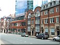
The lifestyle in B19 3PP is shaped by its proximity to essential amenities. Within walking distance are five retail outlets, including Morrisons Daily and Tesco Birmingham, offering everyday shopping needs. The area’s metro and rail stations—such as St Paul’s and Birmingham Snow Hill—provide easy access to public transport, facilitating commutes and leisure trips. While the area lacks parks or green spaces, its density offers a compact, convenience-driven lifestyle. Nearby venues like The Bartons Arms and The Drum Arts Centre contribute to a social scene, though the focus remains on practicality. The mix of retail, transport, and cultural spots creates a functional environment, though residents may seek additional recreational options outside the immediate vicinity.
Amenities
Schools
Residents of B19 3PP have access to a range of schools, including primary and special education institutions. St George’s CofE Junior and Infant School and St George’s CofE School cater to younger children, while St George’s Church of England Academy, Newtown is an academy with a good Ofsted rating, offering secondary education. Arc Oakbridge School, a special school with a good Ofsted rating, provides tailored support for students with specific needs. The presence of both mainstream and specialist schools ensures families have options for different educational requirements. However, the absence of higher education institutions in the immediate area may require residents to commute for university-level study. The quality of local schools, particularly the good-rated academy, is a positive factor for families prioritising education.
| Rank | School | Type | Entry gender | Ages |
|---|
Explore more schools in this area
Go to Schools tabDemographics
B19 3PP has a median age of 22, with the most common age range being young adults (15-29 years). This suggests a community skewed towards students, early-career professionals, and families with young children. Home ownership is low at 15%, indicating that the majority of residents are likely to be renters. The accommodation type is predominantly flats, reflecting the area’s post-war housing stock of tower blocks and multi-storey buildings. The predominant ethnic group is Black, though specific breakdowns are not provided. The low home ownership rate and high proportion of young adults may indicate a transient population, possibly linked to student housing or rental demand. This demographic profile shapes a dynamic but potentially unstable community, where affordability and proximity to amenities are key factors in quality of life.
Household Size
Accommodation Type
Tenure
Ethnic Group
Religion
Household Composition
Age
Household Deprivation
NS-SEC
Explore more demographic insights in this area
Go to Demographics tabPlanning
Planning Constraints
- Flood RiskPremium
- Ramsar Wetland SitesPremium
- Area of Outstanding Natural BeautyPremium
- Protected Nature ReservePremium
- Protected WoodlandPremium