Area Overview for B19 3NT
Photos of B19 3NT


Area Information
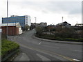
B19 3NT is a small residential postcode area in England, part of the Newtown Ward, also known as Aston New Town. Located to the north-west of Birmingham city centre, it is bordered by the Jewellery Quarter, the University of Aston, and surrounding inner-city districts. The area is defined by its post-war redevelopment, which saw the construction of a large estate of tower blocks in the 1960s. Today, it is a compact community of around 2,226 residents, with a young demographic and a mix of housing types. The area’s proximity to Birmingham’s ring roads and rail networks makes it accessible to the city’s cultural and economic hubs. Its character is shaped by its history of redevelopment, with a legacy of multi-storey flats and a focus on modern infrastructure. Despite its compact size, B19 3NT offers a blend of urban convenience and proximity to key amenities, though its inner-city location means it is not isolated from the city’s dynamics.
- Area Type
- Postcode
- Area Size
- Not available
- Population
- 2226
- Population Density
- 4221 people/km²
The property market in B19 3NT is characterised by a high proportion of rental properties and a limited presence of owner-occupied homes. With only 15% home ownership, the area is largely a rental market, dominated by flats constructed during the post-war redevelopment. These flats are part of a large estate that once included sixteen tower blocks, though some have since been demolished. The remaining housing stock is likely to be multi-storey residential units, offering limited scope for owner-occupiers. For buyers, this means the area is not a typical market for purchasing property, but rather a place where rental demand is strong. Those seeking flats in a compact urban setting may find opportunities, though the small size of the postcode suggests competition for available properties.
House Prices in B19 3NT
No properties found in this postcode.
Energy Efficiency in B19 3NT
Daily life in B19 3NT is shaped by its proximity to retail, dining, and transport hubs. Nearby shops include Morrisons Select, Tesco Bagot, and Aldi Aston, offering a range of grocery and retail options. The area’s metro stops, such as St Paul’s and St Chads, provide easy access to Birmingham’s bustling streets, while rail stations like Birmingham Snow Hill connect residents to wider regional networks. Though the area is compact, its location near the University of Aston and the Jewellery Quarter ensures access to cultural and educational opportunities. The mix of retail, transport, and urban connectivity creates a dynamic lifestyle, though the inner-city setting may lack green spaces or quieter environments.
Amenities
Schools
B19 3NT is served by a range of schools, including primary and special educational institutions. St George’s CofE Junior and Infant School and St George’s CofE School cater to younger students, while St George’s Church of England Academy, Newtown is an academy with a good Ofsted rating. Arc Oakbridge School, a special school also rated good, provides tailored education for students with specific needs. The mix of primary and special schools suggests a focus on inclusive education, which may appeal to families with diverse requirements. The presence of multiple schools within proximity offers flexibility for parents, though the quality of education is tied to the Ofsted ratings, with two institutions achieving good status.
| Rank | School | Type | Entry gender | Ages |
|---|
Explore more schools in this area
Go to Schools tabDemographics
B19 3NT has a median age of 22, with the majority of residents aged between 15 and 29. This reflects a young adult population, likely drawn to the area for education, employment, or affordability. Only 15% of households are owner-occupied, indicating a rental-dominated market. The accommodation is predominantly flats, a legacy of the post-war tower block developments. The predominant ethnic group is Black, reflecting the area’s historical ties to migration and redevelopment. The low home ownership rate and high proportion of young residents suggest a transient community, with many individuals renting short-term or transitioning between properties. This demographic profile may influence local services, with a focus on youth-oriented amenities and flexible housing options.
Household Size
Accommodation Type
Tenure
Ethnic Group
Religion
Household Composition
Age
Household Deprivation
NS-SEC
Explore more demographic insights in this area
Go to Demographics tabPlanning
Planning Constraints
- Flood RiskPremium
- Ramsar Wetland SitesPremium
- Area of Outstanding Natural BeautyPremium
- Protected Nature ReservePremium
- Protected WoodlandPremium