Area Overview for B19 3NF
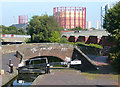
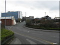
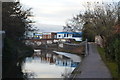
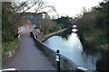
Photos of B19 3NF


Area Information
Living in B19 3NF means being part of a densely populated, inner-city postcode in Birmingham’s Newtown Ward. With a population of 2,226 spread across just 2,654 square metres, this area is among the most densely populated in England, with 838,618 people per square kilometre. It lies within Aston New Town, a post-war redevelopment area characterised by tower blocks and multi-storey flats. The community is young, with a median age of 22 and 15–29-year-olds making up the majority. This is a rental-dominated area, with only 15% of residents owning their homes. The area’s history as a renewal project from the 1960s shaped its current layout, featuring a cluster of flats rather than traditional housing. Despite its density, B19 3NF is positioned near key transport routes like the A34 and A4540, linking it to Birmingham’s city centre and beyond. Its proximity to schools, retail, and rail networks makes it a practical choice for those prioritising connectivity over space.
- Area Type
- Postcode
- Area Size
- 2654 m²
- Population
- 2226
- Population Density
- 4221 people/km²
The property market in B19 3NF is dominated by rental flats, with only 15% of residents owning their homes. The area’s housing stock consists almost entirely of flats, a legacy of its post-war redevelopment as a high-density estate. This makes it a challenging area for buyers seeking owner-occupied properties, as the market is limited to a small number of flats within the postcode. The proximity to Birmingham’s city centre and transport networks may offset the lack of space, but the high population density means competition for available units is fierce. For those considering the area, the focus should be on rental opportunities rather than purchase. The presence of tower blocks, some of which have been demolished, suggests a mix of older and newer housing stock, though the overall supply remains constrained. Buyers should also consider the area’s safety profile, which includes a critical crime risk, when evaluating long-term viability.
House Prices in B19 3NF
No properties found in this postcode.
Energy Efficiency in B19 3NF
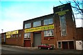
Residents of B19 3NF have access to a range of amenities within practical reach. The area includes five retail outlets, such as Morrisons Select, Tesco Bagot, and Asda Aston, offering everyday shopping needs. Metro stations like St Paul’s, St Chads, and Bull Street provide easy access to local services, while rail stations such as Birmingham Snow Hill and Jewellery Quarter connect to broader networks. The presence of multiple transport options enhances convenience, reducing reliance on cars. Though the area is characterised by high-density housing, its proximity to retail, dining, and transport hubs ensures a functional lifestyle. The historic Bartons Arms pub and defunct Aston Hippodrome add a touch of local character, though the area’s focus remains on practicality over leisure. For those prioritising accessibility over space, B19 3NF offers a compact, well-connected environment.
Amenities
Schools
Residents of B19 3NF have access to a range of schools, including St George’s CofE Junior and Infant School and St George’s CofE School, both primary institutions. For secondary education, St George’s Church of England Academy, Newtown, an academy rated ‘good’ by Ofsted, provides a broader curriculum. Additionally, Arc Oakbridge School, a special needs school also rated ‘good’, serves students with specific educational requirements. This mix of school types offers families flexibility, whether they need primary education, a mainstream secondary school, or specialist support. The presence of multiple schools within walking distance suggests a focus on local provision, though the area’s high population density may influence school capacity and resources. Parents should consider the proximity of these institutions to their homes and the specific needs of their children when evaluating the area.
| Rank | School | Type | Entry gender | Ages |
|---|
Explore more schools in this area
Go to Schools tabDemographics
B19 3NF’s population is overwhelmingly young, with 15–29-year-olds forming the largest age group and a median age of 22. Only 15% of residents own their homes, indicating a strong rental market. The area’s accommodation is almost entirely flats, reflecting its post-war construction as a high-density housing estate. The predominant ethnic group is Black_total, though no specific deprivation data is provided. The high population density—838,618 people per square kilometre—means shared spaces and communal living are the norm. This demographic profile suggests a transient, often student or young professional population, with limited long-term residency. The area’s character is shaped by its history as a renewal project, where 16 tower blocks were built, five of which have since been demolished. This legacy influences the current housing stock and community dynamics, creating an environment where convenience and affordability outweigh space.
Household Size
Accommodation Type
Tenure
Ethnic Group
Religion
Household Composition
Age
Household Deprivation
NS-SEC
Explore more demographic insights in this area
Go to Demographics tabPlanning
Planning Constraints
- Flood RiskPremium
- Ramsar Wetland SitesPremium
- Area of Outstanding Natural BeautyPremium
- Protected Nature ReservePremium
- Protected WoodlandPremium