Area Overview for B19 3HA
Photos of B19 3HA


Area Information
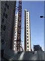
B19 3HA lies within the Newtown Ward, a small residential cluster in north-west Birmingham. With a population of 2,226, it is part of the larger Aston New Town area, historically redeveloped after the Second World War. The area is defined by post-war tower blocks and multi-storey flats, remnants of a 1968 redevelopment plan that reshaped the district. Centred on New Town Row, it borders the Jewellery Quarter, Gun Quarter, and the University of Aston, linking it to Birmingham’s industrial and academic heart. Daily life here is shaped by its proximity to the city’s transport networks, including the A34 and nearby rail stations. The area’s character is marked by a young demographic, with a median age of 22, reflecting its appeal to students and early-career professionals. While the housing stock is dominated by flats, the community’s diversity and access to local amenities make it a practical choice for those seeking affordability and connectivity in a dynamic urban setting.
- Area Type
- Postcode
- Area Size
- Not available
- Population
- 2226
- Population Density
- 4221 people/km²
The property market in B19 3HA is characterised by a low home ownership rate of 15%, indicating that the majority of residents rent their homes. The area is dominated by flats, a legacy of the 1960s redevelopment that prioritised high-density housing. This makes B19 3HA a rental-focused market, with limited availability of owner-occupied properties. The prevalence of flats suggests a practical, cost-effective housing model suited to young professionals and students. However, buyers seeking owner-occupied homes may find limited options here, with the surrounding areas offering more varied choices. The compact nature of the postcode means that property searches should extend beyond B19 3HA to nearby wards with more diverse housing stock.
House Prices in B19 3HA
No properties found in this postcode.
Energy Efficiency in B19 3HA
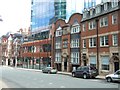
Residents of B19 3HA benefit from a range of amenities within practical reach. Retail options include Morrisons Daily and Tesco Birmingham, offering daily essentials. The area’s proximity to metro stations like St Paul’s and St Chads, along with rail links to Snow Hill and Moor Street, ensures easy access to the city’s transport network. Culturally, the area is linked to landmarks such as The Bartons Arms, a historic pub, and the former Aston Hippodrome theatre. While the tower block estate defines the landscape, it is complemented by nearby green spaces and community hubs. The mix of shops, transport, and historical sites contributes to a functional urban lifestyle, blending practicality with a touch of local character.
Amenities
Schools
Residents of B19 3HA have access to a range of schools, including St George’s CofE Junior and Infant School and St George’s CofE School, both primary institutions. For secondary education, St George’s Church of England Academy, Newtown holds a good Ofsted rating, offering a broad curriculum. Additionally, Arc Oakbridge School, a special needs institution, also has a good rating. This mix of school types ensures families can find options for both mainstream and specialist education. The presence of multiple schools within proximity supports a strong educational infrastructure, though parents may need to consider travel times for secondary schooling. The quality ratings suggest a reliable standard of teaching, which is a key consideration for families prioritising education.
| Rank | School | Type | Entry gender | Ages |
|---|
Explore more schools in this area
Go to Schools tabDemographics
The population of B19 3HA is 2,226, with a median age of 22. The most common age group is young adults (15–29 years), indicating a community skewed towards students, graduates, and early-career professionals. Home ownership is low at 15%, suggesting most residents rent their accommodation. The area is dominated by flats, reflecting its post-war housing stock. The predominant ethnic group is Black residents, though specific proportions are not detailed. The young age profile and high rental rates suggest a transient population, often linked to nearby educational institutions like the University of Aston. This demographic dynamic influences the area’s social fabric, with a focus on affordability and proximity to transport rather than long-term family housing.
Household Size
Accommodation Type
Tenure
Ethnic Group
Religion
Household Composition
Age
Household Deprivation
NS-SEC
Explore more demographic insights in this area
Go to Demographics tabPlanning
Planning Constraints
- Flood RiskPremium
- Ramsar Wetland SitesPremium
- Area of Outstanding Natural BeautyPremium
- Protected Nature ReservePremium
- Protected WoodlandPremium