Area Overview for B19 2WA
Photos of B19 2WA


Area Information
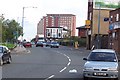
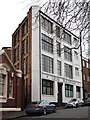
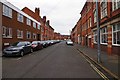
Living in B19 2WA means being part of a small residential cluster in the heart of Birmingham’s Newtown Ward, a historically redeveloped inner-city area. With a population of 1,968, the postcode is a compact community centred on New Town Row, a stretch of the A34 road. The area’s character is shaped by its post-war redevelopment, which saw the construction of tower blocks and multi-storey flats. This makes it distinct from older, more traditional housing stock. Residents here are predominantly adults aged 30–64, with a median age of 22 reflecting a mix of younger and older demographics. The area’s proximity to the Jewellery Quarter, University of Aston, and nearby transport hubs like Birmingham Snow Hill Station ensures easy access to city amenities. However, its compact size and focus on flats mean it’s more suited to those prioritising convenience over expansive living space. The presence of St Francis Catholic Primary School, rated ‘good’ by Ofsted, adds to its appeal for families. Despite its urban setting, B19 2WA offers a blend of practicality and connectivity, though its inner-city location comes with challenges like higher crime rates.
- Area Type
- Postcode
- Area Size
- Not available
- Population
- 1968
- Population Density
- 5811 people/km²
The property market in B19 2WA is characterised by a high proportion of rental properties, with only 20% of homes owned by residents. This reflects the area’s origins as a post-war redevelopment project focused on high-density flats rather than owner-occupied housing. The accommodation type is almost exclusively flats, a legacy of the 1968 redevelopment that built a large estate of tower blocks. While some of these have been demolished, the remaining stock continues to shape the area’s housing landscape. For buyers, this means limited opportunities for purchasing property, with the market skewed toward renters. The small size of the postcode area also means that property availability is constrained, and those seeking homes may need to look beyond B19 2WA’s immediate vicinity. The prevalence of flats suggests a focus on affordability and practicality, though it may not appeal to those seeking larger or more traditional properties.
House Prices in B19 2WA
No properties found in this postcode.
Energy Efficiency in B19 2WA
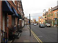
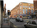
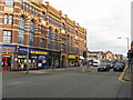
The lifestyle in B19 2WA is shaped by its proximity to retail and transport hubs. Nearby amenities include five retail outlets, such as Morrisons Daily and Tesco Birmingham, offering everyday shopping convenience. The area’s rail and metro stations, including Birmingham Moor Street and St Chads, provide easy access to Birmingham’s broader network, facilitating commutes to work or leisure. While the data does not mention parks or green spaces, the presence of multiple transport options and retail venues suggests a focus on practicality over leisure. The character of the area, defined by its post-war tower blocks, may appeal to those prioritising accessibility over expansive outdoor spaces. Residents can enjoy the convenience of nearby shops and efficient transport, though the urban environment may lack the tranquillity of more suburban settings.
Amenities
Schools
The nearest school to B19 2WA is St Francis Catholic Primary School, a primary institution with a ‘good’ Ofsted rating. This school serves the local community, offering education for younger children in a setting that aligns with the area’s demographic profile. However, no secondary schools are listed in the data, which may be a consideration for families requiring a full range of educational options. The presence of a well-rated primary school is a positive factor for families with young children, though the absence of secondary schooling nearby could necessitate commuting to other parts of Birmingham. The school’s ‘good’ rating indicates a satisfactory standard of education, but prospective residents should investigate further to understand the broader educational landscape.
| Rank | School | Type | Entry gender | Ages |
|---|---|---|---|---|
| 1 | St Francis Catholic Primary School | primary | N/A | N/A |
Explore more schools in this area
Go to Schools tabDemographics
The community in B19 2WA is defined by its demographic makeup, with adults aged 30–64 forming the largest age group, despite a median age of 22. This suggests a mix of younger residents and a more established population. Home ownership is low, at 20%, indicating that the majority of residents are renters. The accommodation type is predominantly flats, reflecting the area’s post-war redevelopment into high-density housing. The predominant ethnic group is Black_total, highlighting the area’s diversity. While this diversity contributes to a dynamic social fabric, it also underscores the need for tailored community services. The low home ownership rate may affect long-term stability for some residents, though it aligns with the area’s history as a rental-focused estate. The median age discrepancy—where younger residents outnumber those over 65—suggests a transient or student-driven population, which could influence local amenities and social dynamics.
Household Size
Accommodation Type
Tenure
Ethnic Group
Religion
Household Composition
Age
Household Deprivation
NS-SEC
Explore more demographic insights in this area
Go to Demographics tabPlanning
Planning Constraints
- Flood RiskPremium
- Ramsar Wetland SitesPremium
- Area of Outstanding Natural BeautyPremium
- Protected Nature ReservePremium
- Protected WoodlandPremium
- Crime RiskPremium