Area Overview for B19 2UD
Photos of B19 2UD


Area Information
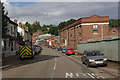
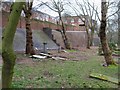
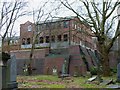
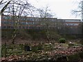
Living in B19 2UD means being part of a small, tightly knit residential cluster in the Newtown Ward of Birmingham. With a population of 1,968, this area is defined by its post-war redevelopment, which transformed it into a hub of multi-storey flats and tower blocks. Situated north-west of Birmingham’s city centre, it lies at the intersection of major roads like the A34 and A4540, linking it to surrounding districts. The area’s character is shaped by its history as a renewal zone, where 16 tower blocks were once built, though five have since been demolished. Today, it is a predominantly flat-based community, with a median age of 22, yet the most common age group is adults aged 30–64. The Black community is the largest ethnic group, reflecting the area’s diverse makeup. Daily life here is urban, with proximity to rail stations, retail outlets, and cultural landmarks like The Bartons Arms and The Drum Arts Centre. While it lacks green spaces, its connectivity to transport networks and nearby amenities makes it a practical choice for commuters and families.
- Area Type
- Postcode
- Area Size
- Not available
- Population
- 1968
- Population Density
- Not available
The property market in B19 2UD is characterised by a high proportion of rental properties, with only 20% of homes owner-occupied. This suggests a market where flats are the primary accommodation type, a direct result of the area’s post-war redevelopment into a tower block estate. While 16 tower blocks were originally built, five have since been demolished, leaving a mix of high-rise and lower-rise flats. The small size of the postcode area means housing options are limited, with buyers likely to consider nearby districts for more varied choices. For those seeking to purchase, the low home ownership rate indicates a potential challenge in finding owner-occupied properties. However, the proximity to transport hubs and retail centres may offset this, making the area appealing to commuters or those prioritising convenience over property diversity.
House Prices in B19 2UD
No properties found in this postcode.
Energy Efficiency in B19 2UD
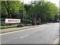
Life in B19 2UD is defined by its urban setting, with access to retail, dining, and transport hubs within practical reach. Nearby amenities include Morrisons Daily and Tesco Birmingham, offering essential shopping options. The area’s rail and metro stations, such as Birmingham Moor Street and Soho Benson Road, provide connectivity to Birmingham’s broader network. While the data does not list parks or leisure facilities, the presence of venues like The Bartons Arms and The Drum Arts Centre suggests a mix of social and cultural spaces. The inner-city location means residents are close to Birmingham’s historic and commercial districts, though green spaces are limited. The lifestyle here is convenience-focused, with a reliance on public transport and retail, making it suitable for those prioritising accessibility over suburban amenities.
Amenities
Schools
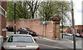
The nearest school to B19 2UD is St Francis Catholic Primary School, a primary institution with a Good Ofsted rating. This school serves the area’s younger residents, though no secondary schools are listed in the data. The presence of a well-rated primary school is a key consideration for families, offering a reliable educational foundation for children aged 4–11. However, the absence of secondary schools in the immediate vicinity may require families to look beyond the postcode for secondary education options. The school’s Good rating suggests it meets acceptable standards in teaching and outcomes, but parents may need to assess additional factors like catchment areas and transport links to ensure access.
| Rank | School | Type | Entry gender | Ages |
|---|
Explore more schools in this area
Go to Schools tabDemographics
B19 2UD has a median age of 22, but the most common age range is 30–64 years, indicating a mix of younger residents and middle-aged adults. Only 20% of households are owner-occupied, with the remaining 80% likely to be rented, reflecting a rental-dominated market. The area is predominantly composed of flats, a legacy of its post-war redevelopment. The Black community constitutes the largest ethnic group, though specific proportions are not detailed. This demographic profile suggests a community where transient or younger residents may be more prevalent, alongside families in their prime working years. The low home ownership rate may indicate limited long-term investment in property, which could affect the area’s stability. The age distribution also implies a need for services catering to both young professionals and older adults, such as healthcare and leisure facilities.
Household Size
Accommodation Type
Tenure
Ethnic Group
Religion
Household Composition
Age
Household Deprivation
NS-SEC
Explore more demographic insights in this area
Go to Demographics tabPlanning
Planning Constraints
- Flood RiskPremium
- Ramsar Wetland SitesPremium
- Area of Outstanding Natural BeautyPremium
- Protected Nature ReservePremium
- Protected WoodlandPremium
- Crime RiskPremium