Area Overview for B19 2RS
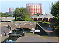
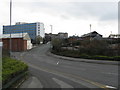
Photos of B19 2RS


Area Information
Living in B19 2RS means being part of a small, tightly knit residential cluster in the heart of Birmingham’s Newtown Ward. The area’s population of 2,124 reflects its compact nature, with homes primarily focused on traditional housing rather than high-density developments. Positioned between the Jewellery Quarter, Aston, and Lozells, B19 2RS sits at the crossroads of Birmingham’s industrial past and evolving urban landscape. The postcode’s proximity to New Town Row, a key section of the A34, links it to major transport routes, while its post-war redevelopment history shapes its character. Residents here benefit from proximity to the University of Aston and the A4540 ring-road, offering both academic and commuter advantages. Daily life balances urban convenience with the distinct identity of a post-war estate, where tower blocks and community hubs coexist. For buyers, this area offers a rare blend of affordability, accessibility, and a foothold in one of Birmingham’s most historically significant districts.
- Area Type
- Postcode
- Area Size
- Not available
- Population
- 2124
- Population Density
- 9312 people/km²
The property market in B19 2RS is characterised by a low home ownership rate of 36%, suggesting that most residents rent rather than own their homes. This contrasts with the typical trend in urban areas, where owner-occupation is more common. The accommodation type is primarily houses, which is unusual for a postcode in Birmingham’s inner city, where flats and terraced housing are more prevalent. This mix may appeal to buyers seeking larger living spaces in a compact area. However, the low home ownership rate implies limited opportunities for long-term investment or equity growth. The area’s small size means property choices are limited to a few clusters of houses, with little scope for expansion. Buyers should consider the rental market’s dynamics and the potential for future development in the surrounding Newtown Ward.
House Prices in B19 2RS
No properties found in this postcode.
Energy Efficiency in B19 2RS
Residents of B19 2RS enjoy a range of amenities within practical reach, including five retail outlets such as Aldi Aston and Morrisons Select, offering everyday shopping needs. The area’s proximity to three rail stations—Jewellery Quarter, Birmingham Snow Hill, and Witton—facilitates easy travel to Birmingham’s business and cultural hubs. While specific parks or leisure facilities are not listed in the data, the area’s historical character includes venues like The Bartons Arms, a historic pub, and The Drum Arts Centre, suggesting a mix of social and cultural opportunities. The presence of multiple transport links and retail options enhances daily life, providing convenience without the isolation often found in more peripheral areas. This blend of accessibility and urban connectivity makes B19 2RS a practical choice for those prioritising ease of movement and local services.
Amenities
Schools
Residents of B19 2RS have access to two primary schools: Lozells Junior and Infant School and Nursery, and Holte School, both rated “good” by Ofsted. These institutions provide quality education for younger children, with a focus on early years and primary learning. The presence of two primary schools within reach suggests a family-friendly environment, though secondary education options are not specified in the data. For families, this mix of schools ensures proximity to essential educational services, reducing the need for long commutes. However, the absence of secondary schools in the immediate vicinity may require additional planning for older children. The “good” Ofsted ratings indicate that both schools meet national standards, offering a baseline of reliability for parents.
| Rank | School | Type | Entry gender | Ages |
|---|
Explore more schools in this area
Go to Schools tabDemographics
The community in B19 2RS is predominantly composed of adults aged 30–64, with a median age of 22, suggesting a mix of working-age residents and younger families. Home ownership here is relatively low at 36%, indicating a higher proportion of renters compared to owner-occupied properties. The area’s accommodation type is primarily houses, which is uncommon in inner-city Birmingham, where flats often dominate. The predominant ethnic group is Asian, reflecting broader demographic trends in the region. This profile suggests a community shaped by migration and economic mobility, with a focus on stability and family living. The lack of specific deprivation data means quality of life is inferred through access to amenities and services, which appear sufficient for daily needs. However, the lower home ownership rate may indicate challenges in long-term financial security for some residents.
Household Size
Accommodation Type
Tenure
Ethnic Group
Religion
Household Composition
Age
Household Deprivation
NS-SEC
Explore more demographic insights in this area
Go to Demographics tabPlanning
Planning Constraints
- Flood RiskPremium
- Ramsar Wetland SitesPremium
- Area of Outstanding Natural BeautyPremium
- Protected Nature ReservePremium
- Protected WoodlandPremium