Area Overview for B19 2JS
Photos of B19 2JS
Area Information
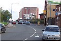
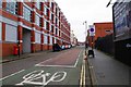
Living in B19 2JS means residing within Newtown Ward, an inner city district located to the north-west of Birmingham city centre. This postcode covers a small residential cluster centred on New Town Row, a section of the A34 road that forms part of the ring-road around the city via the A4540. The area is bordered by the Jewellery Quarter and the University of Aston to the south, as well as Lozells to the north-west. Approximately 1,943 people live within this specific postcode area, contributing to a larger ward population of 16,289. Newtown Ward ranks as the 33rd most populous ward in Birmingham. The district underwent significant changes following the Second World War, with community planning and resources directing a redevelopment approved in 1968. This project constructed a large estate consisting of sixteen tower blocks, fundamentally shaping the modern skyline and street pattern of the locality. Originally designed as a renewal area involving comprehensive redevelopment, the estate replaced former slum housing and heavy industry sites. You are walking through an area defined by its post-war heritage, where five of the original tower blocks have since been demolished, though the remaining high-rise structures and multi-storey accommodation still dominate the visual character. Daily life revolves around this dense urban fabric, situated between the Gun Quarter to the east and Birchfield to the north.
- Area Type
- Postcode
- Area Size
- Not available
- Population
- 1943
- Population Density
- 8230 people/km²
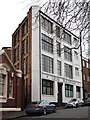
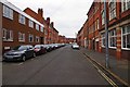
The property market in B19 2JS is distinctly characterised as a rental market rather than an owner-occupied estate. Only 15% of homes in this postcode are owner-occupied, meaning that the vast majority of residents pay rent. The predominant accommodation type is flats, which aligns with the area's history of post-war redevelopment that created sixteen tower blocks. Five of these original blocks have been demolished, but the remaining structures, some reaching 20 storeys high and containing hundreds of flats, still define the housing stock. When you look at homes in this area, you are primarily viewing purpose-built high-density apartments within the Newtown estate or adjacent blocks. This is not a market for traditional family houses or bungalows. The low ownership percentage suggests a transient population or those unable to qualify for mortgages in this specific location. For buyers looking at this small area and its immediate surroundings, you must approach with the understanding that you will likely be purchasing a flat in a large residential cluster. The housing supply is fixed by the existing tower blocks and multi-storey complexes, limiting the availability of ground-floor or single-level properties. You are entering a market where new purchases are rare, and the focus remains on long-term rentals or social housing conversions rather than the conventional ladder of home ownership.
House Prices in B19 2JS
No properties found in this postcode.
Energy Efficiency in B19 2JS
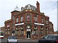
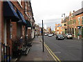
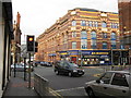
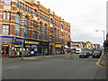
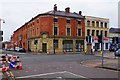
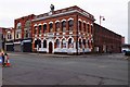
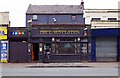
Daily life in B19 2JS is convenient due to the concentration of essential amenities within the Newtown Ward. For shopping, five retail outlets are nearby, including Aldi Aston, Morrisons Select, and Morrisons Daily. These supermarkets provide you with immediate access to food and household necessities without a long drive. Dining and leisure options are closer to the high street, featuring venues like The Bartons Arms, a historic pub that serves the local community. Cultural interests can be pursued at The Elbow Room, a nightclub, or The Drum Arts Centre, which hosts local events and performances. Although Aston Hippodrome has become defunct, the area retains a cultural history embedded in these buildings. Public transport links reinforce this lifestyle by allowing you to reach the city centre quickly via the Metro. You can access St Paul's and Bull Street stations to travel toward the core of the city. The combination of major supermarkets, historic pubs, and arts venues creates a self-contained neighbourhood experience. Children can visit Newtown Nursery School or attend Nishkam High School, ensuring daily routines do not require lengthy commutes. The A34 road and A4540 ring-road also provide quick access to the wider region if you need to travel outside the borough.
Amenities
Schools
Families living in B19 2JS have access to specific educational institutions located within walking distance or nearby the ward boundaries. Newtown Nursery School serves the youngest children in the community, providing early years education before primary school entry. For older children, Nishkam High School stands as the main secondary option. This institution is an academy with an outstanding Ofsted rating, a significant achievement for schools near B19 2JS. The presence of an academy with top ratings indicates a high standard of education directly accessible to residents. The mix of school types shows a small cluster of facilities rather than a wide variety spread across the city. You have a consistent choice of education without needing to commute far to find suitable schooling. The proximity of an outstanding-rated academy like Nishkam High School is a major positive for households in this postcode. While the area has limited residential space, the educational provision is strong for those relying on these specific local assignments. There are no other schools listed in the immediate vicinity, so families must plan education around these two key providers.
| Rank | School | Type | Entry gender | Ages |
|---|
Explore more schools in this area
Go to Schools tabDemographics
The community in B19 2JS is young and predominantly renting. Data indicates a median age of 22 years, with the most common age range for residents falling between 30 and 64 years. Despite this median figure, the higher number of adults suggests that many households consist of young families or individuals with dependents rather than solely student populations. Home ownership stands at just 15%, confirming that this is a rental market where most residents do not own their properties. The predominant accommodation type in the area is flats, a direct result of the high-density tower block estates and multi-storey buildings constructed during the 1960s renewal project. This housing stock contrasts with traditional detached or semi-detached homes found in suburban settings. The area is also notably diverse; the predominant ethnic group is black_total, reflecting a distinct cultural community compared to other parts of the city. There is no data on deprivation levels in the provided statistics, but the high concentration of social housing and low ownership rate typically correlate with specific economic challenges common in inner-city regeneration zones. For you, this means a community driven by landlords and tenants rather than homeowners, with a significant portion of the population likely under the age of 18 or linked to the nearby university institutions.
Household Size
Accommodation Type
Tenure
Ethnic Group
Religion
Household Composition
Age
Household Deprivation
NS-SEC
Explore more demographic insights in this area
Go to Demographics tabPlanning
Planning Constraints
- Flood RiskPremium
- Ramsar Wetland SitesPremium
- Area of Outstanding Natural BeautyPremium
- Protected Nature ReservePremium
- Protected WoodlandPremium
- Crime RiskPremium