Area Overview for B19 2DF
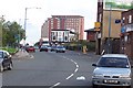
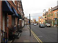
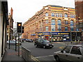
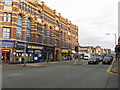
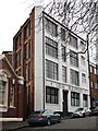
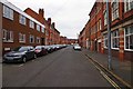
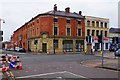
Photos of B19 2DF


Area Information
Living in B19 2DF means being part of a small, tightly knit residential cluster in Birmingham’s Newtown Ward, also known as Aston New Town. This area, centred on New Town Row, sits within a ring-road network connecting the city centre to Walsall and Hockley. With a population of 2,124, it is a compact community shaped by post-war redevelopment, where tower blocks and multi-storey housing dominate the landscape. The area’s character is defined by its proximity to key landmarks like the University of Aston and the Gun Quarter, while its transport links to Birmingham Snow Hill and Witton railway stations provide easy access to the city. Daily life here balances urban convenience with a sense of local identity, supported by nearby schools, retail outlets, and public transport. The area’s mix of younger residents and families reflects its evolving demographic, with a median age of 22 and a strong presence of the Asian community. For those seeking a blend of affordability and connectivity, B19 2DF offers a distinct slice of Birmingham’s inner-city fabric.
- Area Type
- Postcode
- Area Size
- Not available
- Population
- 2124
- Population Density
- 9312 people/km²
The property market in B19 2DF is characterised by a low home ownership rate of 36%, indicating that most residents rent rather than own their homes. The accommodation type is primarily houses, which is unusual for an area historically associated with tower blocks and multi-storey housing. This suggests a mix of older post-war developments and more recent housing stock. For buyers, the small area’s limited size means competition is likely to be concentrated among a few properties, with limited scope for expansion. The rental market is likely to be active, given the low ownership rate, but buyers may find fewer opportunities for long-term investment. The predominance of houses over flats may appeal to those seeking more space, though the area’s inner-city location means properties are unlikely to offer large gardens or detached homes. Prospective buyers should consider the area’s proximity to transport links and amenities when evaluating its value.
House Prices in B19 2DF
No properties found in this postcode.
Energy Efficiency in B19 2DF
The lifestyle in B19 2DF is defined by its proximity to retail, dining, and transport hubs. Nearby amenities include supermarkets such as Aldi Aston, Morrisons Select, and Morrisons Daily, ensuring daily shopping needs are met. The area’s rail and metro stations—Jewellery Quarter, Birmingham Snow Hill, and Witton—connect residents to Birmingham’s broader network, while the A34 road provides access to Walsall and beyond. Though the data does not mention parks or leisure facilities, the area’s inner-city location suggests a mix of urban and industrial environments. The presence of historic pubs like The Bartons Arms and cultural venues such as The Drum Arts Centre adds to the local character. While the area may lack green spaces, its convenience and connectivity make it ideal for those prioritising accessibility over traditional suburban amenities.
Amenities
Schools
Residents of B19 2DF have access to two primary schools within practical reach: Lozells Junior and Infant School and Nursery, and Holte School, both of which hold a ‘good’ Ofsted rating. These institutions cater to younger children, providing a foundation for education in the area. The presence of two primary schools suggests a focus on early education, though the data does not mention secondary schools or further education facilities. For families with young children, the availability of two well-rated primary schools is a significant advantage, reducing the need for long commutes to other parts of Birmingham. The ‘good’ ratings indicate that both schools meet national standards, offering a reliable educational environment. However, parents seeking a broader range of school types may need to look beyond the immediate vicinity for secondary options.
| Rank | School | Type | Entry gender | Ages |
|---|
Explore more schools in this area
Go to Schools tabDemographics
The community in B19 2DF is predominantly shaped by adults aged 30–64, with a median age of 22, indicating a mix of younger residents and older households. Home ownership is relatively low at 36%, suggesting a rental market dominates, with most residents living in houses rather than flats. The area’s demographic is heavily influenced by the Asian community, which constitutes the largest ethnic group. This diversity contributes to a culturally rich environment, though the data does not specify further details on other groups. The age profile suggests a balance of working-age adults and families, with no significant youth or elderly population. While the low home ownership rate may indicate affordability, it also points to a transient population. The area’s character is further defined by its post-war redevelopment, which prioritised high-density housing over traditional family homes, shaping the current social and economic landscape.
Household Size
Accommodation Type
Tenure
Ethnic Group
Religion
Household Composition
Age
Household Deprivation
NS-SEC
Explore more demographic insights in this area
Go to Demographics tabPlanning
Planning Constraints
- Flood RiskPremium
- Ramsar Wetland SitesPremium
- Area of Outstanding Natural BeautyPremium
- Protected Nature ReservePremium
- Protected WoodlandPremium