Area Overview for B19 1TS
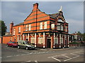
Photos of B19 1TS
Area Information
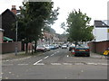
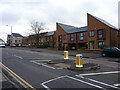
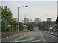
Living in B19 1TS means being part of a tightly knit, small-scale residential cluster in West Birmingham. With a population of 1,987, this area is characterised by its urban density and historical roots as a northern suburb of Birmingham, centred on Lozells Road. The community is shaped by its industrial heritage, with Victorian terraced housing and post-war tower blocks standing alongside council properties. While the area is among the UK’s 5% most deprived wards, it also boasts a vibrant, multi-ethnic population, with Asian communities forming the predominant group. Daily life here is influenced by proximity to Birmingham’s city centre, just over 2 km away, and the presence of nearby rail and metro links. However, the area’s history includes challenges, such as race riots in 1985 and 2005, which highlight its complex social dynamics. Despite deprivation and high unemployment, B19 1TS offers a distinct urban character, blending historic architecture with a resilient, diverse community.
- Area Type
- Postcode
- Area Size
- Not available
- Population
- 1987
- Population Density
- 17789 people/km²
The property market in B19 1TS is defined by a low home ownership rate (37%) and a focus on houses, which is atypical for a densely populated inner-city area. This suggests a rental-dominated market, with limited owner-occupied properties. The housing stock consists of Victorian terraced homes, council properties, and post-war tower blocks, reflecting decades of urban development. For buyers, this small area offers few options, with properties likely to be older and requiring maintenance. The proximity to Birmingham’s transport networks may make it appealing for commuters, but the area’s deprivation status and lack of major employers could deter long-term investment. Prospective buyers should consider the challenges of high unemployment and limited local amenities when evaluating property value and suitability.
House Prices in B19 1TS
No properties found in this postcode.
Energy Efficiency in B19 1TS
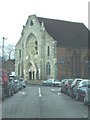
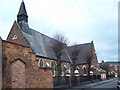
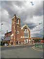
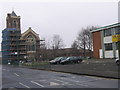
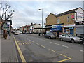
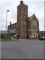
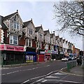
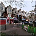
The lifestyle in B19 1TS is shaped by its urban setting and proximity to retail, transport, and community hubs. Nearby amenities include five retail outlets such as Aldi Aston and Morrisons Select, offering everyday shopping convenience. The area’s rail and metro stations provide easy access to Birmingham’s cultural and commercial centres. While the data does not list parks or leisure facilities, the historical presence of community spaces like Lozells Methodist Church suggests a focus on social cohesion. The urban environment, though dense, allows for a mix of daily routines, from commuting to utilising local shops. However, the lack of detailed information on leisure options means residents may need to travel further for recreational activities.
Amenities
Schools
The only school explicitly listed near B19 1TS is Anglesey Junior School, a primary institution. No secondary schools are mentioned in the data, which may require families to seek options further afield. The absence of secondary education within the immediate vicinity could be a practical concern for parents. However, the area’s schools, including Lozells Primary and Heathfield Primary (noted in research), may offer alternative choices. The lack of detailed Ofsted ratings or performance metrics means prospective families should investigate further to assess educational quality. The presence of a primary school supports young families, but the limited range of school types highlights the need for broader regional planning.
| Rank | School | Type | Entry gender | Ages |
|---|
Explore more schools in this area
Go to Schools tabDemographics
The demographic profile of B19 1TS reflects a young median age of 22, though the most common age group is adults aged 30–64. Home ownership stands at 37%, indicating a majority of residents rent their homes. The accommodation type is predominantly houses, which is unusual for a high-density urban area. The predominant ethnic group is Asian_total, with significant Afro-Caribbean and Bangladeshi populations, creating a culturally rich but socially stratified community. The area ranks third in Birmingham’s 2019 Index of Multiple Deprivation, with high levels of income and employment deprivation. This context means residents often face limited local economic opportunities and reliance on public services. Despite this, the area’s diversity and historical significance, such as the Grade II-listed Lozells Methodist Church, contribute to a unique social fabric.
Household Size
Accommodation Type
Tenure
Ethnic Group
Religion
Household Composition
Age
Household Deprivation
NS-SEC
Explore more demographic insights in this area
Go to Demographics tabPlanning
Planning Constraints
- Flood RiskPremium
- Ramsar Wetland SitesPremium
- Area of Outstanding Natural BeautyPremium
- Protected Nature ReservePremium
- Protected WoodlandPremium