Area Overview for B19 1LT
Photos of B19 1LT
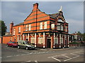
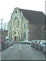
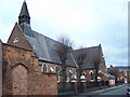
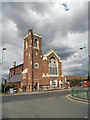
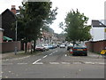
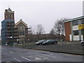
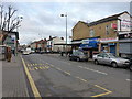
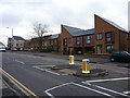
36 photos from this area
Area Information
Key information about the B19 1LT including its size, population, and administrative classification.
- Area Type
- Postcode
- Area Size
- 7269 m²
- Population
- 1794
- Population Density
- 11383 people/km²
House Prices in B19 1LT
42
Properties
£86,289
Average Sold Price
£27,500
Lowest Price
£122,000
Highest Price
Showing 42 properties
| Address | Type | Beds | Baths | Last Sale Price | Last Sale Date | |
|---|---|---|---|---|---|---|
| 66 Wilson Road, Birmingham, B19 1LT | house | - | - | £103,000 | Apr 2020 | |
| 40 Wilson Road, Birmingham, B19 1LT | Terraced | 2 | 1 | £122,000 | Jul 2019 | |
| 72 Wilson Road, Birmingham, B19 1LT | Terraced | 3 | 1 | £96,000 | May 2017 | |
| 92 Wilson Road, Birmingham, B19 1LT | Terraced | 2 | 1 | £89,000 | Mar 2017 | |
| 18 Wilson Road, Birmingham, B19 1LT | house | - | - | £115,000 | Sep 2013 | |
| 86 Wilson Road, Birmingham, B19 1LT | Terraced | 2 | 1 | £83,000 | Aug 2013 | |
| 46 Wilson Road, Birmingham, B19 1LT | house | 3 | - | £113,000 | Aug 2012 | |
| 48 Wilson Road, Birmingham, B19 1LT | house | - | - | £110,000 | May 2008 | |
| 56 Wilson Road, Birmingham, B19 1LT | house | - | - | £97,000 | Apr 2008 | |
| 52 Wilson Road, Birmingham, B19 1LT | house | - | - | £100,000 | Jan 2007 |
Page 1 of 5
Energy Efficiency in B19 1LT
Amenities
Schools
| Rank | School | Type | Entry gender | Ages |
|---|
Explore more schools in this area
Go to Schools tabDemographics
Household Size
One person
most common
Accommodation Type
Houses
most common
Tenure
29
majority
Ethnic Group
asian_total
most common
Religion
N/A
most common
Household Composition
N/A
most common
Age
47
median
Adults (30-64 years)
most common
Household Deprivation
N/A
with no deprivation
NS-SEC
12
in Lower managerial occupations
Explore more demographic insights in this area
Go to Demographics tabPlanning
Planning Constraints
- Flood RiskPremium
- Ramsar Wetland SitesPremium
- Area of Outstanding Natural BeautyPremium
- Protected Nature ReservePremium
- Protected WoodlandPremium