Area Overview for B19 1EF
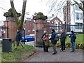
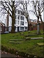
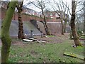
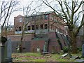
Photos of B19 1EF


Area Information
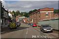
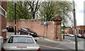
B19 1EF is a small residential cluster within the inner-city district of Lozells in West Birmingham. This postcode serves approximately 1,804 residents and sits about two miles north-west of Birmingham city centre. The location lies between the districts of Handsworth and Aston, forming part of the Lozells and East Handsworth ward. You will find this area defined by Victorian terraced housing mixed with properties from the post-war era. Life here centres on Lozells Road, an area first described as a chapelry in Aston parish back in 1853. The region has a distinct history, having witnessed significant residential development during the late 19th-century Industrial Revolution. You are aware that the local environment carries a complex heritage, including notable events such as the race riots of 1985 and 2005. Despite these historical challenges, the area functions as a tightly packed community. Homes in this postcode benefit from proximity to major urban employment hubs in the city core. You live close to the Jewellery Quarter and Aston Park, which shapes your daily commute patterns and leisure options. The character of this neighbourhood remains strongly rooted in its industrial past, offering a specific type of urban living focused on practicality and centrality.
- Area Type
- Postcode
- Area Size
- Not available
- Population
- 1804
- Population Density
- 10809 people/km²
The property market in B19 1EF is characterised predominantly by rental living rather than owner-occupation. Statistics show that only 22% of homes in this area are privately owned, meaning rental properties make up the bulk of the stock available to buyers. If you are looking to purchase homes in this postcode, you will be entering a market where the residents are mostly tenants. The accommodation type data confirms that Houses are the main dwelling style, though the low ownership rate suggests many of these houses are listed for rent or belong to public housing providers. This dense cluster of residential properties creates a specific market dynamic where investment opportunities may focus on buy-to-let strategies rather than family home ownership. You should note that the area lies within a ward identified as one of the most deprived in the country, which can influence property values and transaction speeds. For those considering moving, understanding that most neighbours rent rather than own provides crucial context for the local real estate climate. The housing stock consists mainly of Victorian and post-war structures typical of inner-city Birmingham.
House Prices in B19 1EF
No properties found in this postcode.
Energy Efficiency in B19 1EF
Residents of B19 1EF enjoy convenient access to a variety of amenities within practical reach. For rail travel, five stations serve the area, including Jewellery Quarter Railway Station, Birmingham Snow Hill Railway Station, and Perry Barr Railway Station. These hubs provide direct links to the wider Birmingham network. Local retail options include Tesco Birmingham, Morrisons Daily, and Iceland Handsworth, ensuring you can find supermarkets and daily essentials nearby. Metro travel is also well supported with five stations, such as Soho Benson Road, Winson Green Outer Circle, and St Paul's. This network of transport and retail facilities means your daily errands require minimal travel time. You will find that shopping for groceries or catching a train involves short walks from your home. The location prioritises functional access over exclusive leisure destinations, catering to the practical needs of a working population.
Amenities
Schools
Diamod Academy stands as the only independent school listed in the data for the vicinity of B19 1EF. Families interested in education options near this postcode will find this private institution as their primary choice within the provided information. The area is known for having a mix of educational providers, though the specific public sector schools such as Lozells Primary, Holte School, and Heathfield Primary are noted in local research rather than the immediate list. However, you must rely on the confirmed data for B19 1EF, which highlights Diamond Academy as the key independent option. This suggests that while the area has historical associations with state schools, the immediate independent sector presence is limited to this single entity. For homeowners considering this location for future generations, the availability of independent schooling is a distinct factor. You should investigate further to see if other relevant institutions are situated just outside the immediate radius of this small residential cluster, as the provided list is specific to the nearest identified schools. The presence of an independent school indicates a desire for alternative education pathways within the community.
| Rank | School | Type | Entry gender | Ages |
|---|
Explore more schools in this area
Go to Schools tabDemographics
The community in B19 1EF possesses a distinctly mature profile, with a median age of 47 years. Adults between the ages of 30 and 64 years represent the most common age range within this population. This demographic skew suggests a neighbourhood populated by established residents rather than young families moving in en masse. Only 22% of local households own their homes outright, indicating that the vast majority of residents rent their accommodation. You will find that Houses constitute the predominant form of accommodation type in this specific postcode area. The population exhibits high multi-ethnic diversity, with the Asian group being the predominant ethnic classification. You must understand that this area falls among the UK's 5% most deprived wards, ranking third in Birmingham per the 2019 Index of Multiple Deprivation. This status reflects levels of income deprivation and unemployment that are higher than the city average. The community feel is shaped by these socioeconomic factors, creating a living environment where financial challenges are a known part of the local reality.
Household Size
Accommodation Type
Tenure
Ethnic Group
Religion
Household Composition
Age
Household Deprivation
NS-SEC
Explore more demographic insights in this area
Go to Demographics tabPlanning
Planning Constraints
- Flood RiskPremium
- Ramsar Wetland SitesPremium
- Area of Outstanding Natural BeautyPremium
- Protected Nature ReservePremium
- Protected WoodlandPremium