Area Overview for B19 1AZ
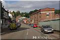
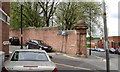
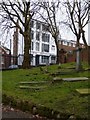
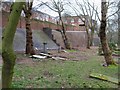
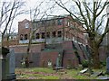
Photos of B19 1AZ


Area Information
B19 1AZ is a small, tightly knit residential postcode in England, home to 2,248 people. Situated within the historic Jewellery Quarter of Birmingham, this area blends centuries-old craftsmanship with modern urban living. The district, designated a 300-acre Improvement District in recent years, retains its industrial heritage while evolving into a hub for creativity and trade. Streets like Warstone Lane showcase classic Victorian and Edwardian architecture, a testament to the area’s 18th-century origins as a wealthy residential and manufacturing zone. Today, B19 1AZ benefits from its proximity to key landmarks such as St Paul’s Church and the Museum of the Jewellery Quarter, which ranks among Europe’s top free attractions. The area’s population, predominantly adults aged 30–64, reflects a community rooted in tradition yet open to contemporary development. Living here means being part of a place where history is tangible, from the Birmingham Assay Office to the legacy of inventors like James Watt. The postcode’s compact size ensures a close-knit feel, with amenities and transport links within easy reach.
- Area Type
- Postcode
- Area Size
- Not available
- Population
- 2248
- Population Density
- 6183 people/km²
B19 1AZ is characterised by a predominance of houses, with 33% of residents owning their homes. This relatively low home ownership rate points to a rental market that may offer opportunities for buyers seeking investment properties or those looking to enter the market through purchase. The presence of houses suggests a mix of older, period-style properties—many with Victorian or Edwardian features—and potentially newer builds. Given the area’s historic significance, properties may retain architectural charm, though renovation or modernisation could be necessary to meet contemporary standards. The compact nature of the postcode means the housing stock is limited, and buyers should consider proximity to surrounding areas for more options. For those prioritising ownership, the relatively low home ownership rate could indicate availability, though competition may arise from the area’s appeal to both renters and buyers drawn to its heritage and connectivity.
House Prices in B19 1AZ
No properties found in this postcode.
Energy Efficiency in B19 1AZ
Life in B19 1AZ is enriched by a mix of historic and contemporary amenities. Within practical reach are five metro stations, including Soho Benson Road and Winson Green Outer Circle, facilitating easy travel across Birmingham. Retail options are plentiful, with Iceland Handsworth, Tesco Birmingham, and Morrisons Daily providing essential shopping. Rail connections to Jewellery Quarter Railway Station and Birmingham Snow Hill offer access to the city’s broader networks. The area’s character is defined by its heritage, with streets like Warstone Lane preserving Victorian architecture and landmarks such as St Paul’s Church and the Museum of the Jewellery Quarter adding cultural depth. While the data does not specify dining or leisure venues, the proximity to Birmingham’s central districts suggests a range of options for entertainment and socialising. This blend of practicality and historical richness creates a lifestyle that is both convenient and steeped in tradition.
Amenities
Schools
The nearest school to B19 1AZ is The Lambs Christian School, an independent institution. While no Ofsted rating is provided, the presence of an independent school suggests a focus on private education for families in the area. The school’s type indicates it is likely to offer a structured curriculum and smaller class sizes, catering to those seeking alternative educational pathways. However, the data does not list other schools, meaning families may need to look beyond the immediate postcode for state-run options. The absence of additional schools in the data implies that parents might need to consider nearby districts for a broader range of educational choices. For those prioritising independent schooling, The Lambs Christian School provides a specific option, but its suitability depends on individual preferences and proximity to the school’s location.
| Rank | School | Type | Entry gender | Ages |
|---|
Explore more schools in this area
Go to Schools tabDemographics
The population of B19 1AZ is 2,248, with a median age of 47 and the majority of residents aged 30–64. This suggests a community of established professionals and families, many of whom may have ties to the area’s historic industries. Home ownership stands at 33%, indicating a rental market dominates, with a significant portion of residents living in rented properties. The predominant accommodation type is houses, reflecting a mix of older, characterful homes and newer developments. The largest ethnic group is the Asian community, which shapes the cultural fabric of the area. While no specific deprivation data is provided, the age profile and home ownership rate suggest a stable, middle-aged population with established ties to the neighbourhood. The absence of younger demographics may influence local services and amenities, though the area’s historic character and proximity to transport links offer appeal to a range of buyers.
Household Size
Accommodation Type
Tenure
Ethnic Group
Religion
Household Composition
Age
Household Deprivation
NS-SEC
Explore more demographic insights in this area
Go to Demographics tabPlanning
Planning Constraints
- Flood RiskPremium
- Ramsar Wetland SitesPremium
- Area of Outstanding Natural BeautyPremium
- Protected Nature ReservePremium
- Protected WoodlandPremium